Download
1 / 62
640 likes | 1.15k Views
PENGANTAR ILMU PERIKANAN DAN KELAUTAN: SUB SISTEM KELAUTAN (MARINES) SUB SISTEM ALAMIAH PERIKANAN: 1. BIOSISTEM KELAUTAN 2. BIOSISTEM PERAIRAN. TIM SUB SISTEM ALAMIAH: KELAUTAN (MARINES). POKOK BAHASAN. PENGERTIAN LAUT, SAMUDERA, BEBERAPA ISTILAH KELAUTAN.

E N D
PENGANTAR ILMU PERIKANAN DAN KELAUTAN:SUB SISTEM KELAUTAN (MARINES)SUB SISTEM ALAMIAH PERIKANAN:1. BIOSISTEM KELAUTAN2. BIOSISTEM PERAIRAN TIM SUB SISTEM ALAMIAH: KELAUTAN (MARINES)
POKOK BAHASAN PENGERTIAN LAUT, SAMUDERA, BEBERAPA ISTILAH KELAUTAN. 2. PEMBAGIAN WILAYAH LAUT SECARA VERTIKAL DAN HORIZONTAL 3. BENTUK-BENTUK EKSPLOITASI OLEH MANUSIA UNTUK MEMANFAATKAN LAUT SBG SDA
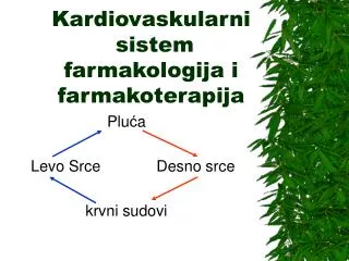
NATURAL ECOSYSTEM: Community Fish species Habitat External forces (e.g. climate change) Aquatic environment The structure of natural sub-system: fish sp interact with ecosystem, & in turn with biophysical environment. External forces impact on entire system (Charles, 2001)
LAUT: Kumpulan air asindalamjumlahbanyakdanluas yang menggenangidanmembagidaratanatasbenuaataupulau. jadi Lautadalah air yang menutupipermukaantanah yang sangatluasdanumumnyamengandunggaramdanberasaasin. POKOK BAHASAN PENGERTIAN LAUT, SAMUDERA, BEBERAPA ISTILAH KELAUTAN. PEMBAGIAN WILAYAH LAUT SECARA VERTIKAL DAN HORIZONTAL BENTUK-BENTUK EKSPLOITASI OLEH MANUSIA UNTUK MEMANFAATKAN LAUT SBG SDA Laut: seluruhbadan air asin yang salingberhubungandanmenutupi 70,78 % daripermukaanbumi. Jumlahinitidaktermasukdanauasin (salt lake)
OCEAN: (Okeanos)= Samudera (Atlantik, Hindia, Pasifik, Artic(k) atau SEA dan MARINE = Laut MARINE VS TERRESTRIAL (Daratan) SEJARAH TERBENTUKNYA LAUT: Lautterbentuk 4,4 miliartahunyglalu. Awalnyabersifatsangatasamdengan air yang mendidih (suhu 1000C). Mengapaasamkrnatmosfirbumidipenuhioleh CO2. Keasaman air inilah yang menyebabkantingginyapelapukan yang terjadi yang menghasilkangaram-garam yang menyebabkan air lautmenjadiasinsepertisekarangini. Pasangsurutlautterjadikarenajarakbulan yang begitudekatdenganbumi.
DARI MANA ASAL MUASAL AIR LAUT bumimulaimendinginakibatberkurangnyaaktivitasvulkanik. Atmosferbumisaatitutertutupolehdebu-debuvulkanik yang mengakibatkanterhalangnyasinarmatahariuntukmasukkebumi. Akibatnya, uap air diatmosfermulaiterkondensasidanterbentukhujandanhujanmengisicekungan-cekungandibumihinggaterbentuklahlautan. Perlahan-lahan, jumlahkarbondioksidadiatmosfermulaiberkurangkrnterlarutdalam air lautdanbereaksidengan ion karbonatmembentukkalsiumkarbonat. Akibatnya, langitcerahsehinggasinarmataharidapatmenyinaribumi. Akibatnyaterjadinyaprosespenguapandan volume air lautdibumimengalamipengurangandanbagian-bagiandibumi yang awalnyaterendam air mulaikering. Prosespelapukanbatuanterusberlanjutakibathujan yang terjadidanterbawakelautan, menyebabkan air lautsemakinasin.
DATA TENTANG LAUT • Luas total Permukaanlaut: 361 juta Km2; • Rata-rata kedalamanlaut: 3.370 m, Total Volume: 1.347 miliar Km2. • Setiap 1 Km3 air lautsetaradenganberat 1,12 miliar ton danmengandung 40 juta ton bahanterlarut. • Kadar garam = salinitas: kandungangaramterlarut = %o . (per seribu). • Salinitas air lautbervariasiantara 33 sampai 38 %odengan rata-rata sekitar 35 %o (atau 35 g pada total 1 Kg air laut). • Lebihdari 90 % garamterlarutberasaldari 6 elemenutama: Chlorin (Cl), sodium (Na+) , Magnesium (Mg2+), Sulfrur (SO42-), Calcium (Ca2+) dan Potassium (K+). Duaelemenlainnya: bikarbonat (HCO3+) danBromin (Br-)
DASAR LAUT MemilikiTopografibergelombang; Lautmemiliki “Sea Mount” (Gununglaut). Adagnlaut yang tidakterlihatada yang terlihat. Gunungtertinggiygmunculdaridasarlaut: Gunung Mauna Kea (Hawai). Tinggi 10.200 m daridasarlaut;
Untuksetiappenurunan 100-200 meter daripermukaanlaut, tekananakanturunhinggasatuatmosfer. Maka, untukkedalamanhingga 6.500 meter tekanannyamencapai 650 atmosfer. Selainitu, dilautdalamjugatidakadasinarMataharidanoksigenatauhidupdalamkondisianaerob.
SUHU AIR LAUT • Suhu air lauttergantungpadakedalamandanposisilokai. Suhu air lagunadangkalmencapai 370 C padasianghari. • Suhu air lautdisekitar equator 24 – 29 o C. • Suhu air lautdikutub: 0 – 4oC • Sekitar 87 % air lautmempunyai rata-rata suhu 4,40 oC. • Thermocline: menjelaskansuatuwilayahpadakedalaman air laut, denganperbedaansuhu yang tinggi. Semakinjauhkedalam, suhu air lautmenurunsecaradrastisdibandingwilayahdiatasmaupundibawahnya.
apakahdatar? Apakahbergelombang? Ataubergunung? Apa yang dilihatdidaratsamasepertiapa yang dilihatdidasarlaut: pegunungan, lembah, datar, berbukit. Kenampakandasarlaut
Adagunung paling tinggi, adalembah paling dalamdanadadaratansemuaadadidasarlaut.
Features of the Ocean Floor • Continental shelf: surrounds the continent as a shallow extension of continental crust extending out to the continental slope. • Continental slope: steep drop-off at the end of the continental shelf that connects the continental crust to the oceanic crust. • Together, they make up the continental margin.
Features of the Ocean Crust • Abyssal plains: are the flattest areas on earth. • Ocean ridges: are long mountain ranges formed when magma seeps or erupts between pieces of the Earth’s crust (tectonic plates). • Trenches: are the deepest part of the ocean and are formed when one tectonic plate is forced under another tectonic plate. • Seamounts: isolated volcanic mountains which erupt under the ocean. Large ones are islands. • Guyots: are extinct volcanoes with eroded flat tops.
Ocean ridges form a mountain chain 40,000 miles long through all the oceans The highest mountain on Earth is Mauna Kea, Hawaii, a seamount The average depth of the ocean is 12,200 feet (3,720 m.)
Trenches form where tectonic plates (chunks of the Earth’s crust) are forced under another plate. The Mariana Trench in the western Pacific is the deepest point on Earth– 36,198 ft. (11,033 m.)
Trieste and the Mariana Trench In 1960, the US Navy sent a small submersible (mini-sub) to see how far down it could go. It sat on the bottom at 35,838 ft. (10,923 m.) The sailors had 7 miles of water over their heads!
Our life does not run without ocean. Weather and climate Fishery Shipping
MANFAAT LAUT BAGI KEHIDUPAN • Penangkapanikanatauperikananlaut (ikanmenyediakan 20 % kebutuhan protein bagi 50 % pendudukdunia.; • Lautmengandungsumber mineral. Ada 73 jenisdari 93 mineral alam. Natrium, chlorida, magnesium, bromine, iodium ,dll. • Sebagai pembentuk iklim dunia (air-sea interaction, ocean phenomenon: El Nino. La Nina, Indian Ocean Dipole, etc.). • Sebagai sarana kegiatan manusia, misal shipping (trading, transportation, ocean training, observation, etc.) • Fishery (fishing, marine culture, fish rancing, etc.) • SumberMakanan (productivity sources: plankton, coral, algae, small and big fishes, etc.) • SumberEnergi (gelombang, mining, bioenergy (algae), • Pharmacy (gamete: anti aging, algae: anti cancer) • Tourism, etc.....
PELAGIC: Epipelagic: 0- 2 00 m Mesopelagic : 200 – 1000 m Bathypelagic: 1000 – 2000 m Abyssalpelagic 2000 – 6000 m Hedalpelagic: > 6000 m BENTHIC: Litoral: Intertidal Sublitoral: 0 – 200 m Bathyal : 200 – 2000 m Abyssal: 2000 – 6000 m Hadal > 6000 m STRUKTUR TOPOGRAFI DASAR LAUT, KEDALAMAN, KOLOM AIR DIATASNYA DAN EFEKTIVITAS SINAR MATAHARI
PELBAGAI ISTILAH COAST LINE (garispantai) atau SHORELINE: Batas air lautterakhirmencapaidaratdanbersifatdinamistergantungpasangsurut.. Menurutkedalamannya, ekosistem air lautdibagisebagaiberikut: • LITORAL: merupakandaerah yang berbatasandengandarat. • NERETIKmerupakandaerah yang masihdapatditembuscahayamataharisampaibagiandasardalamnya ± 300 meter. • BATIAL merupakandaerah yang dalamnyaberkisarantara 200-2500 m. • ABISALmerupakandaerah yang lebihjauhdanlebihdalamdaripantai (1.500-10.000 m).
Pelagic Four Zones of Interest Intertidal Abyssal Benthic
Air apapundilaut yang tidakterlaludekatdengandasarlautdinamaizonapelagik KEDALAMAN DAN LAPISAN ZONA PELAGIK Epipelagik Dari permukaan (Mean Sea Level) hinggakedalaman 200 m (656 kaki). Mesopelagik Dari kedalaman 200 m turunke 1.000 m (3.280 kaki). Batipelagik Dari kedalaman 1.000 m turunkesekitar 4.000 m (13.123 kaki). Abisopelagik Dari kedalaman 4.000 m turunkediatasdasarlaut. Hadopelagik Air dalamdipalungsamudera.
ZONA INTERTIDAL: Zona intertidal merupakanzona yang dipengaruhiolehpasangsurut air lautdenganluas area yang sempitantaradaerahpasangtertinggidansurutterendah. Padazonainiterdapatvariasifaktorlingkungan yang cukupbesar, sepertifluktuasisuhu, salinitas, kecerahandan lain – lain. Variasiinidapatterjadipadadaerah yang hanyaberjaraksangatdekatsajamisalnyabeberapa cm. Zonainidihuniolehorganisme yang keseluruhannyamerupakanorganismebahari. t
Intertidal zone creatures High Tide Low Tide
INTEREST OF FISHERIES Fished species Others: Echinoderms (bintanglaut, landaklaut), elasmobranchs (hiu, sinar), porifera (hewanberpori), etc. Fish Shellfish (kerang2an) Demersal (jenisikanhabitatnyadibagiandasarperairan Pelagic Ikanygumumnyaberenangdngkedalaman 200m Crustaceans (hewanakuatikterdptdi air lautdantawar Molluscs (Kelhewaninvertegrataygmemilikitubuhlunak Herring, Mackerel, Sharks, Salmon, Etc Berdasarkanukuran: ikanpelagisbesarkel Tuna dancakalang, kel Marlin, KelompoktongkoldanTenggiri) Cod, Flatfish, Ocean Perch, Catfish, etc Decapods:shirmp/prawn, crawer (lobster & crab), others (krill) Gastropods (abalon) Bivalve (clams) Chepalopods (squid)
ZONES OF THE WATER COLUMN Abyssal: Zonaabisaladalahsuatuzonadidasarlaut yang amatdalam, dimulaidarikedalaman1000 meter sampai6000meter.Zonainitermasukkedalamlubuklautdanpalunglaut.[1]Tekanan air lautsudahbesarsehinggahanyasedikitbinatang-binatanglaut yang dapathidupdizonaini.
The Abyss A very hostile environment Increasing Cold Increasing Pressure
ZONES OF THE WATER COLUMN Benthic: a term meaning bottom, is the ocean zone ranging from the deepest part of the ocean to the shore. Many kinds of organisms live in the benthic zone– plants, anemones, sponges, fish, skates and rays, octopus, mollusks, crabs, sea stars, corals and worms. Most are scavengers. In the deep ocean, there are special benthic communities around hydrothermal vents whose energy comes from chemical reactions rather than from the sun.
Intertidal Benthic Coral Reef Hydrothermal vent
Hydrothermal Vents In 1977, the submersible Alvin found seafloor vents that were gushing hot mineral-rich water in the midnight depths of the ocean. Cold sea water seeps into cracks in the Earth’s crust and is superheated by the magma in the mantle. The hot water with dissolved minerals from the magma rises and spews out like an undersea geyser .
Cold water and chemical reactions cause mineral deposits to settle out as vent chimneys. Fantastic communities of organisms that live by chemosynthesisthrive around these “black smokers”, using energy from chemical reactions with minerals in the water to live.
Pelagic Intertidal Abyssal Benthic
OCEAN ZONES ZONES OF THE WATER COLUMN FEATURES OF THE OCEAN FLOOR OCEAN COMMUNITIES