Download
1 / 43
430 likes | 438 Views
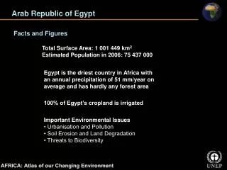
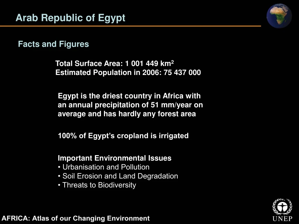
Arab Republic of Egypt. Facts and Figures. Total Surface Area: 1 001 449 km 2 Estimated Population in 2006: 75 437 000. Egypt is the driest country in Africa with an annual precipitation of 51 mm/year on average and has hardly any forest area. 100% of Egypt’s cropland is irrigated.

E N D
Arab Republic of Egypt Facts and Figures Total Surface Area: 1 001 449 km2 Estimated Population in 2006: 75 437 000 Egypt is the driest country in Africa with an annual precipitation of 51 mm/year on average and has hardly any forest area 100% of Egypt’s cropland is irrigated Important Environmental Issues • Urbanisation and Pollution • Soil Erosion and Land Degradation • Threats to Biodiversity
Arab Republic of Egypt The Disappearing Damietta Promontory At several points along the coast, the delta is now receding Damietta Promontory has eroded dramatically as waves and currents have stripped its sands faster than the river can replenish them (yellow arrow) While there are local areas of accretion such as the Damietta Spit (red arrow), on balance the delta is shrinking
Arab Republic of Egypt Megacity Growing in the Desert: Cairo Cairo is the largest city in Africa, ranked by urban population Growing continuously, the population of Cairo increased from less than six million in 1965 to more than ten million in 1998 and the city’s current estimates are at 16 million The urban extent of Cairo (gray areas) expands dramatically between the 1972 and 2005 images
Arab Republic of Egypt Nile Waters in the Desert: Toshka Lakes Much of the needed infrastructure is already in place and crops are already being produced on irrigated land including fruits and wheat (green around the lakes in 2007 image) Continued overflow since mid-1990s from Lake Nasser created a series of lakes (Toshka) in the Western Desert Lake-free Toshka Depression in the Western Desert
Republic of Equatorial Guinea Facts and Figures Total Surface Area: 28 051 km2 Estimated Population in 2006: 515 000 Bioko Island in Equatorial Guinea has several endemic sub-species of primates, including the drill (Mandrillus leucophaeus poensis) and the red-eared monkey (Cercopithecus erythrotis) Oil exports as proportion of total national exports - 90% Important Environmental Issues • Oil Production and Coastal Degradation • Deforestation • Bushmeat and Hunting on Bioko Island
Republic of Equatorial Guinea Oil and Gas in Punta Europa These images show massive infrastructural development of the gas and the hydrocarbon facility at Punta Europa on Bioko between 2000 and 2007 The Alba gas field located 19 km north of Bioko Island is the country’s largest natural gas field, with 37 000 million m3 of proven reserves
Eritrea Facts and Figures Total Surface Area: 117 600 km2 Estimated Population in 2006: 4 560 000 In 2006, Eritrea announced it would become the first country in the world to turn its entire coastline into an environmentally protected zone At 6% per year Eritrea had the third highest population growth rate in Africa between 2000 -2005 Important Environmental Issues • Water Stress • Land Availability and Land Degradation • Deforestation and Threats to Biodiversity
Eritrea Cultivating Mangroves in Hagigo Along 15% of Eritrea’s coast there are stretches of green that contrast with the arid environment surrounding them More than 700 000 mangrove seedlings have been planted along the Eritrean coast since 2001 (yellow arrows) The 2001 and 2007 images of the coast near Hagigo, Eritrea show how quickly the seedlings are growing into stands of mangrove trees (yellow arrows)
Federal Democratic Republic of Ethiopia Facts and Figures Total Surface Area: 1 104 300 km2 Estimated Population in 2006: 79 289 000 In 2005 scientists watched a 60 kilometre fissure develop in the Afar Desert of Ethiopia. The fissure created an eight metre wide rift at its centre which may be the beginning of a “future ocean” Ethiopia has the lowest access to an improved water source in Africa at 22% Important Environmental Issues • Water Availability and Access to a Safe Source • Livestock, Soil Erosion, and Land Degradation • Threats to Biodiversity and Endemism
Federal Democratic Republic of Ethiopia Shrinking Water Resources: Lake Alemaya In recent times Alemaya’s water level and surface area have declined considerably Increasing irrigation and domestic water use, change in the local climate, and changes in the surrounding land cover are believed to be the causes of Alemaya’s demise
Federal Democratic Republic of Ethiopia Urban Sprawl in Addis Ababa 27% of Ethiopia’s urban population lives in Addis Ababa These satellite images taken in 1973 and 2005 show the development of Addis Ababa’s massive urban sprawl The population of Addis Ababa is currently 2.9 million, and is projected to grow to 5.1 million by 2015
Gabonese Republic Facts and Figures Total Surface Area: 267 668 km2 Estimated Population in 2006: 1 406 000 Gabon has more than 8 000 species of plants, 20% of which are endemic Gabon has the highest proportion of land area under forest on the African continent at 84.5% Important Environmental Issues • Threats to Biodiversity • Coastal Degradation and Industrial Pollution • Lack of Sanitation and the Urban Environment
Gabonese Republic Forestry in the Guineo-Congolese Forest In the 1988 image only slight disturbance of the forest cover is visible (yellow arrow) The 2000 image shows a clear cut patch in the centre of the image at a re-growth stage
Republic of the Gambia Facts and Figures Total Surface Area: 11 295 km2 Estimated Population in 2006: 1 556 000 The Gambia is the smallest of the mainland African states 90% of the Gambia River’s annual discharge occurs in only four months, July to October Important Environmental Issues • Drought and Agricultural Productivity • Threats to Forest and Wetland Ecosystems • Overfishing and Coastal Erosion
Republic of the Gambia Urban Sprawl in Greater Banjul Area The capital city of Banjul grew rapidly until the early 1980s, when commuter services from the surrounding area were developed The sprawl of greater Banjul has led to the loss of forest cover and arable land These images show the dramatic increase in urban development in the Banjul area between 1973 and 2006
Republic of Ghana Facts and Figures Total Surface Area: 238 553 km2 Estimated Population in 2006: 22 556 000 The closing of Akosombo Dam in the early 1960s flooded 4% of Ghana’s land and created the largest reservoir in the world by surface area - Lake Volta Ghana’s share of the world’s cocoa production is at 21% Important Environmental Issues • Deforestation • Land Degradation and Coastal Erosion • Overfishing and Reduced Water Volume in Lake Volta
Republic of Ghana Forest Reserves Under Pressure in Ghana In the 1973 image the vegetation inside and outside the protected areas appears green and robust In the 2002/2003 dramatic change is apparent; some of the northern reserves have been decimated and the northern edge of the forest zone has moved south Mines (yellow arrow) pose a serious threat to Ghana’s remaining forests
Republic of Ghana Gold Mining in Wassa West District The mines in Wassa West have been kept out of the forest reserves, which can be seen as dark green areas with clear straight boundaries The 2002 image shows that the footprints of mining operations in the district have grown dramatically since 1986
Republic of Guinea Facts and Figures Total Surface Area: 245 857 km2 Estimated Population in 2006: 9 603 000 Guinea has the world’s largest bauxite reserves and is the world’s number one exporter of bauxite ore 22 of West Africa’s rivers originate in Guinea including the Niger, Senegal, and Gambia Rivers Important Environmental Issues • Deforestation and Refugees • Overfishing and Destruction of Mangrove Forests • Land Degradation
Republic of Guinea A City Between the Mangroves: Conakry In the 1975 image dense settlement has reached the airport and beyond, but natural vegetation still covered much of the area By 2007 nearly all of that vegetation has been overtaken by Conakry’s rapid growth
Republic of Guinea Mining a “Hotspot”: Sangaredi Mine The Sangaredi Mine in the Upper Guinea Forest falls within one of the world’s most biologically rich, yet seriously threatened, ecosystems The Sangaredi Mine is Guinea’s largest and most profitable In the 2007 image, the Sangaredi Mine is visible as a vast open pit approximately 20 km from one end to the other
Republic of Guinea-Bissau Facts and Figures Total Surface Area: 36 125 km2 Estimated Population in 2006: 1 634 000 Guinea-Bissau is the world’s sixth largest producer of cashew nuts, which account for over 90% of its export earnings 82% of Guinea-Bissau’s people are employed in agriculture Important Environmental Issues • Deforestation • Cashew Farming and Soil Erosion • Threats to the Bijagos Biosphere Reserve
Republic of Guinea-Bissau Balanta Rice Farming: Gêba Estuary The production of paddy, or “wetland,” rice started in the late 17th and early 18th centuries The 2005 high-resolution image shows the intensity of rice cultivation in an area near Cufar Rice paddies have replaced many of the mangroves along the Gêba and Mansôa Rivers to the north of the capital, Bissau (2007 image)
Republic of Kenya Facts and Figures Total Surface Area: 580 367 km2 Estimated Population in 2006: 35 106 000 Kenya is world-famous for wildlife safaris to areas like Amboseli and Nakuru National Parks, and the Maasai Mara Game Reserve Kenya is the number 1 producer and exporter of black tea in Africa • Important Environmental Issues • Water Scarcity and Pollution • Desertification and Deforestation • Degradation of Freshwater Ecosystems
Republic of Kenya Protection and Management of Mount Kenya Kamweti is part of Mount Kenya’s protected forest Depending on altitude and rainfall, there are a variety of different ecosystems on Mount Kenya, which are visible to some degree as various shades of green in the 2007 image
Republic of Kenya Irrigated Agriculture: Yala Swamp These images show the area before and after development of the region began A dam (yellow arrow) has also been erected on the river, to provide water for irrigation The small farm parcels in the 2002 image have largely been replaced by larger parcels, as is evident in the 2007 image
Kingdom of Lesotho Facts and Figures Total Surface Area: 30 355 km2 Estimated Population in 2006: 1 791 000 The Tlaeeng Pass, in the north of Lesotho, is 3 275 metres above sea level; it is the highest road in Africa 80% of Lesotho’s land area is classified as rangeland Important Environmental Issues • Degradation of Rangelands • Threats to Biodiversity in the Lesotho Highlands • Water Resource Management and Pollution
Kingdom of Lesotho The Lesotho Highlands Water Project The 1991 image shows part of the project area before the dams were constructed The 2006 image shows the areas inundated after both dams were completed
Republic of Liberia Facts and Figures Total Surface Area: 111 369 km2 Estimated Population in 2006: 3 356 000 Monrovia, the capital city of Liberia, receives on average 5 140 mm of rain per year, making it one of the wettest inhabited places in the world Liberia’s 2007 estimated annual population growth rate was the highest in the world at 4.8% Important Environmental Issues • Deforestation and Rubber Plantations • Threats to Biodiversity • Water Pollution
Republic of Liberia The Harbel Rubber Plantation The Harbel Rubber Plantation just north of Monrovia, Liberia, is the largest in the world These two images show that the extent of the Harbel rubber plantation has expanded slightly in 30 years (yellow arrow)
Republic of Liberia Indigenous Rain Forest: Sapo National Park The 1974 image shows the intact forest of the Sapo area prior to the park’s creation Roads and villages appear to have increased in the area surrounding the park - the 2001/2003 image shows that within the park itself the forest remains in good condition
Socialist People’s Libyan Arab Jamahiriya Facts and Figures Total Surface Area: 1759 540 km2 Estimated Population in 2006: 5 968 000 The Great Man-Made River is the largest underground network of pipes in the world, supplying water from a fossil aquifer in Libyan Arab Jamahiriya’s Sahara Desert to its coastal cities Freshwater supplied per day by the GMMR 6.5 million m3 Important Environmental Issues • Water Scarcity • Land Conversion and Desertification • Oil Production and Pollution
Socialist People’s Libyan Arab Jamahiriya Great Man-Made River Project GMMR’s largest reservoir, known as the Grand Omar Mukhtar, is located at Suluq (2006 image) When fully operational, the GMMR will pump 3.6 million m3 of the Nubian Aquifer water per day. Water from the aquifer is used to support extensive centre-pivot irrigation agriculture at Al Kufra (see 1972 and 2001 images).
Socialist People’s Libyan Arab Jamahiriya Urban Expansion in Tripoli Darker patches south of the city, visible in the 1976 image, represent grasslands that have since been converted to agricultural fields These satellite images, from 1976 and 2006, document some of the major changes in urban extent and the intensification of agriculture in the area surrounding the city. Yellow arrows indicate a few small areas of remaining natural vegetation
Republic of Madagascar Facts and Figures Total Surface Area: 587 041 km2 Estimated Population in 2006: 19 105 000 An astonishing 98% of Madagascar’s land mammals, 92% of its reptiles, 68% of its plants, and 41% of its breeding bird species exist nowhere else on Earth Of the world’s 8 baobab species Madagascar has 7 Important Environmental Issues • Soil Erosion • Endemism and Threats to Biodiversity • Deforestation
Republic of Madagascar Deforestation in Mikea Forest The area of Mikea Forest shown in these images has lost approximately 28% of its primary forest cover in the last three decades and the rate of loss appears to be accelerating The white dashed line shows loss between 1962 and 1999 The 2002/2003 image shows deforestation advancing still further to the west
Republic of Madagascar Morondava’s Centre Pivot Irrigation These three images show the region before irrigation (1973), after irrigation was introduced (2000), and after further expanded irrigation (2006) Roughly 22 000 metric tonnes of sugar were produced in this region in 2006
Republic of Malawi Facts and Figures Total Surface Area: 118 484 km2 Estimated Population in 2006: 13 166 000 With over 1 000 species, many of them endemic, Lake Malawi (Nyasa) is home to the largest variety of fish of any lake in the world 83% of Malawi’s population is rural Important Environmental Issues • Land Scarcity and Soil Erosion • Deforestation for Fuelwood • Water Pollution and Aquatic Biodiversity
Republic of Malawi Algae Blooms: Lake Malawi (Nyasa) In these images, the bluish green swirls in the lake are algae blooms caused by excess nutrients Among other things, the algae reduce dissolved oxygen levels in the water The algae blooms appear worse in 2006 image (note their concentration along the lake’s western shore)
Republic of Malawi Mountain Deforestation in Mount Mulanje Rising to 3 000 metres, Mount Mulanje is the tallest peak in south-central Africa Mulanje Mountain Forest Reserve was created in 1927 primarily to safeguard the water catchments and to control the extraction of the endemic Mulanje cedar—Malawi’s national tree 08 Oct 1973 Between 1973 and 2006, the top of the mountain underwent notable deforestation 09 Aug 2006
Republic of Mali Facts and Figures Total Surface Area: 1 240 192 km2 Estimated Population in 2006: 13 918 000 The Dogon people of Mali use an endemic plant (Acridocarpus monodii) as an effective remedy for malaria and various other illnesses Percentage of Mali’s land which is arable 3.8% Important Environmental Issues • Desertification and Drought • Water Availability and Pollution • Threats to Biodiversity
Republic of Mali The Drying Up of Lake Faguibine Water levels have fluctuated widely in Lake Faguibine since the beginning of the 20th century In the late 1980s, an extended period of reduced precipitation led to a complete drying up of the lake in the 1990s As global warming intensifies, there may be more change in store for the people who depend on water resources such as Lake Faguibine for their livelihoods
Republic of Mali Consequences of Manantali Dam Drought in the 1970s spurred the formation of the Multinational Organization for the Development of the Senegal River (OMVS) The Manantali Dam was one of two large dams built as part of the OMVS project The Manantali Dam did not produce any hydroelectric power until 13 years after its completion