Download
1 / 43
440 likes | 546 Views
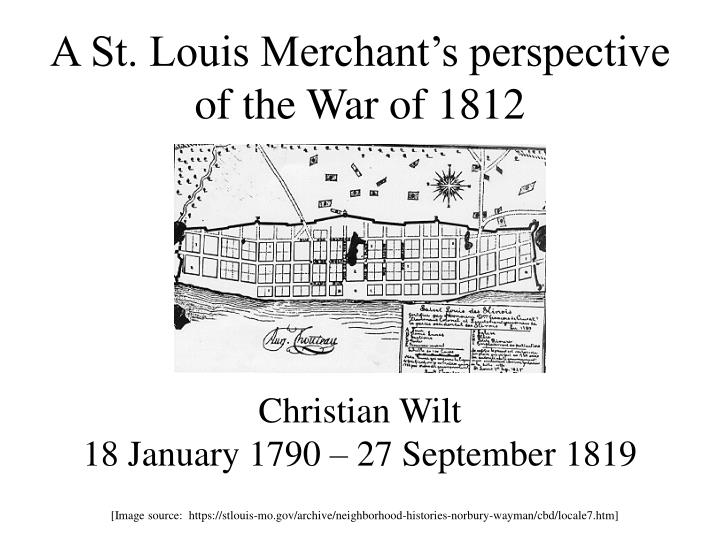
A St. Louis Merchant’s perspective of the War of 1812. Christian Wilt 18 January 1790 – 27 September 1819. [Image source: https://stlouis-mo.gov/archive/neighborhood-histories-norbury-wayman/cbd/locale7.htm].

E N D
A St. Louis Merchant’s perspective of the War of 1812 Christian Wilt18 January 1790 – 27 September 1819 [Image source: https://stlouis-mo.gov/archive/neighborhood-histories-norbury-wayman/cbd/locale7.htm]
Christian Wilt was born 18 January 1790 to Abraham and Rachel Wilt of Philadelphia. Letters hint that he was well-educated. He was described as “honest, adventuresome, and enterprising”. [Jennings, 16] [Image source: http://teachingamericanhistory.org/files/2013/09/phillymap.jpg]
Christian Wilt’s Uncle Joseph Hertzog, who was a Philadelphia merchant, sponsored his entry into business. [Image source: http://teachingamericanhistory.org/convention/birch/image09/]
Wilt traveled from Pittsburgh by keelboat down the Ohio River in the spring of 1810 with $13,841 of inventory composed of groceries from Hertzog’s Crown Street store, and “dry goods, some bought at auction for cash and some secured on short credit; and articles from the Pittsburgh stores which were charged to Hertzog’s account ”. [Jennings, 17-18] [Images source: https://www.connerprairie.org/site-assets/images/taming/keelboat.aspx]
The St. Louis in which Christian Wilt now found himself contained, according to the Census of 1810, fourteen hundred inhabitants; “one-fifth were Americans and about four hundred persons of color.” In no other town of the West was there such a mix of population; it was composed of the descendants of the early French colonists, Canadian voyageurs, Spaniards, Indians, shrewd Yankee traders, lawyers, Scotch-Irish from Kentucky and Pennsylvania. - Jennings, 20
When Christian Wilt settled in St. Louis in 1810, he “had little experience in business, and none in the manner of life and living encountered in a frontier settlement in 1810”. [Jennings, 16] [Image source: http://bloximages.newyork1.vip.townnews.com/stltoday.com/content/tncms/assets/v3/editorial/6/84/684c8576-634d-57b7-904a-41834007bb38/5307c88fd55e4.preview-620.jpg]
Saint Louis already had twelve generalstores operating by 1810, when Wilt rented an old building on the NE corner of Main Street, between the streets now known as Pine and Chestnut, for his first store. [Jennings, 33 & 42] [Image source: http://en.wikipedia.org/wiki/File:Stlouis1780.jpeg]
Wilt outfitted the expeditions of the Missouri Fur Company, as-well-as individual trappers and coureurs-des-bois. He also provisioned Astor’s Overlanders’ expedition up the Missouri, headed for the Oregon Country, in the fall of 1810. [Jennings, 44-45] [Image source: http://www.legendsofamerica.com/photos-oldwest/Trading%20with%20the%20American%20Fur%20Company.jpg]
Wilt expanded his business interests, investing in the lead trade. He also made plans to open a factory, as-well-as a store, at Herculaneum in 1811. [Jennings, 86-92] [Image source: http://upload.wikimedia.org/wikipedia/en/6/67/Herculaneum-mural.jpg]
Wilt proposed opening another store at Ste. Genevieve, with P. Falconer as the agent [Jennings, 88] [Image source: http://www.aubuchon-online.com/images/Maps/Kaskaskia-SteGenevieve2.jpg]
“These merchants, as a class, were important, not only because of their numbers, but because they were men of intelligence, wealth, and enterprise. They developed trade, speculated in land, opened and operated mines, founded manufacturing plants, and began weaving the fabric of society in the land of the West.” [Jennings, 41] [Image source: http://www.nps.gov/bica/historyculture/images/Fur_Traders_on_the_Missouri.jpg]
[Source: http://www.history-map.com/picture/003/Louisiana-with-map-of.htm]
From August 1805 through April 1806, Army engineer Zebulon Pike explored and mapped the upper-Mississippi River to its source in present-day Minnesota. [Source: http://www.loc.gov/exhibits/lewisandclark/images/ree0102a.jpg]
These mapswere the most accurate maps available to civilian leaders and military planners at the time of the War of 1812. [Source: http://www.loc.gov/exhibits/lewisandclark/images/ree0102b.jpg]
Map of Illinois by John Melish (1820) [Source: http://www.davidrumsey.com/maps5147.html]
Anticipating hostilities would erupt during the summer of 1812, Territorial Governor Ninian Edwards collected intelligence on the Indians of Illinois. [Image source: Ninian Edwards’ Papers, Chicago History Museum]
He was interested in their location, number of warriors, and their general disposition towards the United States of America. [Image source: Ninian Edwards’ Papers, Chicago History Museum]
“[I] gained intelligence that the wampum was carried by British influence along the banks of the Missouri and that all the nations of the great river were expected to join the universal confederacy then setting afoot, of which the Prophet was the instrument and British traders the soul.”- Manuel Lisa to William Clark, as quoted from the Missouri Gazette, July 5, 1817] Tenskwatawa by George Catlin (1830)
The federal Congress of the United States of America passed the Militia Reorganization Act, 4 June 1812. [Image source: http://frontierpartisans.com/1886/vengeance-on-the-thames/]
The United States of America formally declared war on Great Britain 18 June 1812.
Knowledge that war had been declared reached Saint Louis 9 July 1812. [Image source: https://stlouis-mo.gov/archive/neighborhood-histories-norbury-wayman/cbd/locale7.htm]
Wilt attempted to supply American troops during the War of 1812. [Jennings, 36] [Image source: http://www.usgennet.org/usa/mo/county/stlouis/bellefontaine/bellefontaine-map.gif]
Fort Michilimackinac surrenderedto the British 17 July 1812. [Image source: http://www.uppercanadahistory.ca/brock/brock5p2a.jpg]
“. . . it is said that there are two regiments formed in Canada of Yankees and that 10,000 Indians have joined the British standard, the Foxes, Sacks, Puants and several other nations have had a council, most of them are for the British . . . .” - Christian Wilt, St. Louis, July 19, 1812
“It is supposed here that unless Hull is successful in the taking of Malden, etc., the Indians will over-run this country. I just learned that an express arrived in Kentucky bringing information of Hull’s being defeated and Detroit and his army entirely cut to pieces. The person that brings this information from Kentucky, it is said, may be relied on.” - Christian Wilt St. Louis, July 26, 1812
On 15 August 1812, a column of soldiers accompanying women and children were attacked as they traversed the dunes along the shore of Lake Michigan south of Fort Dearborn.
General William Hull surrendered Detroit to General Isaac Brock the next day. [Image source: http://www.archives.gov.on.ca/en/explore/online/1812/pics/971_266_detroit_520.jpg]
“I hear nothing of Philipson’s adventure to Canada, Cabanne and Chenir have not returned.” - Christian Wilt, St. Louis, August 16, 1812
“ . . . We have news here that Mackinaw has been taken by the British and Indians which is a thing not impossible, as there was only about twenty-four men stationed there, chiefly cast-off boatmen (Canadians). If the news proves correct I fear that British traders may smuggle in goods and then adieu to all our prospects in the rise of goods and our expectations of gain on ours. It is also to be feared that the Indians may come upon us here, the Governor has ordered out two volunteer companies to relieve McNair’s Company of cavalry, who have been out one month. Honey belongs to one and will have to go. I shall have to shut up his store unless I can find a young man to take his place. It is a shame to the heads of our war department that more attention has [not] been paid to putting the frontiers in a state of defense. In Bellefontaine there is stationed not more than twenty men if that. Fort Mason, about 150 miles up the Mississippi, about the same number, Fort Madison about 50 men. Lieut. Pryor thinks that if Mackinaw is taken Fort Madison is also as it is much too large for the number of troops there. Hull marches into Canada with 2500 when he might just as well have taken 8 or 10 thousand. If Mackinaw is taken it will encourage the Indians to ravage the frontiers.” - Christian Wilt, St. Louis, August 23, 1812
(1) Fort Bellefontaine, U.S. headquarters(2) Fort Osage, abandoned 1813(3) Fort Madison, defeated 1813(4) Fort Shelby, defeated 1814(5) Battle of Rock island Rapids, July 1814 and the Battle of Credit Island, September 1814(6) Fort Johnson, abandoned 1814(7) Fort Cap au Gris and the Battle of the Sink Hole, May 1815. [Image source: http://familysearch.org/learn/wiki/en/Missouri_Territory_in_the_War_of_1812]
Fort Madison, near the mouth of the Des Moines River, was abandoned as untenable in September 1813, as-a-result of intermittent skirmishing and being besieged. [Image source: http://upload.wikimedia.org/wikipedia/commons/6/64/Old_Fort_Madison,_built_in_1808_-_History_of_Iowa.jpg]
An attempt to re-supply Fort Shelby in southwestern Wisconsin was thwarted at the Battle of Rock Island Rapids (Campbell’s Island), 19 July 1814. [Image source: http://www.illinois.gov/ihpa/Experience/Sites/NorthWest/PublishingImages/CampbellsIslandBronzeRelief.png]
A combined-force of Indians and British captured Fort Shelby, 20 July 1814. [Image source: http://images.wisconsinhistory.org/700004120249/0412002568-l.jpg]
Major Zachary Taylor’s attempt to wrest control of the upper-Mississippi River back from the British was turned-back at the Battle of Credit Island, 4-5 September 1814.
Fort Johnson was established on the Illinois-side of the Mississippi River in September 1814. [Image source: http://www.callawayfamily.org/images/jamescallawaymap.jpg]
The History of Saint Louis Neighborhoods, Missouri Territory in the War of 1812, https://stlouis-mo.gov/archive/neighborhood-histories-norbury-wayman/cbd/locale7.htm (14 May 2014) • http://familysearch.org/learn/wiki/en/Missouri_Territory_in_the_War_of_1812 (14 May 2014) • Ninian Edwards Papers, Folder #3 (1812-1813) of Box #1 (1798-1825), Chicago History Musem • Jennings, Sister Marietta. A Pioneer Merchant of St. Louis, 1810-1820: The Business Career of Christian Wilt. New York, New York: Columbia University Press, 1939. • Teaching American History, Ashbrook Center, 2006-2012 http://teachingamericanhistory.org/convention/map/ (15 May 2014) • Saint Louis in 1800, St. Louis Post-Dispatch, http://www.stltoday.com/news/multimedia/st-louis-in/image_684c8576-634d-57b7-904a-41834007bb38.html (15 May 2014) • Historical Narratives of Early Canada, http://www.uppercanadahistory.ca/brock/brock5.html (15 May 2014) • Battle of Campbell’s Island http://www.archive.org/stream/battleofcampbell00mees/battleofcampbell00mees_djvu.txt