Download
1 / 12
120 likes | 139 Views
This system allocates a /48 IPv6 address for every 10*10 meter section of the Earth using latitude and longitude coordinates, reducing impact on global routing tables. Utilize a mathematical formula to derive unique IPv6 addresses and network masks. Detailed process described in the links provided.

E N D
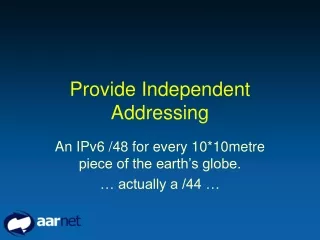
Provide Independent Addressing An IPv6 /48 for every 10*10metre piece of the earth’s globe. … actually a /44 …
PIA IPv6 addresses • Described at: http://www.tndh.net/~tony/ietf/draft-hain-ipv6-pi-addr-fmt-01.txt • Use latitude & longitude to mathematically derive an IPv6 address, and the size of the area to derive the network mask. • Need to route through an aggregation point (an IPv6 internet exchange) – least impact on global routing table.
Provider Independent Addressing | 4 | 44 | 16 | 64 bits | +---+-------------------------+--------+---------------------------+ |FP | Reference | SLA | Interface ID | +---+-------------------------+--------+---------------------------+ bits degrees nominal square scope sites -------------------------------------------------------------------- 4 -> 90.00000 10000 km octant 8 -> 22.50000 2500 km expanse 12 -> 5.625000 600 km zone 16 -> 1.406250 150 km region 20 -> 0.3515625 40 km metro 16777216 24 -> 0.087890625 10 km city 1048576 28 -> 0.02197265625 2.5 km locality 65536 32 -> 0.0054931640625 600 m neighborhood 4096 36 -> 0.001373291015625 150 m block 256 40 -> 0.00034332275390625 40 m lot 16 44 -> 0.0000858306884765625 10 m site 1
Core Routing Table Examples Region lat long bit interleave --------------------------------------------------------- W. Europe (west) 080000 : 3F0000 -> 15D5:0000:0000:: W. Europe (east) 080000 : 000000 -> 1080:0000:0000:: S. Africa 260000 : 000000 -> 1828:0000:0000:: NE Africa 030000 : 030000 -> 100F:0000:0000:: E. Europe 080000 : 060000 -> 1094:0000:0000:: C. Asia 030000 : 0C0000 -> 105A:0000:0000:: E. Asia 060000 : 180000 -> 1168:0000:0000:: Australia 260000 : 180000 -> 1968:0000:0000:: Alaska 0C0000 : 240000 -> 14B0:0000:0000:: NW US 080000 : 2B0000 -> 14C5:0000:0000:: Central America 030000 : 2E0000 -> 145E:0000:0000:: SE US 060000 : 300000 -> 1528:0000:0000:: South America 260000 : 300000 -> 1D28:0000:0000:: NW Africa 000000 : 3D0000 -> 1551:0000:0000::
Locations within 600km sq New York area (~Zone)::/14 Danvers, MA – 42.56940 n 70.94246 w 152F:9607:3912:: Cambridge, MA – 42.37704 n 71.12561 w 152F:91C4:DD54:: Boston, MA – 42.21300 n 71.03300 w 152F:9157:0D93:: Providence, RI – 41.49260 n 71.24400 w 152F:3911:63EF:: Bridgeport, CT – 41.10010 n 73.12100 w 152F:20A8:845C:: Upton, NY – 40.52100 n 72.53100 w 152F:0B65:086A:: New York, NY – 40.42510 n 74.00200 w 152E:59EA:A19C:: Newark, NJ – 40.44080 n 74.10200 w 152E:5B05:C043:: Cherry Hill, NJ – 39.93080 n 75.01754 w 152E:46C3:71DE:: Baltimore, MD – 39.17250 n 76.36400 w 152C:BE78:E194:: TysonsCorner, VA – 38.55070 n 77.13500 w 152C:B2C9:6AA0:: Reston, VA – 38.93501 n 77.35144 w 152C:ADDF:EE96:: Chantilly, VA – 38.88413 n 77.43544 w 152C:ADC7:D985::
Locations within 150km sq Miami area (~Region)::/18 Boca Raton, FL – 26.34460 n 80.21094 w 1521:CDF9:EA84:: DeerfiledBeachFl – 26.30956 n 80.09917 w 1521:D8A6:6941:: CoralSprings, FL – 26.27140 n 80.25558 w 1521:CDCF:9D64:: PompanoBeach, FL – 26.23153 n 80.12346 w 1521:D883:B75E:: FtLauderdale, FL – 26.12156 n 80.12878 w 1521:D821:B208:: PembrokePines,FL – 26.02427 n 80.24018 w 1521:CD50:2C74:: South Miami, FL – 25.70025 n 80.30141 w 1521:C743:9C32:: Key Biscayne, FL – 25.69210 n 80.16248 w 1521:C757:653D:: Homestead, FL – 25.47664 n 80.48385 w 1521:C52B:2B95::
Locations within 40km sq Chicago area (~Metro)::/22 Skokie, IL – 42.03617 n 87.73283 w 152A:3E97:06F4:: Schaumburg, IL – 42.05807 n 88.04819 w 152A:3EC8:53B0:: Chicago, IL – 41.88585 n 87.61812 w 152A:3E58:3436:: Oak Brook, IL – 41.78910 n 87.94009 w 152A:3EF3:E7FD:: DownersGrove, IL – 41.80343 n 88.01375 w 152A:3EEC:9433:: Orland Park, IL – 41.61938 n 87.84225 w 152A:3E2C:0D25::
PI Examples (Florida) • Alpha - 1523:3173:3ACB::/48 (UFL) • Golf - 1523:2887:785F::/48 (FSU) • India – 1521:D223:2B11::/48 (FIU) • Dingo – 151A:3023:E3E::/48 (UPR) • Fox – 1521:C74C:C4D9::/48 (UMiami) • Hotel - 1523:40B0:3347::/48 (UOrlando)
Calculating PIA IPv6 addresses • Usage described at: http://www.tndh.net/~tony/ietf/draft-hain-ipv6-pi-addr-use-01.txt • Determine latitude/longitude in degrees and decimals, e.g. 22.3333 s, -33.12345 w • Enter Lat/Long into PIA calculator to get PIA ipv6 address • see Abilene PIA background and calculator at loadrunner.uits.iu.edu/~neteng/ipv6/pi/pi.html
PIA Lab:--calculate PIA for your location-- Alice Springs Latitude -23.7951 Longitude 133.889 Elevation 546m http://www.bom.gov.au/climate/map/stations/015590.shtml Bourke Lat -30.052 Long 145.952 Broome Latitude -17.9492 Longitude 122.2336 Elevation 7m http://www.bom.gov.au/climate/map/stations/003003.shtml Cairns Latitude -16.8736 Longitude 145.7458 Elevation 3m http://www.bom.gov.au/climate/map/stations/031011.shtml Darwin Latitude -12.4245 S Longitude 130.8832 E Elevation: 30.0m http://www.bom.gov.au/climate/map/stations/300017.shtml Doomadgee (closest lat/long I could find was another town) Latitude -17.7422 Longitude 139.5492 Elevation 5.5m http://www.bom.gov.au/climate/map/stations/029004.shtml http://www.gulf-savannah.com.au/regions/doomadgee.asp
PIA Lab • Calculate provider-independent address for your location • Allocate prefixes as before to all interfaces, peers • Apply additional addresses to all router interfaces • Adjust BGP (network statement, prefix-list, static-to-null, filters) as necessary to advertise/accept new routes • Check: do laptops on your LAN receive new address? can your router see all other prefixes? • How could they be aggregated given the calculated addresses?
PIA Lab:Some Australian Locations Bits in 3rd nibble: • Broome: 191b:4f44:fd5a::/48 0001 • Alice Springs: 1935:5ad9:be57::/48 0011 • Cairns: 1949:feeb:a8fb::/48 0100 • Doomadgee: 194a:587f:2a6e::/48 0100 • Bourke: 1963:772e:9f0a::/48 0110 • Darwin: 191d:1a32:6e0f::/48 0001 • So they could be aggregated on the 9th bit