Download
1 / 21
210 likes | 352 Views
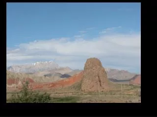
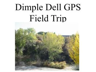
Dimple Dell GPS Field Trip. This is a field trip to Dimple Dell Park just south of 7th East. Entrance is on Carnation Drive.

E N D
This is a field trip to Dimple Dell Park just south of 7th East. Entrance is on Carnation Drive. This field trip concentrates on using GPS units to find areas of erosion, deposition, and places that resist erosion because of grasses, foliage, and cryptogrammic crust. As students move from place to place they will observe the area and record their findings.
GPS Coordinates for the Stations • 1. N 40 34.047’ W 111 51.910’ • 2. N 40 34.072’ W 111 51.954’ • 3. N 40 34.079’ W 111 51.984’ • 4. N 40 34.091’ W 111 52.022’ • 5. N 40 34.100’ W 111 52.082’ • 6. N 40 34.112’ W 111 52.129’ • 7. N 40 34.119’ W 111 52.173’ • 8. N 40 34.135’ W 111 52.284’
GPS Names for the Stations • 1. Road Flooding • 2. Far Hillside Erosion • 3. Cryptogrammic crust on the Hillside • 4. Riverbank Erosion • 5. Dry Streambed-Signs of Water • 6. Runoff Signs-Downhill • 7. Sink Hole • 8. Geo Cache
GPS Coordinates and Names For the Stations • 1. N 40 34.047’ W 111 51.910’ Road Flooding • 2. N 40 34.072’ W 111 51.954’ Far Hillside Erosion • 3. N 40 34.079’ W 111 51.984’ Cryptogrammic Crust • 4. N 40 34.091’ W 111 52.022’ Riverbank Erosion • 5. N 40 34.100’ W 111 52.082’ Dry Streambed-Signs of Water • 6. N 40 34.112’ W 111 52.129’ Runoff Signs-Downhill • 7. N 40 34.119’ W 111 52.173’ Sink Hole • 8. N 40 34.135’ W 111 52.284’ Geo Cache
Road Flooding • Signs that water was on the road. • There are deposits of sand. • There is a deep part on the curve. • An island where the water went around. • Shows where water came out on the road. • Shows where water went back into the stream.
Far Hillside Erosion • Signs of run-off from the top to the bottom. • Shows the soil at the bottom of the hill. • Hillside has holes in it made by birds. • Was once a deposit by a larger stream. • Made of clay showing the stream slowed down. • Has steep cliffs showing breaking off.
Cryptogrammic Crust • Shows erosion of many years ago. • Small growth of lichen on the hillside to hold the soil back from run-off. • Other plants are able to begin to grow because of the hill being held by the crust. • Deer tracks on the hillside.
Riverbank Erosion • Rocks showing in the erosion. • Eating part of the road away. • Irregular wearing. • Roots showing. • Sand bars made down stream.
Stream Bed--Signs of Water • Water has made a cut in the hillside. • The water has exposed the roots of trees. • Round rocks at the bottom of the bed. • Not just a straight stream, but meandering. • As it levels out, it put down the sediments.
Run-off Signs--Downhill • Grass lying down. • Some parts of the hill worn away. • New plants growing where the hill is worn down. • Some rocks exposed.
Sink Hole • A depression on the hillside • All the plants are still there. • Sides of the sink hole show the dirt. • Water has either dissolved a small part of the soil underneath and sank, or • Water has washed the soil away underneath and the hole sank when when the water was gone.
Geo Cache • A tree covered place in the forest. • Shows signs of other humans being there. • Hidden from the main path. • Good place for animals to hide.