Download
1 / 26
320 likes | 821 Views
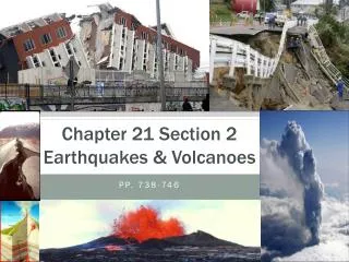
Chapter 21 Section 2 Earthquakes & Volcanoes. pp. 738-746. Earthquakes. Occur due to plate movement faults Introduction to Earthquakes It’s an Earthquake Song. Earthquakes: Focus vs. Epicenter. Foc u s : point U NDER Earth ’ s surface where waves originate…along the fault line

E N D
Chapter 21 Section 2Earthquakes & Volcanoes pp. 738-746
Earthquakes • Occur due to plate movement faults • Introduction to Earthquakes • It’s an Earthquake Song
Earthquakes: Focus vs. Epicenter • Focus: pointUNDEREarth’s surface where waves originate…along the fault line • Epicenter: point ON Earth’s surface directly above the focus…surface waves begin here and move outward • Focus of an Earthquake
Seismic Waves • 3 types of seismic waves: • P-waves • S-waves • Surface waves Seismic Waves Song
P-Waves • P (primary)-waves: move the fastest • Rocks are squeezed & pushed indirection of wave (longitudinal) • P-Wave Animation
S-Waves • S (secondary/shear)-waves: rocks move at right angles (transverse)to direction of waves • Slowerthan P-waves • S-Wave Animation
Surface waves • Rocks move sideways and up & down • Slowestof the three types of waves • Most destructive wave Surface Wave Animation
How are earthquakes measured? • Seismograph: instrument that can detect, amplify, and record ground vibrations too small to be perceived by human beings • Seisomogram: a graph showing the motion of the ground versus time • Seismograph Animation • Seismograph-ing to the beat • Cali Seismogram Real Time
Travel-time curves • Measures the time between P & S-waves (that hit a particular seismic station) • Wave speed differs b/c of density & rigidity of Earth’s layers • Tells you the distance of location from epicenter • As the time between wavesincreases the distance from epicenter increases • Time & Distance= Directrelationship!
Locating the Epicenter • Use travel-time curve • Ex. Difference between P & S waves=6.3 min • What’s the distance from the epicenter? • 4,000 km
Big Deal? What does that tell us… • By looking at travel-times of seismic waves to different stations, we can generate a probability of epicenter location (scale distance on map) • See circles around d1, d2 and d3? • Where all 3 circles intersect tells us epicenter! • Quake Movie Trailer
Determining Destruction • Richter Scale • measures magnitude (energy of largest seismic wave) on 1-10 scale • looking at the wave’s largest amplitude • Each magnitude is 10 times stronger than the previous magnitude • Ex: magnitude 8 earthquake releases as much energy as detonating 6 million tons of TNT! • Largest EQs Since 1900 • Predicting Earthquakes?! Larger earthquakes occur less frequently, the relationship being exponential; for example, roughly ten times as many earthquakes larger than magnitude 4 occur in a particular time period than earthquakes larger than magnitude 5. This is an example of the Gutenberg-Richter law. Ex: For every magnitude 4.0 event there will be 10 magnitude 3.0 quakes and 100 magnitude 2.0 quakes.
Determining Destruction con’t • Modified Mercalli Scale • amount of shaking experienced at different locations (intensitydamage) • Varies based on: • overall magnitude • how far you are from the fault that ruptured in the earthquake • rock/ land texture or type (i.e. sand vs. concrete) • More meaningful measure of severity to the nonscientist because intensity refers to the effects actually experienced at that place.
Tsunamis • Japan March 2011 Tsunami Photos Nat. Geo. • Tsunami Animation • Cause: series of ocean waves generated by sudden displacements in the sea floor, landslides, or volcanic activity. • In the deep ocean, the tsunami wave may only be a few inches high. • The tsunami wave may come gently ashore or may increase in height to become a fast moving wall of turbulent water several meters high. • Tsunamis 101
Mt. St. Helens Volcanoes
Zones of Volcanism • Volcanism: all the processes associated with the release of magma, hot fluids, and gas • Fueled by magma • Rises to surface because less dense • Called lava once at surface
Location of Volcanoes NOT RANDOM! • Mostly determined by plate boundaries • Most at convergent and divergent boundaries • 5% far from boundaries
Major Belt of Convergent Volcanoes Circum-Pacific Belt (Pacific Ring of Fire) • Outlines the Pacific Plate • Convergent volcanism: • Plates colliding • Continental subduction zones • Characterized by explosive eruptions
Divergent Volcanism • Formed where plates move apart • New ocean floor is produced here • Pillow lava forms at ocean ridges • Characterized by non-explosive eruptions • About 2/3 of Earth’s volcanoes occur at divergent boundaries • Ex: Icelandic volcanoes uncharacteristically explosive due to hot spot
Hot Spots • Unusually hot regions of Earth’s mantle where high-temperature plumes (columns) of magma rise to the surface • Usually form far from plate boundaries • Stationary – plate moves over spot • Ex: Hawaiian Islands Bend in chain change in direction of plate movement!
Volcano Anatomy • Conduit: tube-like structure that magma travels through to surface • Vent: opening that lava comes out of • Crater: bowl-shaped depression around the vent • Usually less than 1 km (0.6 mi) in diameter
Types of Volcanoes • Appearance determined by: • Type of material that forms volcano • Type of eruptions • 3 types: • Shield • Cinder cone • Composite 1. 2. 3.
Shield Volcanoes • Broad, gently sloping sides • Non-explosive, quiet eruptions • Made of layers of basaltic lava • Largesttype (width wise) • Ex: Mauna Loa (Hawaii)
Cinder Cone • Steep sides, cone shaped • Mostly basaltic lava • Explosive eruptions • Smallesttype (most less than 500 m or 0.3 mi high) • Often on or near larger volcanoes • Ex: Lassen Volcanic Park (California)
CompositeVolcano • Large, cone shaped, concave slopes • Much larger than cinder cones • Made of layers of rock (harden lava) from explosion and lava flows • Violent eruptions (with periods of quiet ones) • Ex: Mt, Augustine (Alaska), Mt. St. Helens (Washington)
Mt. Vesuvius, Italy • Catastrophic eruption of A.D. 79 destroyed the cities of Pompeii and Herculaneum and killed at least 16,000 people • Composite--Buried 10’ deep with lava & ash filled hollows with plaster to see form • Thermal energy570 degrees F (300 degrees C) • Most died instantly of extreme heat, with many casualties shocked into a sort of instant rigor mortis.