Download
1 / 90
920 likes | 1.24k Views
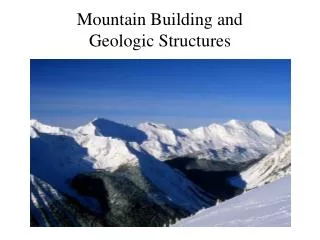
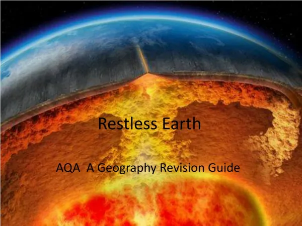
Chapter 6 Restless Earth: Earthquakes, Geologic Structures, and Mountain Building. What Is an Earthquake?. An earthquake is the vibration of Earth produced by the rapid release of energy Energy released radiates in all directions from its source, ( focus ) Energy is in the form of waves

E N D
Chapter 6 Restless Earth: Earthquakes, Geologic Structures, and Mountain Building
What Is an Earthquake? • An earthquake is the vibration of Earth produced by the rapid release of energy • Energy released radiates in all directions from its source, (focus ) • Energy is in the form of waves • Sensitive instruments around the world record the event
Earthquake Focus and Epicenter Figure 6.2
What Is an Earthquake? • Earthquakes and faults • Movements that produce earthquakes are usually associated with large fractures in Earth’s crust called faults • Most of the motion along faults can be explained by the plate tectonics theory • There is vertical as well as horizontal displacement associated with quakes • Most faults are locked by the confining pressure of the overlying crust • There are brief abrupt movements along faults that accompany an earthquake
What Is an earthquake? • Elastic rebound • Mechanism for earthquakes was first explained by H. F. Reid • Rocks on both sides of an existing fault are deformed by tectonic forces • Rocks bend and store elastic energy
What Is an earthquake? • Elastic rebound • Earthquake mechanism • Slippage at the weakest point (the focus) occurs • Vibrations (earthquakes) occur as the deformed rock “springs back” to its original shape (elastic rebound)
What Is an earthquake? • Foreshocks and aftershocks • Adjustments that follow a major earthquake often generate smaller earthquakes called aftershocks • Small earthquakes, called foreshocks, often precede a major earthquake by days or, in some cases, by as much as several years
Seismology • The study of earthquake waves, seismology, dates back almost 2000 years to the Chinese • Seismographs, instruments that record seismic waves • Record the movement of Earth in relation to a stationary mass on a rotating drum or magnetic tape
Seismology • Seismographs • More than one type of seismograph is needed to record both vertical and horizontal ground motion • Records obtained are called seismograms • Types of seismic waves • Surface waves • Travel along outer part of Earth
Seismology • Types of seismic waves • Surface waves • Complex motion • Cause greatest destruction • Exhibit greatest amplitude and slowest velocity
Seismology • Types of seismic waves • Body waves • Travel through Earth’s interior • Two types based on mode of travel • Primary (P) waves • Push-pull (compress and expand) motion, changing the volume of the intervening material • Travel through solids, liquids, and gases
Seismology • Types of seismic waves • Body waves • Secondary (S) waves • “Shake” motion at right angles to their direction of travel • Travel only through solids • Slower velocity than P waves
Locating an Earthquake • Terms • Focus—The place within Earth where earthquake waves originate • Epicenter—Location on the surface directly above the focus • Epicenter is located using the difference in velocities of P and S waves
Locating an Earthquake • Locating the epicenter of an earthquake • Three station recordings are needed to locate an epicenter • Each station determines the time interval between the arrival of the first P wave and the first S wave at their location • A travel-time graph is used to determine each station’s distance to the epicenter
Seismogram Showing P, S, and Surface waves Figure 6.7
A Travel-Time Graph Figure 6.9
Locating an Earthquake • Locating the epicenter of an earthquake • A circle with a radius equal to the distance to the epicenter is drawn around each station • The point where all three circles intersect is the earthquake epicenter
Finding an Earthquake Epicenter Figure 6.10
Locating an Earthquake • Earthquake belts • About 95 percent of the energy released by earthquakes originates in a few relatively narrow zones that wind around the globe • Major earthquake zones include the Circum-Pacific belt and the Oceanic-Ridge system
Measuring the Size of Earthquakes • Two measurements that describe the size of an earthquake are • Intensity—A measure of the degree of earthquake shaking at a given locale based on the amount of damage • Magnitude—Estimates the amount of energy released at the source of the earthquake
Measuring the Size of Earthquakes • Intensity scales • Modified Mercalli Intensity Scale was developed using California buildings as its standard • The drawback of intensity scales is that destruction may not be a true measure of the earthquake’s actual severity
Measuring the Size of Earthquakes • Magnitude scales • Richter magnitude—Concept introduced by Charles Richter in 1935 • Richter scale • Based on the amplitude of the largest seismic wave recorded • Accounts for the decrease in wave amplitude with increased distance
Measuring the Size of Earthquakes • Magnitude scales • Richter scale • Magnitudes less than 2.0 are not felt by humans • Each unit of Richter magnitude increase corresponds to a tenfold increase in wave amplitude and a32-fold energy increase
Measuring the Size of Earthquakes • Magnitude scales • Other magnitude scales • Several “Richter-like” magnitude scales have been developed • Moment magnitude was developed because none of the “Richter-like” magnitude scales adequately estimates very large earthquakes • Derived from the amount of displacement that occurs along a fault
Earthquake Destruction • Amount of structural damage attributable to earthquake vibrations depends on • Intensity and duration of the vibrations • Nature of the material upon which the structure rests • Design of the structure
Earthquake Destruction • Destruction from seismic vibrations • Ground shaking • Regions within 20 to 50 kilometers of the epicenter will experience about the same intensity of ground shaking • However, destruction varies considerably mainly due to the nature of the ground on which the structures are built
Damage Caused by the 1964 Anchorage, Alaska Quake Figure 6.13
Earthquake Destruction • Liquefaction of the ground • Unconsolidated materials saturated with water turn into a mobile fluid • Tsunamis, or seismic sea waves • Destructive waves that are often inappropriately called “tidal waves”
Earthquake Destruction • Tsunamis, or seismic sea waves • Result from vertical displacement along a fault located on the ocean floor or a large undersea landslide triggered by an earthquake • In the open ocean height is usually < 1 meter • In shallower coastal waters the water piles up to heights over 30 meters
Formation of a Tsunami http://esminfo.prenhall.com/science/geoanimations/animations/86_Tsunami.html Figure 6.14
Earthquake Destruction • Landslides and ground subsidence • Fire
Earth’s Layered Structure • Layers are defined by composition • Three principal compositional layers • Crust—The comparatively thin outer skin that ranges from 3 km (2 miles) at the oceanic ridges to 70 km (40 miles in some mountain belts) • Mantle—A solid rocky (silica-rich) shell that extends to a depth of about 2900 km (1800 miles)
Earth’s Layered Structure • Layers are defined by composition • Three principal compositional layers • Core—An iron-rich sphere having a radius of 3486 km (2161 miles)
Earth’s Layered Structure • Layers defined by physical properties • With increasing depth, Earth’s interior is characterized by gradual increasesin temperature, pressure, and density • Main layers of Earth’s interior are based on physical properties and hence mechanical strength
Earth’s Layered Structure • Layers defined by physical properties • Lithosphere(sphere of rock) • Consists of the crust and uppermost mantle • Relatively cool, rigid shell • Averages about 100 km in thickness, but may be 250 km or more thick beneath the older portions of the continents
Earth’s Layered Structure • Layers defined by physical properties • Asthenosphere(weak sphere) • Beneath the lithosphere, in the upper mantle to a depth of about 600 km • Small amount of melting in the upper portion mechanically detaches the lithosphere from the layer below allowing the lithosphere to move independently of the asthenosphere
Earth’s Layered Structure • Layers defined by physical properties • Mesosphere or lower mantle • Rigid layer between the depths of 660 km and 2900 km • Rocks are very hot and capable of very gradual flow
Earth’s Layered Structure • Layers defined by physical properties • Outer core • Composed mostly of an iron-nickel alloy • Liquid layer • 2270 km (1410 miles) thick • Convective flow within generates Earth’s magnetic field
Earth’s Layered Structure • Layers defined by physical properties • Inner core • Sphere with a radius of 3486 km (2161 miles) • Stronger than the outer core • Behaves like a solid