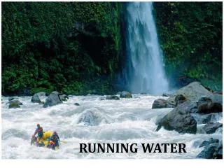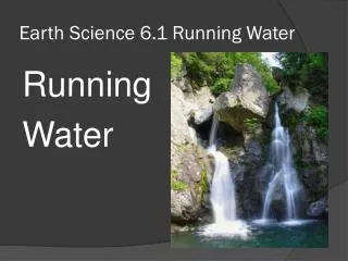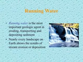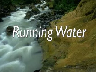
Running water
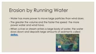
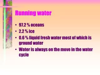
Running water. 97.2 % oceans 2.2 % ice 0.6 % liquid fresh water most of which is ground water Water is always on the move in the water cycle. Water Cycle. Infiltration = soak in run off - surface flow evaporation = back into the atmosphere transpiration = back into the atmosphere by plant

Running water
E N D
Presentation Transcript
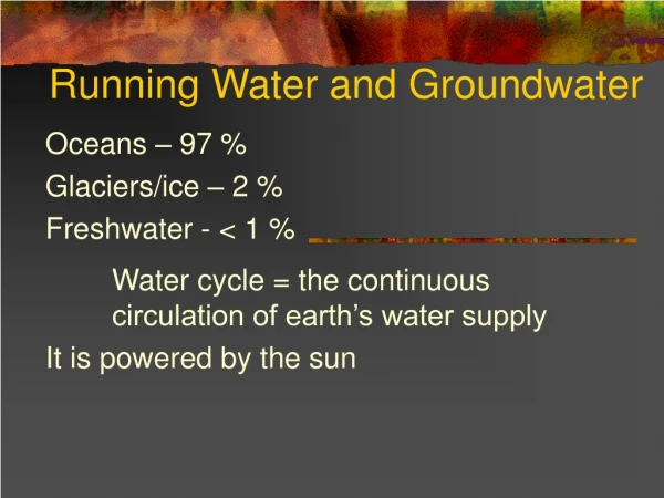
Running water • 97.2 % oceans • 2.2 % ice • 0.6 % liquid fresh water most of which is ground water • Water is always on the move in the water cycle
Water Cycle • Infiltration = soak in • run off - surface flow • evaporation = back into the atmosphere • transpiration = back into the atmosphere by plant • evapotranspiration - combined
Running water • Run off begins as sheet flow. • How much goes into the ground depends on the infiltration capacity of the soil • Factors of infiltration • intensity and duration of rain fall • soil wetness(saturation) • soil texture • slope • vegetation
Running water • Rills - tiny channels • Gullies - larger channels • stream - any running body of water • sometime called rivers if really large
Stream characteristics • Gradient or slope is the vertical drop of the stream over a fixed horizontal distance, • The steeper the slope the more energy available for stream flow. • Cross-sectional shape determines the amount of drag. • The less drag the faster the water can flow • Size and roughness also influence drag
Stream characteristics • Discharge is the amount of water flowing past a certain point in a given amount of time • Discharge (meter 3/ second)= • channel width(meters) X depth (meters) X velocity (meters/second)
Changes downstream • Longitudinal profile - a look at the stream from head to mouth • gradient decreases downstream • discharge increases downstream • width, depth and velocity increase downstream • When gradient is high, discharge is small
Base level • Running water in a stream will erode downward over its course until it reaches a balance point. • This balance point is called the base level. • Base level is the lowest elevation to which a stream can erode. • Two types of base level
Base level • Ultimate base level - sea level • Temporary ( local) base level - anything which has the capacity to limit downward erosion. • Lakes, resistant bedrock, or a larger stream • Kalamazoo River • Ultimate base level the Atlantic ocean • Local base level Lake Michigan
Base level • Base level can be changed. • Raised base level results is velocity dropping and deposition begins up stream. • Lowered base level results in velocity increasing and erosion increasing. • How do you raise base level? Build a dam. • How do you lower base level? Uplift the land or lower sea level.
Base level • Sooner or later a stream will reach base level and be neither eroding or depositing just transporting. • A graded stream is at base level
Stream Erosion • Waters in streams are turbulent. They whirl and eddy. • The material in streams (sand, gravel, silt, and clay sized particles, plus dissolved minerals) abrades the streambed and become rounder and smoother with transport. This is called the load. • Potholes are gouged by gravel caught in an eddy.
Stream Transport • Dissolved load - minerals dissolved by ground water and added to the stream. • Suspended load - usually the largest load of a stream. Fine sand, silt and clay sized particles. • How much suspended sediment depends on velocity of the stream and settling rate of the sediment.
Stream Transport • Bed Load - the material on the stream bed too large to be carried by suspension. • This is the stuff that does the grinding to produce downward erosion. • This material moves by rolling, sliding and saltation. • Saltation is jumping or skipping down stream
Stream Transport • The ability to carry material is measured in capacity and competence. • Capacity is the maximum load a stream can carry. • Competence - the maximum sized particle a stream can carry. • The greater the stream’s discharge the greater the capacity and competence.
Stream deposition • When velocity slows the stream can no longer carry its load. • Particles will be deposited by size with the largest settling out first. • This sorting explains why particles of the same size are found together. • Alluvium is the term for all stream deposited sediments
Stream deposition - channel • Channel deposits - the materials deposited mid-stream usually sand or gravel in bars. • Point Bars form in the inside bend of a stream meander. • Braided streams have bars mid channel. • Merger of two streams with different velocity, • after glacial melting, or • after heavy down pour.
Stream deposition- floodplain • Floodplain - the area adjacent to a stream that is covered with water during a flood. • Natural levees flank the stream and are an accumulation of gravel deposited during a flood when the water lost it competence and capacity upon leaving the channel.
Stream deposition- floodplain • Some levees are so high that tributary streams can’t enter the main stream. • These streams (Yazoo tributaries ) flow along the flood plain of the larger stream in swampy (back swamp) poorly drained areas.
Stream deposition- Fans and Deltas • When a stream loses its competency abruptly it will drop its load. • Alluvial fans will form if the deposition occurs on land. These are fairly steep. • Delta will form if the deposition occurs under water.These are fairly shallow.
Stream deposition- Fan • Alluvial fans form when a high gradient stream in a narrow mountain valley enters a broad flat basin. • The change is gradient is drastic resulting is immediate deposition. • Coarse material is deposited at the top of the fan while finer material is carried lower.
Stream deposition- delta • Deltas form when a stream enters a lake or the ocean.
Stream deposition- delta • The main stream will become sediment choked, so it will seek a higher gradient route to base level. • It may do so by splitting into branches called distributaries.
Stream deposition- delta • Mississippi River Delta - a bird-foot delta. • This delta extends far out into Gulf of Mexico . • Many Smaller sub deltas have grown since the ice age. • Threat to the Mississippi includes a potential capture and diversion of water further upstream. • Could spell disaster for New Orleans.
Stream Valleys • Playfair’s law - all streams have a main trunk, fed by branches and have carved the valley in which they exist. • Two types of stream valleys • narrow V shaped valleys • wide valleys with flat floors
Stream Valleys - V shape • Characterized by • downcutting • narrow canyons with steep wall • rapids and waterfalls • Valley walls undergo weathering and mass wasting at the top to help with the profile.
Stream Valleys - Wide valleys • More common in a graded stream • Erosion shifts from down-cutting to lateral. • Streams flow in floodplain is sweeping bends called meanders. • Erosion takes place on the outside of the bend at the cut bank. • Deposition takes place on the in side of the bend at the point bar • Causes the meander to migrate laterally and downstream
Stream Valleys - Wide valleys • Sometimes one meander will cut off another to create a shorter channel • The abandoned meander is called an oxbow lake. • Eventually the lake fills with sediment to create a cut off scar • Incised meanders- form when there is a rapid change in base level.
Drainage networks • All streams drain to an ocean. • The drainage basin is all the land contributes water to the stream. • A divide is the imaginary line that separates two drainage basins. • Individual drainage basins have one of four patterns depending on the material on which they flow.
Drainage Patterns • Dendritic - the most common - tree like branches emptying into larger trunks • Radial - like spokes on a bike tire draining the side of an isolated cone or dome. • Rectangular - flowing over jointed rocks making sharp right angle turns • trellis - also rectangular but looking more like a trellis with lots of branches.
Stream Piracy - Ahrg!! • Streams erode headward, downward and laterally. • As Niagara Falls erodes it is doing so up stream (headward erosion) • When the headward erosion of one stream breaches the divide it can divert water from a slower stream. This is stream piracy.
Floods and Flood Control • What causes floods? Too much water from rain or melt water. • Controls include building artificial levees, dams,channelization (dredging) and better flood plain management (non-structural controls).