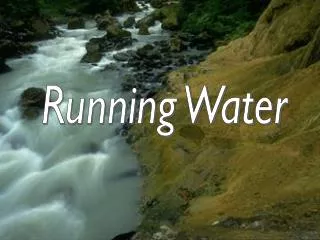
Chapter 15- Running Water
530 likes | 718 Views
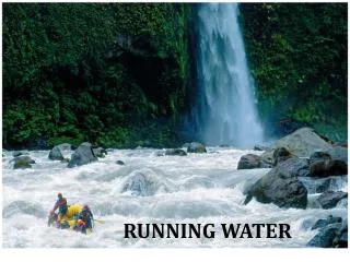
Chapter 15- Running Water. RUNNING WATER Earth is the water planet, unique in our Solar System: -97% of water on Earth is in the oceans -2% is frozen in glaciers -rest is in rivers, lakes, groundwater, etc Streams and Rivers- i.e. running water - are important for several reasons:

Chapter 15- Running Water
E N D
Presentation Transcript
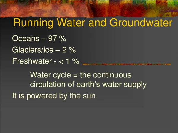
Chapter 15- Running Water RUNNING WATER Earth is the water planet, unique in our Solar System: -97% of water on Earth is in the oceans -2% is frozen in glaciers -rest is in rivers, lakes, groundwater, etc Streams and Rivers- i.e. running water - are important for several reasons: -erosional agents -transportation agents -economic uses Hydrologic Cycle: moving water is a major part in this cycle: re-circulation of water from oceans to atmosphere to continents to oceans, and repeat…. Transportation Aspect: fluid flow occurs in two forms- 1.laminar flow-sheet like, planar; occurs at shallow depth; less common; groundwater flow 2. turbulent flow-irregular flow due to velocity and roughness; more common
Hydrologic Cycle: water evaporates, rises as water vapors, forms clouds, Rain, washed to ocean thru rivers…process repeats… Chp15: Running Water
Chp15: Running Water Relative amounts of water on Earth
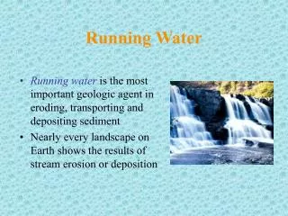
Running Water is the most important geologic agent modifying the Earth’s surface. • Exception- glaciers and deserts. • 1. sheet flow vs channelized flow: • -sheet flow: not confined to depressions • -channelized flow: is confined to trough-like depressions. Width and depth varies- • from creek to large rivers • 2. Stream gradient: flow downhill along a slope…the gradient is measured by the • vertical drop / horizontal distance: 1000m/500km= 2m/km • 3. Velocity and Discharge: • a. Velocity: downstream distance water travels in time: m/sec or ft/sec • -Varies across channel width and along its length: water moves slower along • riverbed and at banks-friction is higher. • -Channel shape and roughness: water flows faster in semicircular channel profile • than others; less contact with bed and banks • b. Discharge: volume of water passing any point in given period of time: • discharge (Q) =cross sectional area (A) * flow velocity (V) • Q= A * V • Mississippi River= 18,000 cubic cm/ sec • Amazon River= 200,000 cubic cm/sec
Laminar flow-streamlines parallel to one another Chp15: Running Water Turbulent flow-streamlines intertwined, mixing occurs
Chp15: Running Water Average gradient of stream= 2m/km Can vary over length of stream…
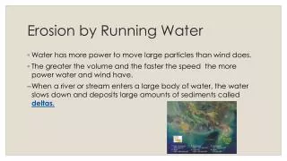
Erosion and Transportation by Running Water • Erosion removes loose particles of rock and soil, including dissolved • substances (dissolved load in streams) • Solid particles: moved by several processes- • 1. abrasion: rock is worn and scraped by impact of solid particles • 2. bed load: larger particles of sand and gravel size move along • stream bed. • 3. dissolved load: materials put into solution by chemical weathering- • usually fine sized sedimentary particles. • Suspended load- silt and clay sized particles kept suspended by • turbulence.
Sediment transported as bed load and suspended load. Arrows on right • are proportional to water velocity. • b. Particle size and velocity of moving water influences sediment erosion, • transportation and deposition
Deposition by Running Water Alluvium= sediments deposited when a river floods. 1. Braided Stream Deposits: numerous channels separated by gravel/sand bars When viewed from above, look like braids -Braided streams develop when sediment volume exceeds transport capacity. - Usually deposit coarse material (sand and gravel). Common in arid and semi arid regions. 2. Meandering Streams: single, sinuous channel with broad loops/curves known as meanders. -semi circular stream bed profile in cross section in straight regions; asymmetric around curves. -due to higher velocity on outer bank (cut bank)- cut bank erodes, with deposition on opposite bank. These deposits are called point bars. These are sand-rich: well sorted, often cross bedded! Oxbow lakes: meanders cut-off during river flood, left behind-isolated- after water level recedes.
In a meandering • channel the velocity • is greatest near outer • bank. Arrows proportional • to velocity. Outer bank is • eroded, inner bank has point • bar deposited… • b. 2 point bars at bends of • meandering river. • c. This point bar is several • hundred meters across.
Deposition by Running Water 3. Floodplain deposits: when a river floods, it spreads out over its banks along low relief features……known as floodplain floodplains can consist of any type of deposit: -point bars that build laterally due to lateral accretion (sand rich) -natural levees: during flood, sands pile up along stream margin, building vertically. Fine grained material deposited outside the levee-channel.
Floodplain deposits forming as result of lateral accretion of point bars.
3 stages of floodplain development by vertical accretion: a. Stream at low water stage. b. Stream floods, deposits levees and mud in overbanks. c. Stream confined to channel, bordered by levees.
4. Deltas: -when running water enters another body of water, its velocity decreases and it deposits sediment -local shoreline moves seaward, or progrades, as sediment is deposited -a distinctive vertical sequence results: bottomset beds, foreset beds, topset beds. 3 types of marine deltas are identified: function of erosion and sediment supply: a. stream dominated-(Mississippi R) long finger like features; “birds foot” b. wave dominated- (Nile R) barrier islands around edge of delta; curved c. tide dominated- (Ganges R) tide parallel ridges perpendicular to coast 5. Alluvial Fan: Lobate deposits of alluvium on land; common in arid to semiarid regions with little vegetation. During and after rainstorms, water rushes down canyons, when reaches mouth of canyon, dumps its load quickly (poorly sorted)
Internal structure of • delta. • b. Small delta, about 20m • across showing 3 sets
Delta classification: • Stream dominated- • Long finger like • extensions • (Mississippi R) • b. Wave dominated-arcuate • (Nile R) • c. Tide dominated- • Linear ridges perpendicular • to delta edge. • (Ganges R)
5. Alluvial Fan: Lobate deposits of alluvium on land; common in arid to semiarid regions with little vegetation. During and after rainstorms, water rushes down canyons, when reaches mouth of canyon, dumps its load quickly (poorly sorted)
a. Alluvial fan forms where streams discharge from mountain canyons onto adjacent lowlands. b. Alluvial fans in Death Valley, CA
Flood Control We try to control river flooding with dams and levees: this in only viable to certain level which a river will exceed eventually
Oroville Dam in CA: flood control, recreation, crops Chp15: Running Water
Natural falls in river, would this adjust river gradient?
Flood control: levee along river bank constructed to keep river contained during flood. B. floodways constructed to carry excess water from rivers away from communities.
Significance of the ‘Base Level’ concept: Base Level concept: the lowest level to which rivers can erode… in most cases this is Sea Level. Locally this can be different-if Man has made dams etc. in lakes or streams; or if naturally occurring features act as same… -Note that when sea level rises or lowers, base level changes Graded Stream concept…. Graded stream is a stream with an equilibrium profile in which a delicate balance exists between gradient, discharge, flow velocity, channel shape, and sediment load so that neither erosion or deposition occur within the river channel. This condition is closely approximated in many streams and rivers.
Graded streams: • An ungraded stream • has irregularities along • a longitudinal profile. • b. Erosion and deposition • along stream tend to eliminate • irregularities and yield • a concave profile approximating • a graded profile. • c. Actual measured profiles • of 3 rivers. VE=275x
a. Constructing a dam and reservoir create a local base level. b. Stream will adjust to new base level if lake is drained.
Illustrations of local base level concepts in relation to ultimate base level (sea level)
How do Valleys form? • Valley-on land, a low area bounded by higher areas. • Gullies-canyons-gorges: steeper sides, deeper valleys • stream terraces: have a fairly flat upper surface, steep slope descending • to lower level of present-day floodplain. • -evidence of streams flowing at higher elevation in past (eroded down to • present level!!) • 2. incised meanders: streams restricted to deep meandering canyons cut • into bedrock. • -downcutting: occurs when a stream has more energy than it needs to • transport its sediment load. • 3. superposed streams: streams that are seen to cut through ridges of • bedrock (Appalachian Mtns).
Origin of superposed stream: stream begins cutting down into horizon- tal strata. Horizontal layer removed by erosion, exposing underlying structure. Stream cuts narrow valleys in resistant rocks that form ridges forming water gaps.
Climate and River flooding: • - seasonal impacts that vary from year to year. • Floods actually re nourish the top soil in floodplain, over time • increase ability of soils to yield good crops. • -Economic impact in terms of flood control, damage mitigation, etc • is considerable.
Dominant weather pattern over US in summer 1993: concentrated rain s.howers in Midwest
Satellite photos of 3 rivers flooded in summer ’93. X=Portage, Ill
Damage near Portage, ILL caused by floods in summer 1993.
Chapter 15- Running Water: Summary • Streams and Rivers- i.e. running water - are important for several reasons: • -erosional agents • -transportation agents • -economic uses • Transportation Aspect: fluid flow occurs in two forms- • -laminar flow- sheet like, planar; occurs at shallow depth; less common; • groundwater flow • -turbulent flow- irregular flow due to velocity and roughness; more common • 1.sheet flow vs channelized flow: • a. sheet flow: not confined to depressions • b. channel flow: is confined to trough-like depressions. Width and depth varies-from • creek to large rivers • 2. Stream gradient: flow downhill along a slope…the gradient is measured by the • vertical drop / horizontal distance: 1000m/500km= 2m/km • 3. Velocity and Discharge: • Velocity: downstream distance water travels in time: m/sec or ft/sec • -Varies across channel width and along its length: water moves slower along riverbed • and at banks-friction is higher.
-Channel shape and roughness: water flows faster in semicircular channel profile than • others; less contact with bed and banks • b. Discharge: volume of water passing any point in given period of time: • discharge (Q) =cross sectional area (A) * flow velocity (V) • Q= A * V • Erosion and Transportation by Running Water • Erosion removes loose particles of rock and soil, including dissolved substances • (dissolved load in streams) • 1. Solid particles: moved by several processes- • a. abrasion: rock is worn and scraped by impact of solid particles • b. bed load: larger particles of sand and gravel size move along • stream bed. • c. dissolved load: materials put into solution by chemical weathering-using fine sized • sedimentary particles. • Suspended load- silt and clay sized particles kept suspended by turbulence. • Deposition by Running Water: Alluvium= sediments deposited when a river floods. • 1.Braided Stream Deposits: numerous channels separated by gravel/sand bars • 2. Meandering streams: curved sinuous streams • 3. Floodplain deposits: deposits on flanks of rivers, outside river bank • 4. Deltas: 3types are important: wave, tide, and stream dominated • 5. Alluvial fans: lobate features formed where canyons exit mountain range
Significance of the ‘Base Level’ concept: • Base Level concept: the lowest level to which rivers can erode…in most cases this • is Sea Level. • Locally this can be different-if Man has made dams etc. in lakes or streams • Note that when sea level rises or lowers, base level changes • Graded Stream concept…. • Graded stream is a stream with an equilibrium profile in which a delicate balance • exists between gradient, discharge, flow velocity, channel shape, and sediment load so • that neither erosion or deposition occur within the river channel. • How do Valleys form? • Valley-on land, a low area bounded by higher areas. • Gullies-canyons-gorges: steeper sides, deeper valleys • stream terraces: have a fairly flat upper surface, steep slope descending to lower level • of present-day floodplain. • -evidence of streams flowing at higher elevation in past (eroded down to present level!!) • 2. incised meanders: streams restricted to deep meandering canyons cut into bedrock. • -downcutting: occurs when a stream has more energy than it needs to transport its • sediment load. • 3. superposed streams: streams that are seen to cut through ridges of bedrock (Appalachian • Mtns). • Economic Uses and Impact of Rivers- transportation, soil replenishment for crops