Download
1 / 60
600 likes | 645 Views
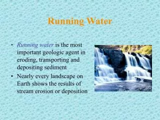
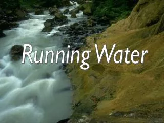
Explore the water cycle, stream features, sediment transport, base level, channel patterns, and human impact on rivers. Learn about stream profiles, velocity, sediment types, and effects of damming on ecosystems. Discover alluvial fans, deltas, and river deposition.

E N D
Learning Goals: Rivers 1. Describe and illustrate the water (hydrologic) cycle. 2. Describe and illustrate the shape and major features of a stream; explain why streams become wider, deeper, and flow faster downstream. 3. Compare and contrast bedload, suspended load, and dissolved load, and explain how each moves in the water of a stream. 4. Define base level, and explain how it relates to sediment erosion, transportation, and deposition. 5. Describe the major types of stream channel patterns, and illustrate their major features; explain factors influencing channel pattern. 6. Explain how modifying river channels affects flood size and frequency.
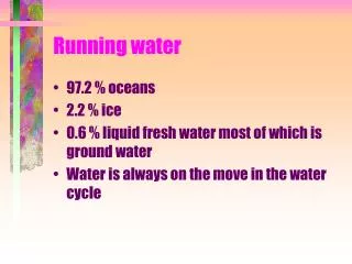
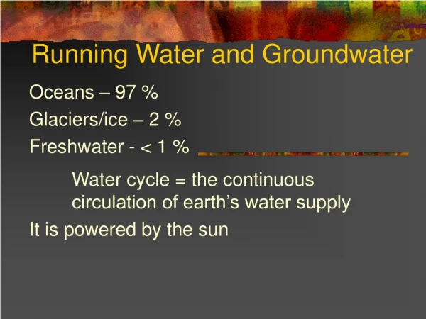
Hydrologic cycle • The hydrologic cycle defines how Earth’s Earth’s water supply is circulated • Processes involved in hydrologic cycle • Precipitation • Evaporation • Infiltration • Runoff • Transpiration
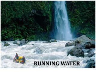
Running water • Begins as sheetflow • Infiltration is controlled by • Intensity and duration of rainfall • Prior wetted condition of the soil • Soil texture • Slope of the land • Nature of the vegetative cover • Runoff of snowmelt in Colorado only occurs when soil is saturated. So if not enough snow falls in a given winter, we may not get the runoff to Front Range cities is it just melts in place and wets the soil (but does not saturate it.
Clicker Question: When during the year is runoff in creeks in the Front Range of Colorado likely to be consistently the highest (over periods of weeks)? • In the winter after large snowfalls B) In the spring when snow melts C) In the summer after rainshowers D) In the fall
Running water • Streamflow • Factors that determine velocity • Gradient, or slope • Channel characteristics including shape, size, and roughness • Discharge – the volume of water moving past a given point in a certain amount of time
Running Water • Changes from upstream to downstream • Profile • Cross-section of a stream • From head (headwaters) to mouth of stream • Profile is a smooth curve • Gradient decreases downstream • Factors that increase downstream • Velocity • Discharge • Channel size
Clicker Question: What section of Boulder Creek has the highest gradient A) The section in the Plains near the Platte River B) The section in the Indian Peaks headwaters C) The section that runs through Boulder D) The section that runs through Nederland
Running water • Changes from upstream to downstream • Gradient and channel roughness decrease downstream • Base level and graded streams • Base level is the lowest point to which a stream can erode
Base level and graded streams • Two types of base level • Ultimate (sea level) • Local or temporary • Changing conditions causes adjustment • Raise base level = deposition • Lower base level = erosion
Clicker Question: What is the physical result of placing large dams on rivers? A) The reservoirs eventually fill with sediment B) Rivers decrease their power upstream of the dam (and ability to downcut) C) Rivers contain less sediment downstream of the dam D) Ecosystems downstream change as a result of less flood frequency E) All of the above
Running water • Transport of sediment by streams • Transported material is called load • Types of load • Dissolved load • Suspended load • Bed load • Capacity –maximum load stream transports
Suspended load - confluence Green & Colorado Rivers in Canyonlands, Utah
Competence • maximum particle size a stream transports • Determined by the stream’s velocity • Deposition of sediment by a stream • Caused by a decrease in velocity • Competence is reduced • Sediment begins to drop out
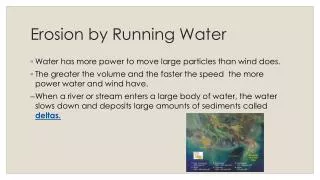
Deposition of sediment by a stream • Channel deposits • Bars • Braided streams • Deltas • Floodplain deposits • Natural levees – form parallel to the stream channel by successive floods over many years
Running water • Deposition of sediment by a stream • Alluvial fans • Develop where a high-gradient stream leaves a narrow valley • Slopes outward in a broad arc
Lawn Lake Fan New lake formed upstream from fan
Running water • Deposition of sediment by a stream • Deltas • Forms when a stream inters an ocean or lake • Consists of three types of beds • Foreset beds • Topset beds • Bottomset beds
Where is the Mississippi River likely to move next? Its unlikely to move again Into the Atchafalaya swamp Into the large lake near New Orleans D) Into the area marked “5” on the map below
Stream valleys • Most common landforms on Earth’s surface • Two general types of stream valleys • Narrow valleys • V-shaped • Downcutting toward base level • Can include rapids and waterfalls
Stream valleys • Features of wide valleys often include • Floodplains • Erosional floodplains • Depositional floodplains • Meanders • Cut bank and point bar • Cutoffs and oxbow lakes
Learning about cutbank migration the hard way! Where should this person have located their house? On the pointbar Further downstream on another cutbank C) Further upstream on another cutbank C) 50 feet away from the river on the cutbank
Where should you locate your house in this region? In the floodplain next to the river In the floodplain away from the river C) On the bluff on the edge of the floodplain D) On the bluff away from the edge of the floodplain B) D) A) C)
Incised meanders and stream terraces • Incised meanders • Meanders in steep, narrow valleys • Caused by a drop in base level or uplift of region