Download
1 / 17
170 likes | 533 Views
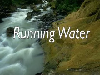
CHAPTER 6.1 RUNNING WATER. Chrom = color Chron = time Chrys = gold, yellow Cide = to kill Cise = to cut Circ = around Clam = shout Clar = clear Clud = close Cline = lean Co = together.

E N D
CHAPTER 6.1 RUNNING WATER Chrom = color Chron = time Chrys = gold, yellow Cide = to kill Cise = to cut Circ = around Clam = shout Clar = clear Clud = close Cline = lean Co = together Find a word in which each root is used. Write the root, it’s meaning, the word, and the word’s meaning. Turn in for a grade.
The WATER CYCLE 1 2 8 3 9 14 13 5 4 6 10 11 12 7
Precipitation is more over continents … … and evaporation is more over oceans. Earth’s Water Balance precipitation evaporation World Precipitation Map Animation http://svs.gsfc.nasa.gov/vis/a000000/a003400/a003461/index.html
Streamflow = how a stream or river flows • Gravity influences the way water moves to the oceans.
velocity = the distance water travels in a period of time. The ability of a stream to erode and transport materials depends largely on its velocity. Pg 160 Figure 3
gradient = the slope of a stream channel expressed as the vertical drop over a certain distance. • (pg 160 Figure 4)
discharge = the volume of water flowing past a certain point in a given unit of time. • (pg 161 Table 1) Hydrologists measured stream discharge and took water samples to determine how much sediment is suspended in the stream and how much sediment is moving along the streambed. USGS Photograph taken on April 27, 1985, by Lyn Topinka.
Since May 18, 1980, when Mt St Helens erupted, sediment transport rates for the rivers flanking Mount St. Helens, especially the Toutle River, have been among the highest in the world. More than 20 million tons of suspended sediment was transported from the Toutle River basin in the first 7 months after the May 18, eruption, or 15 million tons in only 13 days. About 39 million tons of suspended sediment was transported from October 1981 to September 1982, enough to cover an average city block to a depth of 8 kilometers. Since 1980, storms have been of only low to moderate intensity; consequently, less than 5 percent of the total volume of the avalanche deposit has been removed by erosion, so it will persist as a sediment-management problem for many years.
Stream profiles = cross-sectional view of a stream from its source to its mouth. While gradient decreases between source and mouth, discharge increases.
Tributary = a stream or river that empties into another stream or river. tributaries Rutherfordton Broad River
Headwaters = all of the streams that combine to make a larger stream. Delta = deposited soil from a river that build up until it rises above the water. Base level = lowest point to which a stream can erode its channel.
Meanders = curves that develop in the course of a river. Oxbow = area where a meander curves met. Oxbow Meander http://merchistongeography.blogspot.com/2007/11/animation-of-river-meanders-and-oxbow.html
Two types of Base Level: Temporary Base Level = where water levels off temporarily. Ultimate Base Level = where water levels off permanently. Temporary Base Level Ultimate Base Level
Mississippi River The velocity at the headwaters of a river is less than at the mouth of the river. And this is the Mississippi River also.
World’s Longest Rivers Fun Quiz http://www.ilike2learn.com/ilike2learn/Rivers/Longest%20Rivers.html