Download
1 / 17
170 likes | 317 Views
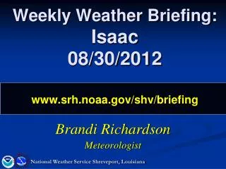
Special Weather Briefing Isaac 530 PM - 08/29/2012 www.srh.noaa.gov/shv/briefing. Keith Stellman Meteorologist. National Weather Service Shreveport, Louisiana. Isaac Summary. A little better agreement this afternoon Official Isaac Forecast Winnfield -> Ruston -> Prescott, AR

E N D
Special Weather BriefingIsaac 530 PM - 08/29/2012www.srh.noaa.gov/shv/briefing Keith Stellman Meteorologist National Weather Service Shreveport, Louisiana
Isaac Summary A little better agreement this afternoon Official Isaac Forecast Winnfield -> Ruston -> Prescott, AR A little Faster in moving out Rainfall threat highest Jena->Monroe->El Dorado->Hope/Nashville Model Data A couple models still on a more westward track Largest impacts over N LA/S AR, but some wind impacts into E TX/SE OK possible National Weather Service Shreveport, Louisiana
Current Position Ridge to the northwest…causing slower motion. It is forecast to shift east and allow Isaac to sling northward H
Model Forecast of Upper Ridge Ridge begins bridging east north of Isaac H GFS forecast @ Thu PM Ridge gets East of Isaac and begins to sling it north H GFS forecast @ Thu AM
Timing + Precip (Thu -> Fri) 6 AM - Noon Midnight – 6 AM **based on GFS track which is ~30 miles west of official Noon – 6 PM 6 PM - Midnight Midnight – 6 AM
Official Rainfall Forecast Locally higher totals may be possible
Official Forecast Impacts: Flooding • N LA • Greatest risk for flooding • Overnight Wed -Fri AM • S AR • 2nd greatest risk area • Early Thu AM-Fri PM • Extreme E TX • ..Only in a western track scenario Flash Flooding Possible
Official Forecast Impacts: Winds 8 PM Wed Tropical Storm force winds • N Central LA • ~40-45 mph • Wed night-most of Thu • SW AR/SE OK • 15-20 mph • Peak in 30s on Thu • Deep E TX • 20-25 mph • Late Wed PM – most of Thu • E TX • 10-15 mph • Thu 5 AM Thu
Official Forecast Impacts: Winds 3 PM Thu Tropical Storm force winds • Timing of TS winds • Primarily in gusts • Central LA • After 12 AM -> 5 PM • North West LA • 1 PM - > 8 PM • North Central/North East LA • 5 AM -> 9 PM 7 PM Thu
Official NHC Track Forecast Potential Tropical Storm force winds area Latest track forecast 1 AM Friday 1 PM Thu 1 AM Thu
Official Forecast Impacts: Tornadoes • US 165 Corridor-> eastward • Most at risk • Quick spin-ups • Not much lead time • Elsewhere • Can’t rule it out, but very low risk Thu AM – Fri AM
Watches/Warnings/Advisories Flash Flood Watch 7 AM Thu - 7 PM Thu Topical Storm Warning Flash Flood Watch 7 PM Wed - 1 PM Thu
Track Model Spread Key is in first 24 hour spread
“What if” Isaac is a little West Official track “What if” track
Potential Impacts • On forecast Track • N LA/S AR • Heavy rainfall/flooding (5-10”) • Greatest impact timeframe: Thu/Thu PM • Winds 40-45 mph with higher gusts Late Wed PM-Thu PM for N/LA; ~25 mph with higher gusts for S AR • Prime tornado threat area east of US 165 • Power outages possible primarily in LA east of I-49 corridor • E TX/SE OK • Rainfall: 1-2” isolated 3” • Winds 20-30 mph with higher gusts Thu AM-Thu PM
NEXT CONFERENCE CALL: August 30, 2012 @ 10:00 AM www.srh.noaa.gov/shv/briefing National Weather Service Shreveport, Louisiana