Download
1 / 14
140 likes | 309 Views
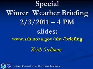
Special Winter Weather Briefing 2/3/2011 – 4 PM slides: www.srh.noaa.gov/shv/briefing. Keith Stellman. National Weather Service Shreveport, Louisiana. Overview. Tonight/Friday Arctic air in place across the region

E N D
Special Winter Weather Briefing2/3/2011 – 4 PMslides:www.srh.noaa.gov/shv/briefing Keith Stellman National Weather Service Shreveport, Louisiana
Overview Tonight/Friday Arctic air in place across the region Upper level system moves in and draws moisture in from the gulf over the cold air. Accumulations of 1-3 inches snow/minor sleet accumulations possible I-20 Corridor and south (Winter Weather Advisory area) Tyler>Longview>Shreveport>Magnolia>El Dorado and points south. Ice accumulations of 0.25-0.50 inches possible…(Winter Storm Warning area) Lufkin->Nacogdoches>Natchitoches->Winnfield>Monroe>Columbia>Colfax>Jena Beginning this evening 6 pm ending by 6 pm Friday. (Winter precipitation north of the Winter Storm Warning area may begin a little later than 6 pm this evening.) National Weather Service Shreveport, Louisiana
Big Picture Arctic Surface High H Strong Upper Level Low Pressure Area Today L L L Friday Tngt National Weather Service Shreveport, Louisiana
Current Radar/Temps – 3:15 PM • Temps still at or below Freezing Initial precip band moving north
Sleet/snow/Freezing rain Dilemma Temperature profile at Midnight- Jena • High Res models suggest Freezing Rain in Jena with warm nose at 1000-5000 ft (Southeast) • Cold nose helps rain freeze quickly Freezing line Surface Tempeatures 28-32 Height
Sleet/snow/Freezing rain DilemmaTemperature profile at Midnight- Monroe • High Res models suggest Mix with more Freezing Rain • Warm nose not as prevalent but deep enough to melt the snow into sleet/FZRA Freezing line Surface Tempeatures 27-30 Height
Sleet/snow/Freezing rain Dilemma Temperature profile at Midnight- Natchitoches • Warm Nose appears and looks deep enough to melt the snow • Could either be sleet or freezing rain • Toledo Bend->Natchitoches->Jonesboro Surface Tempeatures 28-31 Freezing line Height
Total Liquid Equivalent (precip amounts) 18Z High Res Model Run • Model has backed off a bit on total amounts • Generally > 0.25” of precip in Deep East TX, all of LA except NW.
Total Liquid Equivalent (precip amounts) Model Concensus (SREF) • Model has reduced amounts slightly as well (0.50 is a max across the Southeast) • The 2” line • Rouge estimate of the mix line
Heaviest starts occurring After 9 PM -> 6AM Timing 6PM-9PM 3PM-6PM Midnight - 3 AM 3 AM – 6 AM 6 AM – 9 AM Light snow late morning tapering Off by ~noon
Temperatures Thursday Night - Friday Lows Highs
Impacts • 1-2 inches snow/minor sleet accumulations possible I-20 Corridor and south (Winter Weather Advisory area) Tyler>Longview>Shreveport>Magnolia>El Dorado and points south. • Isolated 3” amounts possible further south and east. • Lower visibilities after Midnight • Ground temps ~40/35 in AR… Precip will stick to bridges/overpasses and main roadways • Cold temperatures through Saturday AM to keep it around • Ice accumulations of 0.25-0.50 inches possible) Lufkin->Nacogdoches>Natchitoches->Winnfield>Monroe>Columbia>Colfax>Jena • Over 0.50” would cause widespread Power outages • Only isolated areas in extreme Southeast • Instant freeze on all surfaces with temps in the 20s
NEXT CONFERENCE CALL: Next Thursday @ 10 AM www.srh.noaa.gov/shv/briefing National Weather Service Shreveport, Louisiana