Download
1 / 17
170 likes | 358 Views
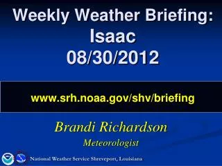
Weekly Weather Briefing: Isaac 08/30/2012 www.srh.noaa.gov/shv/briefing. Brandi Richardson Meteorologist. National Weather Service Shreveport, Louisiana. Preview. Current Observations Center east of LaSalle Parish M otion is north-northwestward Official Isaac Forecast

E N D
Weekly Weather Briefing:Isaac08/30/2012www.srh.noaa.gov/shv/briefing Brandi Richardson Meteorologist National Weather Service Shreveport, Louisiana
Preview Current Observations Center east of LaSalle Parish Motion is north-northwestward Official Isaac Forecast Slightly east of Wednesday’s forecast track Becoming a Depression today Impacts looking more on the minimal side Model Data Several models still on a more westward track Needs to take a strong northwestward turn Through Wednesday National Weather Service Shreveport, Louisiana
Current Observations Numerous reports of wind damage Power Outages
Observed Rainfall 0.06 0.40 0.85 0.05 0.85 0.57 0.64 0.03
Official NHC Track Forecast Wednesday morning Latest track forecast (shifted a hair eastward)
Official Rainfall Forecast Tonight 3-5” 2-3” 1-2” Today Locally higher totals may be possible
Official Forecast Impacts: Flooding • S AR, Extreme N Central LA • Greatest risk for flooding • Today PM-Fri AM • SW AR, Parts of NW LA • De Queen/Nashville – Bienville/Jonesboro • Today early PM-Fri AM • Central LA • Natchitoches/Coushatta – Columbia/Jena • Today Flash Flooding Possible
Official Forecast Impacts: Winds 1 PM Today Tropical Storm force winds • N Central LA • ~35-40 mph • Today, decreasing this afternoon • SW AR/SE OK • 25-30 mph • Tonight • E TX • 20-25 mph • Today 3PM Today
Official Forecast Impacts: Tornadoes • N Central LA/S AR • Most at risk • Quick spin-ups • Not much lead time • Elsewhere • Can’t rule it out, but very low risk Thu AM – Fri AM
Watches/Warnings/Advisories Flash Flood Watch Now - 7 PM Tonight Topical Storm Warning Flash Flood Watch Now - 7 PM Tonight
Uncertainty Still several models indicating a move towards the NW Current motion makes these model tracks less probable
The Rest of the Forecast H 7 PM Friday
The Rest of the Forecast H 7 PM Saturday
The Rest of the Forecast H 1 PM Monday
Summary Current Observations Center just east of LaSalle Parish Three-hour motion is due-N Official Isaac Forecast Slightly east of Wednesday’s forecast track Becoming a Depression today Impacts looking more on the minimal side Model Data Several models still on a more westward track Needs to take a strong northwestward turn to verify Through Wednesday Ridge is squeezed southeastward around Isaac and back into the Desert SW Region remains under the influence of the ridge National Weather Service Shreveport, Louisiana
NEXT CONFERENCE CALL: Thursday September 6, 2012 @ 10 AM www.srh.noaa.gov/shv/briefing National Weather Service Shreveport, Louisiana