Download
1 / 26
350 likes | 791 Views
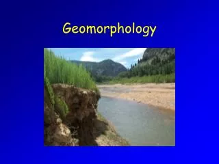
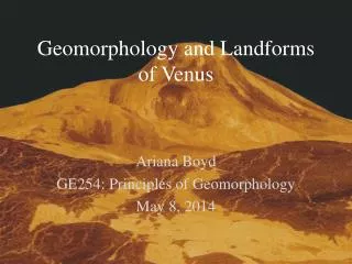
Rivers and Geomorphology. CGF3M. Rivers. 1. Energy. 2. Stages of River Development. 3. Drainage Basins. 4. River Patterns. 5. Geomorphological Features. Energy. Features due to erosion or deposition depending on speed. Low energy/low speed = deposition High energy/high speed = erosion.

E N D
Rivers and Geomorphology CGF3M
Rivers 1. Energy 2. Stages of River Development 3. Drainage Basins 4. River Patterns 5. Geomorphological Features
Energy • Features due to erosion or deposition depending on speed. • Low energy/low speed = deposition • High energy/high speed = erosion
Stages of River Development A: Youthful/Upper Stage B: Mature/Middle Stage C: Old/Low Stage
A: Youthful Stage • Steep, fast, straight, vertical erosion
B: Mature Stage • Less steep, slower, meanders, horizontal erosion
C: Old Age Stage • Flat, slow, meandering, depositional
Drainage Basins • Area in which all raindrops eventually drain into the same river system, ocean, or lake (catchment, watershed) The Amazon Drainage Basin
Drainage Basins • Tributaries: smaller rivers that drain into larger rivers. • Interfluves: pieces of higher land between tributaries. • Divide: higher ground between drainage basins.
Drainage Patterns • Main river = trunk • Tributaries = branches • Distributaries = roots
Drainage Patterns • 5 Drainage Patterns: • Dendritic • Trellis • Radial • Deranged • Rectangular
Dendric Drainage Pattern • Flow across level land, merging with other rivers • Resemble branching tree
Trellis and Rectangular • Ground is made of folded bedrock, rivers may follow a straighter course along the softer bedrock, with hard rock on either side. • Often in mountainous areas. • Trellis: one main trunk • Rectangular: square pattern
Radial Pattern • Landforms influenced by volcanoes and cone-shaped hills. • Streams radiate outward in all directions from central zone
Deranged Pattern • No distinct pattern noted • Often lakes are found throughout • Glaciation has torn the landscape leaving this deranged pattern
Geomorphological Features • Levees: sediments deposited in the stream channel that contain the water. (ridges).
Geomorphological Features • Meander: sinuous back and forth sweep of a river in old age. • Meander scar: an oxbow lake that has dried up leaving a dry hollow where the river channel had been.
Geomorphological Features • Oxbow lakes: an area of poor drainage that occurs when a meander is cut off from the main river channel, forming a lake.
Geomorphological Features • Delta: depositional feature found at the mouth of a river. • River’s water reaches mouth of river and the sediment is carried settles.
Geomorphological Features • Estuary: the flooded mouth of a river valley.