Download

1 / 36
580 likes | 1.87k Views
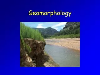
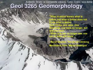
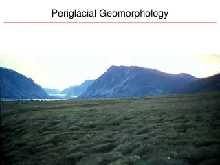
Watershed Geomorphology. Motivation. Effect of water on landscape: Whereas hydrologists are mostly concerned with the movement of water, a common task is to assess the impact of water flow on the transport of materials – sediment and solutes Effect of landscape on water

E N D
Motivation • Effect of water on landscape: • Whereas hydrologists are mostly concerned with the movement of water, a common task is to assess the impact of water flow on the transport of materials – sediment and solutes • Effect of landscape on water • Runoff is controlled by inputs from climate, and the physical properties of the watershed (geology, soils, land use, land cover…) • A long-term dynamic equilibrium exists between climate and earth materials, resulting in watershed “shape”, that dictates the short-term hydrologic response
Outline • Motivation • Form and process • Form and hydrologic response • Watershed Similarities • Watershed Delineation • Hillslopeprocesses • Fluvial processes • Channel head • Landscape evolution
Expectations • Me: Lecture, provide readings, design project and occasional homework – Provide learning opportunities • You: Listen, READ and be ready to discuss, do project and homework - learn
What is a watershed? • A topographically delineated area drained by a stream system – that is, the total land area above some point on a stream or river that drains past that point. • The watershed is a hydrologic unit often used as a physical-biological unit and a socioeconomic-political unit for the planning of and management of natural resources. • A watershed is essentially a network of hillslopes connected by streams. • Watersheds operate as transfer function that convert precipitation into streamflow. • Under the driving force of gravity, river basins take in moisture from the atomosphere in a distributed and intermittent manner, store it in the soil, and release it gradually into a network o stream channels where is isconcentratred and delivered more-or-less continuously to the outlet.
What is a watershed • The area that appears on the basis of topography to contribute all the water that passes through a given cross section of a stream. • The area of land that catches rain and snow that drains or seeps into a common marsh, stream, river, or lake. • The term watershed describes an area of land that drains downslope to the lowest point. The water moves through a network of drainage pathways, both underground and on the surface. Generally, these pathways converge into streams and rivers, which become progressively larger as the water moves on downstream, eventually reaching an esturay and the ocean. Other terms used interchangeably with watershed include drainage basin or catchment basin. • All land is part of one watershed or another. When rain falls, much of the water runs across the surface of the land toward a stream, river, pond, or lake as surface runoff. The land area that drains runoff to the stream, or other surface water body, is called a watershed, or drainage basin. • " that area of land, a bounded hydrologic system, within which all living things are inextricably linked by their common water course and where, as humans settled, simple logic demanded that they become part of the community."
Components of a watershed • Ridges/divides • Hillslopes • Gullies, rills, • Ephemeral channels • Floodplains • Riparian zones • Perennial channels • Vegetation • Soils • Aquifers • Bedrock
Pattern and ProcessForm and function • Watersheds are natural partitions in the landscape that evolve under deterministic and stochastic controls towards self-similar critical states under the guiding principles of energy minimization. Water, sediment, and solutes are byproducts of watershed processing Hydrologic driver q t Hydrologic response
Why do watersheds appear similar Visually AND statistically?
Watershed Properties • Watersheds are natural partitions in the landscape that evolve under deterministic and stochastic controls towards self-similar critical states under the guiding principles of energy minimization. • What are critical states?
Ratios tend to be similar for all rivers Horton’s Laws of Drainage Networks = Bifurcation ratio = Law of stream areas = Law of stream lengths
L = CA0.6 Hack’s Law Exponent tends to be near 0.6 for all rivers. What does this mean?
WITHIN a drainage basins, bankfull flow tends to scale log-linearly with area.
Hydraulic Geometry At-a-Station Downstream b 0.1-0.2 0.5 f 0.4 0.33-0.4 m 0.4-0.5 0.10-0.17
Watershed Evolution • “Universal” properties exist arrangement of slopes and channels in watersheds • Statistically similar despite visual differences • Landscape evolution governed by common underlying principles • Watersheds are natural partitions in the landscape that evolve under deterministic and stochastic controls towards self-similar critical states under the guiding principles of energy minimization. • There is a dynamic relationship between water flow and landscape form What are the implications?
Basic Principles of Geomorphology (Ritter et al., 1995) • A delicate balance or equilibrium exists between landforms and processes. The character of this balance is revealed by considering both factors as systems or parts of systems. • The perceived balance between process and form is created by the interaction of energy, force, and resistance. • Changes in driving force and/or resistance may stress the system beyond the defined limits of stability. When these limits of equilibrium, or thresholds are exceeded, the system is temporarily in disequilibrium and a major response may occur. The system will develop a different equilibrium condition adjusted to the new force or resistance controls, but it may establish the new balance in a complex manner. • Various processes are linked in such a way that the effect of one process may initiate the action of another. • Geomorphic analysis can be made over a variety of time intervals. In process studies the time framework utilized has a direct bearing on what conclusions can be make regarding the relationship between process and form. Therefore, the time framework should be determined by what type of geomorphic analysis is desired.
Next Steps • Watershed delineation in DEMS • Watershed denudation processes • Hillslope • Fluvial • Return to “universal” properties