Download
1 / 10
120 likes | 481 Views
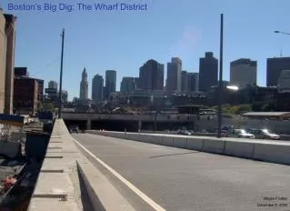
Boston’s Big Dig: The Wharf District. Megan Findley December 5, 2005.

E N D
Boston’s Big Dig: The Wharf District Megan Findley December 5, 2005
The depression of Boston’s Central Artery Tunnel, a project known as the “Big Dig,” has proven to be one of the largest, most environmentally and technically challenging infrastructure investments undertaken in the United States. Although historically familiar with large land-altering projects, Boston’s leaders and constituents have struggled with this project’s completion. While expending great focus on engineering, mitigation, and economic details, consideration for the end result has been minimal – until now. Plans for the “surface artery,” the stretch of open land created by the central artery’s demolition and relocation underground, are currently at the forefront of public debate. This paper will focus on the Wharf District, arguably the most visible and controversial section of the surface artery. Context Boston’s increasingly automobile-dominated downtown in the 1940’s prompted transportation officials to begin envisioning various design innovations. Public Works chairman William F. Callahan conceived of building an elevated expressway through downtown Boston, with enough on and off ramps for the use of local traffic. Begun in 1950, construction of the Central Artery tore through the center of downtown Boston, displacing 20,000 residents and removing over 1,000 residential and commercial buildings. In addition to its unsightliness, the Artery divided neighborhoods, and separated the city’s financial and historic areas from its waterfront. Although community opposition failed to prevent a majority of the Artery’s construction, citizens succeeded in opposing its component – an inner belt, Interstate 695, that would pass westward through the city. The Artery’s final section of construction was sent underground through Dewey Square, or “South Station.” Lack of support for the Artery, and resultant deficiencies in the region’s transit system were important arguments for the Big Dig’s inception. Because it was built before the development of interstate highway federal standards, the Artery expressway had a number of design problems. Tight turns, entrance ramps without merge lanes, and insufficient capacity for growing vehicular loads were just a few of its problems. Painted green, the Central Artery quickly became known as Boston’s other “green monster.” In the 1960’s transportation planners began designing alternatives to the Artery. M.I.T. engineers Bill Reynolds and Frederick P. Salvucci (Secretary of Transportation under Gov. Michael Dukakis), came up with a plan to completely relocate the artery underground. Official planning began in 1982, and after five years of extensive lobbying, Congress approved the public works appropriation bill in 1987. Although President Reagan vetoed the bill due to its expenses, Congress overrode his veto and project construction began in 1991. In addition to the Artery’s depression, projects included construction of the Zakim Bunker Hill Bridge and the Ted Williams Tunnel, as well as the restoration of Spectacle Island. When completed, the Central Artery/Tunnel Project will have created more than 300 acres of open space. 27 of those acres will be devoted to the Surface Artery, 75% of which will be devoted to the open space string of parks called the “Rose Kennedy Greenway.” These specifications and guidelines for the greenway’s development are outlined by the city’s “Boston 2000” Master Plan. Designations for the Wharf District parcels adjacent to the waterfront are made for open space and parks. Image shows Boston’s highway systems; the Central Artery (shown in detail on the right) has been buried. Construction of surface parks is pending design approval
Land-Making From its colonization to present day, Boston’s landscape has endured continuous alterations. From 1630 to 1850, the city of Boston expanded the North End, South Cove, and central waterfront shorelines through the process of “wharfing out.” In more outlying sections of the city, such as South Boston, Dorchester, East Boston, and Charleston, wharfing out began later and continued well into the 20th century. Figures below illustrate Boston’s expansion during this time. (Light green represents current landform) making during the 20th century took place in outlying sections of the city, particularly at Columbia Point and in East Boston for the airport. Previous to the big dig, Subaru Pier in South Boston was the city’s last land making project, and was completed in the early 1980’s. Creation of the Rose Kennedy Greenway joins Boston’s long tradition of large-scale land-alterations. Parks The incorporation of parks into Boston’s landscape has, since before Olmsted’s arrival in 1878, been a fundamental concern of the city’s planning. The construction of parks provided a direct means for city expansion, population density, economic development, improved health, and city beautification. Provided with an opportunity to improve upon his work on Central Park, Frederick Law Olmsted arrived in Boston with the goal to “permeate the increasingly harsh, dense, and expanding industrial city with the healing effects of nature.” The emerald necklace took root in the 1880’s, beginning with the Back Bay Fens and moving southward. The growing city has intruded on portions of the necklace, but Olmsted’s parks continue “to serve Boston as he envisioned, attracting diverse populations and bringing them together in the enjoyment of nature.” Continuing on after Olmsted’s plans, Charles Eliot and Sylvester Baxter initiated a plan to encircle Boston with a second “green” ring that would be emblematic of a metropolitan political alliance. Their successful vision consisted of 15,000 acres of public reservations, thirty miles of river frontage, ten miles of ocean shoreline, and twenty-two miles of right-of-way for parkways. The legacy of open space planning continues today with the Central Artery’s creation of more than 300 acres of open space, 30 of which can be found in the central city’s fabric. For two decades, the Boston Redevelopment Authority (BRA) has viewed the city’s surface above the Big Dig as an opportunity to dramatically enhance Boston’s park system and to reunite the districts that were torn apart in the 1950s by the construction of the Central Artery. Olmsted’s Emerald Necklace has always been an incomplete loop; extending the Fens and the Charles River Esplanade as a series of parks running through the city over the Big Dig could extend the Emerald Necklace, bringing it closer to completion. In addition to wharfing out, Boston engaged in many projects specifically designed to create new land. The 19th century’s burgeoning population and introduction to railroads prompted projects that expanded Boston’s land area. Boston’s South Bay Lands and the filling of Back Bay were among several of its additions. Following the inauguration of the Boston park system in the 1870’s, waterfront areas in many sections of the city were filled to create public parks. Most land
Waterfront: The design, access to, and usage of Boston’s waterfront have been among the city’s fundamental concerns since its founding. Although the harbors initially represented an important conduit to the outside world, perceptual awareness of the water’s edge has diminished over the years. Like many of the nation’s industrial-era cities, the 20th century’s decline in maritime infrastructure resulted in “a sort of ever-receding land-side tide.” Although the city was founded on a virtual island, encountering water today often requires a search. Construction of the Central Artery reinforced residents’ cognitive separation of the city from its eastern waterfront. In the 1960’s, consequently, many of the historic wharves lost their mercantile functions to become parking lots. Present uses attempt to restore vitality, but it’s the Central Artery’s demolition that will effectively foster the allowance of reconnections. Above: wharves as parking lots in the 1960’s (L) and as they are today (R) The adjacent corridors through State Street and Quincy Market constitute a double axis through which Boston has evolved for more than three centuries. Once the site of the Boston massacre, the Old State House now sits atop two subway lines and rests securely amidst a ring of modern skyscrapers - Boston’s leading financial institutions. With the Central Artery’s demolition, the view from the Old State House to Long Wharf will be restored. Similarly, the Quincy Markets, named after Josiah Quincy, the city’s mayor in the 1820’s, represent Boston’s earliest waterfront urban renewal effort. Faneuil Hall, rebuilt after a fire in 1761 and doubled to its present size in 1805 sits at the head of the original Town Dock, where Quincy’s markets now reside. Historically designed in conjunction with the waterfront, these areas will again enjoy their original views and connections once the Greenway’s construction is complete. Few American cities can boast a richer palimpsest of history than Boston, and nowhere is this layering more apparent or complex than in the Wharf District where more than three centuries of history come together. Redesigning this area represents an excellent opportunity to make both connections and reconnections: to reconnect the city to the harbor, to contribute to and facilitate a transformed experience of the city, and to connect the past, present, and future. Intimate understanding of this site is required for a successful redesign where people of all backgrounds may come together. Left: Views of the Old State House to and from the Central Artery will be restored Right: layers through which Boston’s financial and historic areas meet the Central Artery’s Wharf District
Central Artery Corridor Master Plan The “Boston Central Artery Corridor Master Plan,” designed by SMWM Architects and commissioned by the Massachusetts Turnpike Authority, provides a detailed study of the surface artery, along with a framework for the land’s future uses. The Master Plan is the result of an extensive public participation process, including the input of neighbors, city residents, historians, waterfront planners, artists, designers, and state and local officials. It created a set of guidelines under which selected landscape architects would develop parcel designs. Karen Alshuler, the San Francisco architect who led the study, was instructed not to challenge any rules set forth by the environmental permit or zoning law. Thus constrained, the master planning process produced a least-common-denominator document that “failed to ignite any enthusiasm.” The resulting design did, however, challenge conventional wisdom in one specific way: for years, officials conceived of the new corridor as a single boulevard through the city. Rather than reinforcing the scar of the elevated highway, however, the Master Plan attempts to restore the built fabric of the downtown. It divides the corridor into districts, each with its own history, architecture, and constituency. Encompassing a total of 8 acres, the Greenway’s three new parks are estimated to cost $26.2 million to design and build. The four acres and four blocks devoted to the Wharf District constitute the largest section of the Greenway, with a cost estimate of $16 million. Although many civic groups and coalitions lobby for their own specific interests in the Surface Artery’s design, landscape architects were chosen by the Massachusetts Turnpike Authority to design the parcels within the guidelines set forth by the Master Plan. EDAW of Alexandria, VA, and Copley Wolff Design Group of Boston were selected to design the open space between Christopher Columbus Park and High Street. The design process was expected to take about 15 months (finishing early 2004), but landscape construction has yet to commence. EDAW’s proposed designs are shown below. Three schematic ideas form the templates from which specifics will be assembled for the final design.
Civic Promenade Description • Unified into a long green space • Along west edge: 40 ft. wide paved promenade • Low serpentine wall for seating along promenade’s eastern side • Series of retail kiosks placed at regular intervals along walkway • Kiosks are triangular, pointed, glass-front structures 60 ft. tall; they dually function as lanterns and visually mediate between the low park and tall buildings to the west. Their form is suggested by the towers of the new cable-stay bridge crossing the Charles River. • Two center blocks are mirror images, the center street leading to New England Aquarium. Ground is molded to resemble a wave, with beach grasses planted on top. • A pair of tall fountains, in the form of cauldrons or tall goblets, would feature rising and falling water synchronized with the ocean tides. • Southern two blocks are combined into one, with a large fountain placed off-axis; • A street that ends at the east flank of the combined block is expressed as a diagonal path that lines up with the heroic west entrance to Rowe's Wharf. • Heavy pedestrian use is expected in the park at the north end, near Faneuil Hall to the west and Marine Park to the east. This block contains a big plaza and a fountain that emanates from the pavement so that children can run through. • The fountain's shape is a counterclockwise spiral inspired by the region's nor'easters. Additionally, several private organizations have commissioned separate planning studies for the design of Greenway parcels. The Artery Business Committee (ABC) took interest in the Wharf District parcels; this diverse group of residents, office workers, owners, interest groups and non-profit organizations prepared their report to serve as guidelines for the Turnpike Authority and its master plan consultants, SMWM. In addition to creating five principles for design and programming, the ABC’s report examines methods for enlivening spaces and studies the urban form and physical/regulatory framework within which the parcels sit. A summary of their five guiding principles for design and programming follow: 1. Reinforce the character of the Wharf District 2. Reconnect the city with the harbor 3. Support and surround the open space with people and activities 4. Create a walkable and attractive environment 5. Ensure a high quality and attractive public realm
Criticisms Despite the company’s initial success in winning the design opportunity, EDAW’s site proposals have failed to ignite enthusiasm, respond to site-specific conditions, and integrate all the various elements present in the Wharf District Parcels. In a community discussion led by the Boston Redevelopment Authority (BRA), the commission which oversees and approves greenway designs, EDAW’s proposals provided the template against which private and public stakeholders re-examined the space’s needs. Although discouraging, EDAW’s temporary failure spawned creative, enthusiastic responses and ideas for the future. Robert Kroin, chief architect of the BRA synthesized the Authority’s views into a published format for the community’s input. The document’s main observations are as follows: “The blue band represents our waterfront boulevard; it collects and organizes the harbor buildings, views, parks, and paths. The orange band represents the urban artery; it collects and organizes the districts, streets, landmarks, and places. The green band takes the Greenway concept and makes it a reality that enhances the parks system. All three of these bands come together at the Wharf District—a very special condition.” “We have to be able to see the Greenway as one park. Likewise, we must see the Wharf District blocks as one park. Each of the individual blocks must refer to the larger whole, to the elements that unite them. The Wharf District parks have to relate to the city, the harbor, the park system, and each other in a way that responds to the dynamic nature of how we will experience them in three dimensions over time.” “The closer view of this district illustrates the obvious: it’s all about the harbor, because that’s what draws us here. The parks should anticipate the harbor by allowing us to see, smell, and feel what’s in store at the water’s edge, as well as views back to the Boston downtown skyline and layers of history present in these views . The parks aren’t a substitute for the waterfront. Perhaps the parks shouldn’t be destinations at all but rather spaces that prepare us for the bigger experience. The orange, blue, and green bands are time lines as well as lines through space; they bring us in physical and visual contact with four hundred years of history. The intersection of the three bands illustrates the complexity of the Wharf District. Things don’t fall into neat patterns and that’s part of what makes it Boston. The parks need to interpret this complexity for us—not on brass plaques, but in their urbanism and design.”
The current design variations don’t meet the standards implied by these principles. The scope is too small: the design does not look very far beyond their immediate parcel boundaries to an integration with the other sections of the greenway in a meaningful way that would help unify it. The variations do not adequately create connections between the city, the harbor, and the parks and in some areas the designs obstruct the connections. The variations do not clearly relate to city or harbor; it’s hard to tell without the map which side is land and which is water. They fail to respond to opportunities for views of landmarks, notable features, and the sea. The three design variations don’t consistently include the basic elements of urbanism—sidewalks, for example. While the current park designs may provide space for people to gather, they don’t provide motives for gathering that evolve from the site. At best they make passing references to the underlying principles that need to form the underpinning of any design. Views and view corridors are one aspect of that complexity. The views include distant vistas, broad panoramas, and fleeting glimpses. The views aren’t static; take a few steps and it’s all different. They overlap each other. They juxtapose land and water, old and new. Our narrow downtown streets don’t allow us to see the big picture but the parks give us a ‘picture window’ and a way to understand our city. They show us how the Wharf District is unique 3 dimensional, changing experience that orients and re-orients one to the complex relations that make up the district. What a different city we see when we look at the Back Bay from Commonwealth Avenue Mall, for example, or East Boston from Piers Park. Views are important because they connect us to place and time; they make history visible; and they make Boston’s topography understandable by revealing the shape of the peninsula.
Prior to the search for designers, Boston had long received criticism for its lack of vision nearing the project’s completion. The failure of EDAW’s proposals therefore must be considered within the context from which they were working. Unlike most successfully planned-for civic spaces, the surface artery greenway has been somewhat of an afterthought to the project’s main focus. Although highly anticipated for its potentialities, consideration for the greenway’s design had not been given serious thought during the project’s implementation. Like an unknown Christmas present hidden by dazzling packaging, the greenway was collectively anticipated, but no one could really say what it might look like. Partly to blame, various stakeholders could not decide who was to take charge. The artery was owned by the state, administered by the Massachusetts Turnpike Authority, and City of Boston strongly desired involvement. The Boston GreenSpace Alliance, Artery Business Committee, Horticultural Society, North End Neighborhood, and Chinese community all had their own agendas, each with their own impression of how the land should develop. Even the legislature had its own opinions on matters; without citizen input, the legislature secretly dubbed the land “The Rose Kennedy Greenway.” Key decisions about the greenway were made nearly two decades ago at the end of the Dukakis administration; John DeVillars, secretary of environmental affairs at the time, had the right to approve or disapprove the Big Dig. As a caveat to its approval, he decided that 75% of the artery land must be “public open space,” a rule that was later enacted into a city zoning law. This number was arbitrary, never debated, nor considered in light of any designs for the land. It was a statistic that unfortunately pervaded (and in many cases dictated) all subsequent debates and designs for the land, including the Central Artery Corridor Master Plan. As suggested by Globe Correspondent, Robert Campbell, perhaps the greenway’s lackluster plans are the product of our increasingly participation-oriented society. When the Central Artery was built in the 1950’s, planning decisions were determined without concern for citizen reaction or approval. Today, decisions are made in almost complete opposition to that sort of top-down process. There are, of course, numerous benefits to such organization, but perhaps the complications coincidental with required public participation inhibit the kind of vision and risk required for large-scale project successes. Alternately, perhaps Rem Koolhaas had it right when he prophesized that, “doomed is the public realm, the space we all share, the space where we come together as citizens of one community for some better purpose than buying things out of boredom.” If there is truth to this statement, then maybe Bostonians are caught – in the desire to produce a viable public space, without the conventional shopping, anonymity, and commercialization needed for such spaces to succeed today. With numerous successfully-constructed parks already woven into Boston’s fabric, the greenway may represent a 21st century chance to redefine the public realm in a way that not only connects the physical elements of its land, but encourages a unique form of modern civic interaction. Without any guiding precedent, of course, and without dictated leadership, perhaps Bostonians are simply waiting for this type of design to occur in a serendipitous fashion – and EDAW’s designs just haven’t “made it” quite yet. Money, finally, is a consistently rigid barrier. After years of enormous increases in the Big Dig’s price tag, the public has become wary of further investments, much less transfer of ownership. The subject is, unfortunately, tiring and a bit blasé, despite the project’s near-completion. The debate concerning parcel design, like many significant projects, is fascinatingly real and frustratingly complex, and the historical magnitude of this process is only heightened by such difficulties. The entire country anxiously awaits its culmination. (Illustration by Keith A. Webb, The Boston Globe)
References Altshuler, Alan, and David Luberoff. “Big Dig Projects: Are They Worth It?” http://www.ksg.harvard.edu/news/opeds/2003/luberoff_bg_032703.htm Artery Business Committee. “Central Artery Corridor Master Plan Completed.” http://www.arterybusiness.com/NEWSLETTERS/ABC%20Report.pdf Betchel, Parkins Brinckerhoff. “The Big Dig: Key Facts About Cost, Scope, Schedule, and Management.” http://www.pbworld.com/news_events/press_room/response/key_facts.pdf “Beyond the Big Dig Recommendations” http://www.boston.com/beyond_bigdig/forum/national_recommendations.htm “Board Members Chosen for Rose Fitzgerald Kennedy Greenway Conservancy.” http://www.massturnpike.com/user-cgi/news.cgi?dbkey=123&type=Archived&src=newsarchive Boston Society of Architects. « Beyond the Big Dig. » http://www.architects.org/shaping_communities/index.cfm?doc_id=81 Campbell, Robert. “After the Big Dig, the big question: Where’s the vision?” http://www.boston.com/beyond_bigdig/news/artery_052602.htm “Dispute Over Surface Artery Design.” http://www.planetizen.com/node/10689 Freeman, Alan. “Above the Cut: The Big Dig selects landscape teams for three new parks in downtown Boston.” http://www.asla.org/lamag/lam03/march/feature2.html “Harbor Gardens: A Concept for Boston’s Wharf District.” A report prepared with the wharf district working group by Hubert Murray Architect + Planner / Public Placemeakers / Jung Brannen Associates. http://www.boston.com/beyond_bigdig/plans/abc/index.shtml “Is Public Space Dead?” http://www.vanalen.org/forums/public_space.htm# Jhirad, Susan. “The Public Cost of Privatization.” http://www.commondreams.org/views04/1203-01.htm Landsmark, Ted. “Creating a Lively Space That Engages Us All.” http://www.boston.com/beyond_bigdig/opinion/artery_030303.htm Massachusetts Turnpike Authority. “Wharf District Parks.” http://www.masspike.com/bigdig/parks/wharfparks.html McCown, James. “Boston Reconnecting.” http://www.architectureweek.com/2001/0926/building_2-2.html McGrory, Brian. “A Troubling Downturn.” http://www.boston.com/beyond_bigdig/opinion/artery_011703.htm Palmer, Thomas C. “Park Designs Surfacing Quickly.” http://www.boston.com/beyond_bigdig/news/artery_042003.htm “Plans For the Land.” http://www.boston.com/beyond_bigdig/plans/ SMWM. “Boston Central Artery Corridor Master Plan.” http://www.smwm.com/portfolio/projectinfo.asp?projectId=241395 Tuchman, Robert. “Wharf District Alternative Design Concepts.” http://www.cityofboston.gov/bra/pdf/documents/..%5Cpublications%5CWharf-District-BRA-Response.pdf