Weather
This chapter delves into the formation and characteristics of air masses, explaining how they are influenced by temperature and moisture content. It discusses different types of air masses, including maritime, continental, polar, and tropical, and how they interact to form weather fronts. Key concepts such as cold fronts, warm fronts, stationary fronts, and occluded fronts are explored, alongside the instruments used for measuring atmospheric conditions. Insights into the effects of air pressure differences on wind patterns and forecasting are also covered.

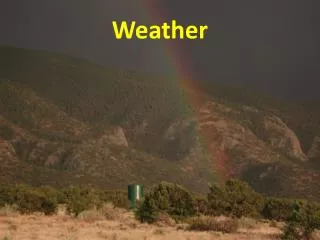
Weather
E N D
Presentation Transcript
Weather Chapter 24
Air Masses • Differences in air pressure are caused by unequal heating of Earth’s surface. • Heated equatorial air rises & creates a low-pressure belt. • Cold air near the poles sinks & creates a high-pressure centers. • Differences in air pressure creates the wind patterns
How does air move? • Moves from areas of high pressure to low pressure. • Worldwide movement of surface air from poles toward equator. • Temperature & pressure differences give us the wind belts.
Formation of Air Masses • Air mass = large body of air throughout which temperature & moisture content are similar. • Air masses over frozen polar regions are cold & dry; air masses formed over tropical regions are warm & moist.
Types of Air Masses • 4 TYPES: • MARITIME (WET) • CONTINENTAL (DRY) • POLAR (COLD) • TROPICAL (WARM) • Can be different combinations, example maritime polar - mP
Fronts • When 2 unlike air masses meet, density differences usually keep the air masses separate. • Cool air mass is dense; doesn’t mix with less-dense air of a warm air mass. • A boundary --- known as a front --- forms between the air masses.
Types of Fronts • Cold fronts = the front edge of a moving mass of cold air that pushes beneath a warmer air mass
Warm Front • Front edge of advancing warm air mass that replaces colder air with warmer air
Stationary & Occluded Fronts • Stationary = a front of air masses that moves either very slowly or not at all. • Occluded = forms when a cold air mass overtakes a warm air mass & lifts the warm air mass off the ground & over another air mass.
Weather Instruments • Weather observations are based on a variety of measurements including: atmospheric pressure, humidity, temperature, wind speed, & precipitation.
Instruments Used to Measure Lower-Atmospheric conditions Barometers = measures atmospheric pressure Thermometer = measures & indicates temperature Wind vane = used to determine direction of wind Anemometer = used to measure wind speed
Instruments Used to Measure Upper-Atmospheric Conditions • Radiosonde = package of instruments carried by a balloons to measure temp, dew point, & wind velocity • Radar = a system that uses reflected radio waves to determine velocity & location of objects • Weather satellites • Computers
Forecasting Weather • Data that is collected by weather stations are transferred onto weather maps. • Station model = a pattern of meteorological symbols that represents the weather at a particular observing station & that is recorded on a weather map.
Plotting Temperature, Pressure, Fronts & Precipitation • Lines that connect points of equal atmospheric pressure are called isobars. • Closely spaced isobars indicate a rapid change in pressure & high winds • Isobars that form closed circles indicate centers of high or low air pressure. (Marked with an H or L).