Download
1 / 39
400 likes | 506 Views
West Bank including East Jerusalem Humanitarian Overview, January 2011. West Bank Key Issues. Shrinking Space for Palestinians Restricted access in Area C and East Jerusalem House Demolition, Settler Violence Access and Movement Restrictions and recent movement easings

E N D
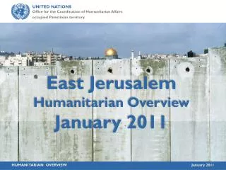
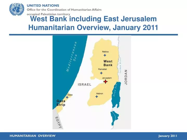
West Bank including East Jerusalem Humanitarian Overview, January 2011
West Bank Key Issues Shrinking Space for Palestinians • Restricted access in Area C and East Jerusalem • House Demolition, Settler Violence • Access and Movement Restrictions and recent movement easings • Fragmentation of the West Bank
West Bank Overview WEST BANK West Bank: 5,600 km2 Area C Greenline Palestinian Built-up areas Population: 2,350,583PCBS Census 2007 Oslo A & B Israeli settlementsapprox. 149 settlements,100 outpostsPopulation: Approx. 500,000
Restricting space in area C of the West Bank • Area C: 60% of West Bank • Land Reserves for Urban Expansion and Infrastructure. • Palestinian construction prohibited in 70% of Area C and restricted in 29% • Only 1% of Area C planned for Palestinian development • Population: est. 150,000 Restricting Space: The Planning Regime Applied by Israel in Area C of the West Bank December 2009
House Demolitions Area C: 200 demolitions a year (av.) > 3,000 pending orders East Jerusalem 100 demolitions a year (av.) > 1,500 pending orders > 60,000 vulnerable
Palestinian built-up area Settlement E1 project Jerusalem – Restricted space BARRIER Constructed 1987 Under construction Planned 2005
Shrinking Space for Palestinians in E. Jerusalem Restrictive planning Restrictive permit regime Shortfall of about 1,100 HU/year
East Jerusalem, Silwan-Al Bustan
East Jerusalem, Sheikh Jarrah Shepherd Hotel • Settler attempts to take over land for expansion/ new settlements. • Land/property expropriated by court order, in contravention of international law. • Plans to build over 540 residential units and public/commercial buildings for settlers. • About 60 Palestinian residents were so far forcibly evicted (2009-2010) • Estimated 500 at risk of displacement Al-Kurd Ghawi Hannoun Kubbania Um Haroun OCHA Office
Settlements inEast Jerusalem Jewish settlements established in the middle of Palestinian neighborhoods of East Jerusalem
Settler Violence in 2010 “Price tag” strategy since 2007 2010: Increase of 26% in Settler related violence incidents : Up to 476 from 352 in 2009 Impunity: lack of law enforcement 92% of 600 cases monitored by Yesh Din between 2005- 4/2010 closed
Settler related violence incidents trend 117% Increasesince 2006 Last update: 31 Dec 2010
Access and Movement:Multi-layered system of restrictions Checkpoints & roadblocks Barrier and ‘Seam Zone’ Restricted roads Closed military areas (Firing Zones) Nature reserves Israeli settlements Administrative restrictions Shrinking Space, Displacement
Closures in the West Bank WEST BANK • Road Gates • Road Blocks • Road Barrier • Earth Mounds • Trenches / Earth Walls • Checkpoints (& Partial Checkpoints) Greenline Roads
EARTH WALLS A continuous wall or series of earth mounds. ROAD BARRIERS Road barriers alongside major roads to prevent movement across the roads.Total of 125 km ROAD BLOCKSA series of 1 metre high concrete blocks used to obstruct vehicle access. ROAD GATESA metal gate, often manned by IDF, to control movement along roads. EARTHMOUNDSA mound of rubble, dirt and/or rocks used to obstruct vehicle access. TRENCHES A ditch used to prevent vehicle crossing. Total of 33.6 km PARTIAL CHECKPOINT An established checkpoint operating periodically. CHECKPOINTSA barrier manned by IDF and/or Border Police.
Number of Closures 64 24 114 70 166 1046 20 CHECKPOINTSA barrier manned by IDF and/or Border Police. PARTIAL CHECKPOINTSAn established checkpoint operating periodically. ROAD GATESA metal gate, often manned by IDF, to control movement along roads. ROADBLOCKSA series of 1 metre high concrete blocks used to obstruct vehicle access. EARTHMOUNDSA mound of rubble, dirt and/or rocks used to obstruct vehicle access. TRENCHES A ditch used to prevent vehicle crossing. ROAD BARRIERS Road barriers placed alongside major roads prevent movement across the roads. EARTH WALLS A continuous wall or series of earth mounds used to restrict access. In total 514 closures As of 4 January 2011 Flying Checkpoints Average: 2009 65 2010 91 As of December 2010
Closure Trend Number of West Bank Closures A 36% increase since AMA was signed 800 700 625 18 % decrease since March 09 550 AMA 614 569 561 600 533 514 471 533 500 396 376 400 300 200 100 0 Aug 05 Nov 05 Jan 06 Oct 06 Oct 07 Jan 08 March 09 June 09 Feb ’10 4 Jan‘11 Palestinian Elections Hamas Take-over Disengagement Annapolis
Other Closures • 123 obstacles in Hebron City (H2) • 64 Barrier gates • 8 Green Line checkpoints * Not included in OCHA closure count (Dec. 2010)
Easing of movement between urban centers • Removal of obstacles • Shifting permanent checkpoints into partial • Ad hoc checks • Lifting some permit requirements • Yet - Key routes remain blocked
No improvement in access to • Areas isolated by the Barrier (inc. East Jerusalem) • The Jordan Valley • Land in the vicinity of settlements
The Jordan Valley Access to, and land use within the eastern strip remained restricted
Tayyasir • The Jordan Valley • Access tightly controlled by checkpoints • Entry of private vehicles restricted Hamra Ma’alehEfraim Yitav
Access to land in the vicinity of Israeli settlements remained limited
Construction of Barrier in the West Bank Started in June 2002 after an escalation of suicide bombings- issue is the route
The Barrier WEST BANK Total Length: 707 km Within the West Bank 85% Constructed61.4% (434 km) Under Construction8.4% (60 km) Planned30.2% (213 km) Green Line
Closed Area Communities 7,800 people in closed areas “Permanent Resident” Permits When route completed: 85% of the completed route will be in the WB 33,200 will live in closed areas” 125,000 surrounded / 3 sides Access problems
55 0 1 2 Miles QalqiliaJayyous ACTIVATE LAYERS Habla Tunnel Jayyus’ Land Road 55 Water wells Green Line West Bank BarrierConstructedPlanned Dismantled PalestinianBuilt-up IsraeliSettlements Barrier Gates
East Jerusalem: Key Humanitarian Concerns • Barrier related: • Access to services • Communities & land “dislocated” by Barrier • In addition: • Evictions, Demolitions • Residency rights • Poor living conditions • Displacement
East Jerusalem Access Qalandiya Olives Gilo
Access to Health • All Jerusalem ID holders / West Bank and Gaza residents • Permits & access for West Bank patients, staff & ambulances to East Jerusalem hospitals • Problems of access for Jerusalem residents who live outside Barrier • Access problems within East Jerusalem due to ambulance escorts (ICRC/PRCS/MADA agreement) • Access to West Bank/Jerusalem hospitals for dislocated communities
Access to Education • Permits & access for West Bank teachers /students to Jerusalem • Classroom shortage in Municipal system / Demolition / sealing of Al Waqf schools • Estimated 5-10,000 pupils not enrolled / high dropout rate • Access to West Bank/Jerusalem schools for dislocated communities
Residency rights • Revocation of social benefits & Jerusalem ID cards • Family reunification • Registration of children • Municipal boundary vs. Barrier boundary
‘Dislocated’ communities & isolated land • West Bank Palestinian communities on ‘Jerusalem’ side of Barrier • East Jerusalem communities on ‘West Bank’ side of the Barrier • West Bank communities severed from their previously close ties to Jerusalem • West Bank land isolated on ‘Jerusalem side’ of Barrier
Areas A and B (Oslo Accords) Areas C 149 Israeli settlements,100 outposts and land cultivated by Israelis Israeli military closed areas (Fire Zones) and 48 military bases Nature Reserves West Bank Barrier and Areas between the Barrier and the Green Line Restricted Roads Closures and Checkpoints The effect of the closures and the road system Fragmentation of the West Bank Tunnels (As of September 2008)
The Shrinking Space of Bethlehem Governorate Potential sites for development of Bethlehem tourism if Israeli measures lifted Governorate comprised of approximately 658 square Km • Israeli annexation into Jerusalem • IDF closure of Dead Sea coast line (32 Km) • Israeli settlements (19), Israeli pop. 86,000 • Area C (66%) – full Israeli control • Israeli military closed areas (40% of the governorate and 60% of Area C) • Nature Reserves (19.4%) • Bypass roads • Israeli settlement outposts (16) • Barrier – constructed & under construction • Barrier - Planned • Closures : checkpoints and obstacles (29) • Settlement expansion
Conclusions For Humanitarian and/or full economic recovery there is a need to: • Lift Access restrictions • Establish Palestinian Control over Space & Resources. • Barrier on 1967 Green Line