Download
1 / 21
210 likes | 333 Views
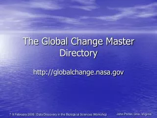
The Global Change Master Directory (GCMD) aims to assist the scientific community in discovering Earth science data, related services, and information, including instrument descriptions. Primarily focused on providing comprehensive NASA resources, GCMD creates a high-quality database to minimize costs associated with data collection and dissemination. By offering metadata sharing, multiple entry points for data access, and tools for validating and submitting information, GCMD supports a collaborative platform for understanding Earth's climate and environmental changes while enhancing access to essential scientific data.

E N D
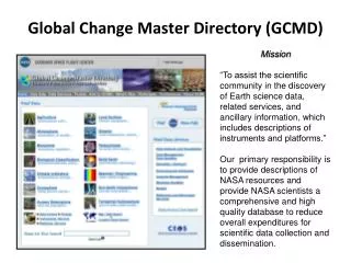
Global Change Master Directory (GCMD) Mission “To assist the scientific community in the discovery of Earth science data, related services, and ancillary information, which includes descriptions of instruments and platforms.” Our primary responsibility is to provide descriptions of NASA resources and provide NASA scientists a comprehensive and high quality database to reduce overall expenditures for scientific data collection and dissemination.
GCMD: Meeting Obligations to the Community Metadata Sharing and Linkages to Data Systems *April 2010 NASA Non-NASA
Multiple Entry Points for Discovering Earth Science Data and Services Keywords NASA Data Data Services Data Centers Instruments Map/Date Search Projects Platforms/ Sources Location Name Search Full-text
Controlled Keyword Sets Science Keywords Services Keywords Locations Instruments * Platforms * Spatial/Temporal Data Resolution Range Visualization Type Analysis Type • URL_Content Type • Chronostratigraphic Units • ISO Topic Category • Data Set Language • Data Centers * • Personnel * • Projects * • *Authors may create new entries, but software checks for uniqueness & consistency. • Unique Entry_IDs are also assured. • Required
Five-Level Keyword Hierarchy Variable Level 2 Variable Level 1 Term Variable Level 3 Topic 6
Data Service Descriptions • Describe Earth science related tools, software, and services. • Relate to the processing, viewing, analysis, archival, retrieval, production, interpretation, acquisition, modeling, visualizing, formatting, or indexing of Earth science data. • Provide a link between services and associated data set descriptions. Data Service Population by Keywords Data Services Interface
Contributing Earth Science Data and Service Descriptions Tools for Creating, Validating, and Submitting Information About Your Data Set or Service.
Metadata Submission, Validation and QA Validation (controlled fields and syntax) Science staff - metadata coordinators Partnership between coordinators and data providers
Link Checker/Editor • Internal “Web-Based” Tool (developed to fix EOSDIS links). • Scans the entire GCMD metadata collection (2 times a month). • Provides reports of broken and redirected URLs based on scans. Reports are also available as a text file and can be distributed to metadata providers. • Permits internal users to update broken links directly in the metadata. • Caches all web pages to provide a reference in case a site is extinct. • Implemented in docBUILDER to warn users of broken links at validation.
Focus on Quality of Metadata Content Focus on Quality of Metadata Content Revised, New, and deleted DIFs Revised, New, and deleted SERFs Revised, New, and deleted SERFs
Directory Population Over Time (1999-2009) 24,000 Current Population Data Sets: 22,508 Data Services: 2,194 Climate Diagnostics: 203 20,000 16,000 Population Value 12,000 8,000 4,000
GCMD Portal Collaborations Portals are subset views of the directory, allowing organizations to maintain and document their contributed data set and services descriptions. http://gcmd.nasa.gov/Data/portal_index.html
Portal Growth (1999-2009) Number of Portals Year
CEOS Climate Diagnostics: Climate Visualizations for Environmental Decision Making The Climate Diagnostics directory offers climate diagnostic visualizations that can be easily interpreted by decision makers. This site is designed to enhance the Global Earth Observation System of Systems (GEOSS) by providing these visualizations of climate trends and variability. Users can search by controlled Earth science keywords, Essential Climate Variables (ECVs), Societal Benefit Areas (SBAs), or through a full-text search. Controlled location keywords and a Google map are also available to query on a location of interest. Choose “Add Climate Diagnostics” to contribute visualizations.
Science User Working Group Meeting June 2-4, 2010 Building 34