Mozambique
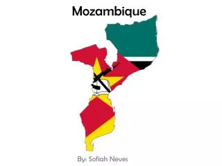
Mozambique. Bethany Dempsey 8 th period. Map. Capital: Maputo. Geography and Landforms. 1. highest point: Monte Binga 2,436 m 2. Lebombo Mountains are an 800km long, narrow range of mountains in Southern Africa.

Mozambique
E N D
Presentation Transcript
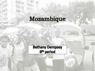
Mozambique Bethany Dempsey 8th period
Map Capital: Maputo
Geography and Landforms • 1. highest point: Monte Binga 2,436 m • 2. LebomboMountains are an 800km long, narrow range of mountains in Southern Africa • 3. Zambezi river- Zambezi is in fact the fourth-longest river in Africa, and the largest flowing into the Indian Ocean from Africa. • 4. Lake Malawi- Lake Malawi (Nyasa) is the country's major lake.
Geography and Landforms • 5. Mozambique channel- Positioned between the countries of Comoros, Madagascar and Mozambique, it is a busy and important route for east African commerce. The channel is approximately 1,000 miles long and home to significant ocean currents and is a breeding ground for some of the southern hemisphere's most severe cyclones
Major Cities 1. Beira 2. Chimoio 3. Maputo 4. Matola 5. Nampula
Historic Sites and Landmarks 1. Island of Mozambique- The Portuguese established a port and naval base in 1507. The island also became an important missionary center and is now a World Heritage Site. 2. Pracados Trabalhadores- This structure is located at the end of Guerro Popular in Maputo where there is a statue honoring the fallen heroes of Mozambique during World War I.
Historic Sites and Landmarks 3. Fort San Sebastian or Fortaleza- The fort was built in 1781, during the colonial era, by the Portuguese and was the center of the original settlement. Today, the fort is a military museum and the fort is the site of annual commemoration ceremonies marking the anniversary of the independence of Mozambique.
Recreation and Outdoor Activities • Gorongosa National Park is a 3,770 square kilometer park at the southern end of the Great African Rift Valley in the heart of central Mozambique. Gorongosais home to an astounding diversity of animals and plants—some of which are found nowhere else in the world.
Mozambique has a national football (soccer) team popularly known as The Black Mambas, as well as a national cricket team. • There are many outdoor activities to choose from on the coast including: snorkeling, water sports, dune boarding, and island drives.
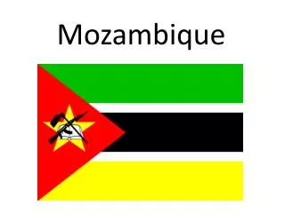
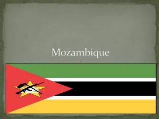
Country Flag Three equal horizontal stripes of green, black, and yellow, with a red isosceles triangle based on the hoist side; the black band is edged in white. Centered in the triangle is a yellow five-pointed star bearing a crossed rifle and hoe in black superimposed on an open white book. Green represents the riches of the land, white peace, black the African continent, yellow the country's minerals, and red the struggle for independence; the rifle symbolizes defense and vigilance, the hoe refers to the country's agriculture, the open book stresses the importance of education, and the star represents Marxism and internationalism.
Setting/Location • Southeastern Africa, bordering the Mozambique Channel, between South Africa and Tanzania • Borders: Malawi, South Africa, Swaziland, Tanzania, Zambia, Zimbabwe • Slightly less than twice the size of California
Climate/Weather Conditions • Tropical to subtropical climate with plenty of sunshine and rarely cold • The Mozambique weather is characterized by seasonal rains at a specific time of the year.The rainy season is from November to April and the temperatures can get very hot and humid, particularly between December and February. • Temperatures and rainfall patterns vary greatly between the regions of the country.
Transportation • Cars (Roadway: 30,400 km) • Airplanes (106 airports) • Trains (Railway: 4,787 km) • Ships/boats (Ports: Beira, Maputo, Nacala)
Arts and Culture • National Museum of Art in Maputo- This museum houses a large collection of works by Mozambican artists such as Malangatana, NaguibMucavele and Chissano. • The Iron House of Maputo- This house, made entirely of iron, walls, ceiling and all, was designed by Gustav Eifel (who also designed the Eiffel Tower and Statue of Liberty). It was built as the governor’s house in the late 19th Century, but it proved far too hot, being made of iron, for residence.
Language and Dialect • Emakhuwa26.1% • Xichangana 11.3% • Portuguese 8.8% (official, spoken by 27% of population as a second language) • 43 spoken languages • Many African dialects
Food • The cuisine of Mozambique revolves around fresh seafood, stews, corn porridge, arroz(rice), millet (a type of grain), and mandioca(cassava). Meats such as bifel(steak) and frango(chicken) are often accompanied by beans, cassava chips, cashew nuts, coconut, batata(potatoes), and a variety of spices, including garlic and peppers (a Portuguese influence). • Mozambique's papaya and pineapples are known as some of the juiciest in the world • Mozambican chá(tea), make a delicious ending to any meal • Portugesegreatly impacted the cuisine of Mozambique. Cassava cake Cassava chips papaya
Additional Information • Mozambique is the 14th poorest country in the world with a GDP per capita of $900. • Mozambique was ruled by Portugal for nearly 500 years and did not gain independence until 1975. • Natural gas is an important natural resource in Mozambique. • 51st largest country in terms of population. • AIDS is an ongoing problem due to poor living conditions in many areas. 1975
Natural Hazards • severe droughts • devastating cyclones and floods in central and southern provinces flood cyclone drought
Life Expectancy Total population:51.78 years male: 51.01 years female:52.57 years
Major Religion • Catholic 23.8% • Muslim 17.8% • Zionist Christian 17.5% • other 17.8% • none 23.1%
Largest Ethnic Group African 99.66% (Makhuwa, Tsonga, Lomwe, Sena, and others)
Top 3 Imports • Machinery and equipment • Vehicles • Fuel
Top 3 Exports • Aluminum 2. Prawns 3. Cashews