Download

1 / 34
340 likes | 574 Views
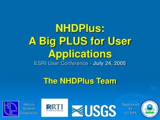
The National Hydrography Dataset Plus What is NHDPlus?. Vision for a National Geospatial Surface Water Framework. National Hydrography Dataset (NHD). National Elevation Dataset (NED). Watershed Boundary Dataset (WBD). How will this vision be attained?. The Team. EPA Project Lead

E N D
Vision for aNational Geospatial Surface Water Framework National Hydrography Dataset (NHD) National Elevation Dataset (NED) Watershed Boundary Dataset (WBD) How will this vision be attained?
The Team EPA Project Lead Tommy Dewald Horizon Systems Cindy McKay Jen Hill Bob Deffenbaugh USGS WRD Al Rea Rich Moore Craig Johnston Modeling Consultant Tim Bondelid
NHD Plus An integrated suite of application-ready geospatial surface water data products. It’s the first national effort to integrate: • National Hydrography Dataset (NHD) • National Elevation Dataset (NED) • National Watershed Boundary Dataset (WBD) • National Land Cover Dataset (NLCD) NHDPlus links the mapped stream network to the landscape.
NHD Plus – What’s Inside? NHD Greatly improved 1:100K National Hydrography Dataset PLUS (9 more components): • Value Added Attributes • Elevation-based Catchments • Catchment Characteristics • Headwater Node Areas • Cumulative Drainage Area Characteristics • Flow Direction, Flow Accumulation, and Elevation Grids • Min/Max Elevations and Slopes • Flow Volume & Velocity Estimates • Flow Gages with Network Locations
2 1 Impairment Drinking Water Intake 3 What is the National Hydrography Dataset (NHD)? • A Framework dataset that includes: • Hydrographic features for making maps • A national stream addressing system • A modeling network for navigating upstream/downstream • A maintenance infrastructure • User updates • Distributed formats – personal geodatabase, shapefiles, coverages • Compatible with ArcHydro Model & Tools
Value-Added Attributes (Stream Order, Stream Level, Waterbody-Network link and more…) • A set of two dozen network characteristics • Derived from native NHD content • For Analysis, Navigation & Display
Elevation Grid (elev_cm) National Elevation Data (NED) used to create the NHDPlus
Hydrologically-Conditioned Elevation National Hydrography Dataset (NHD) Watershed Boundary Dataset (WBD) National Elevation Dataset (NED)
Flow Direction Grid (FDR) Cells point down hill to the neighboring cell with the lowest elevation Flow Accumulation Grid (FAC) Cells contains the count of the number of cells that are uphill
Catchment Grid & Shapefile The portion of the land surface that drains to a network flowline
Catchment Attributes • Mean Annual Temperature (Prism - 4km) • Mean Annual Precipitation (Prism - 4km) • % of each of the 21 land use classifications from the 1992 National Land Cover Dataset (NLCD)
Flowline Attributes • Raw min/max elevations • Smoothed min/max elevations • Slope • Cumulative drainage area • Cumulative land use classifications • Flow volume, incremental inflow – Unit Runoff Method • Flow volume – Vogel Method • Velocity – Jobsen
USGS Gage Point Events on NHDPlus – Coming Soon! • Many Attributes: • Gage ID • Reachcode/Measure • Lat/Long • Agency • Station Name • Several Dozen Flow Stats • And more…
Distribution Units for Elevation, FAC, and FDR Grids 62 units total
NHDPlus Distribution Units for NHD, Catchments, and Attribute Tables 20 20 09 17 10U 01 04 02 07 16 10L 14 05 18 11 06 15 13 08 03 0318 12 06 10 01 02 03 11 12 14 16 17 18 20 04 09 07 05 13 0318 15 08
Point Links Linear Links Linear Reach: 02020005000375 Measure: 48.247 Linear Reach: 05030204004722 From Measure: 15.0 To Measure: 90.00 Waterbody Reach: 06030102002785 + shape Area Links Linking Data to the NHDPlus
Things Linked to NHDPlus • EPA Water Programs • Water Quality Standards • Water Quality Monitoring Stations • Assessed Waters • Impaired Waters • Nonpoint Source Projects • Beaches • Fish Consumption Advisories • Sewage No Discharge Zones • Permitted Dischargers • Drinking Water Intakes • Drinking Water Wells • Clean Watershed Needs • Special Appropriations Projects • And More… • USGS Flow Gages
STEP 8 Value Added Attributes Temperature & Precipitation Flow Volume & Velocity Land Use
Watershed Characterization • Main Stem: Huntsville Spring Branch • Stream Order: 3 • Stream Level: 4 • Area weighted precipitation 1431.2 mm • Area weighted temperature 15.3 oC • Land Use • Open Water 1% • Residential 28% • Commercial/Ind/Trans 9% • Barren 1% • Forest 33% • Pasture/Hay 5% • Row Crops 12% • Urban/Rec Grasses 5% • Wetlands 5% • Other 1% • Drainage area 180.5 km2 • Mean Annual Flow (UROM) 128.6 cfs • Mean Annual Flow (Vogel) 123.7 cfs • Mean Annual Velocity (UROM) 0.95 fps • Mean Annual Velocity (Vogel) 0.87 fps
Importance of the NHDPlus • The NHDPlus Is a Complete Analytical Tool • Very Robust Stream Network • New Attributes for Improved Applications • Catchments, FDR, FAC and Elevation Add the Landscape into the Analytic Environment • Watershed Delineation and Characterization • Integration with virtually any landscape dataset • Models!!!!
NHDPlus – What’s Available? • Data: • Great Lakes (04) • Mississippi (05, 06, 07, 08, 10, 11 and 0318) • Texas (12) • Rio Grande (13) • Colorado (14 and 15) • Great Basin (16) • Pacific Northwest (17) • California (18) • New England (01) • Mid-Atlantic (02) • By End of September – South Atlantic (03), Souris-Red-Rainy (09) • Documentation: • User Guide • Various Presentations • Metadata • Release Notes for each hydro region • Training: • Eight Exercises/Tutorials • Tools: • NHD Flow Table Navigator • NHDPlus VAA Navigator #0 – Preparation #1 – Setting Up The Data #2 – Linking Data to NHD #3 – Navigating with Geometry #4 – Navigating with VAAs & Flow Table #5 – Network Analysis #6 – Raster Dataset #7 – Watershed Delineation #8 – Simple Model
Where to get NHDPlus Data, Documentation, Presentations, Exercises and Tools Web Site: http://www.epa.gov/waters Click on “NHDPlus” Web Site: http://www.horizon-systems.com/nhdplus FTP Site: ftp://ftp.horizon-systems.com/nhdplus Fall 2006: In the EPA Waters Database Email: NHDPlus@HSCNET.COM