Download
1 / 35
370 likes | 739 Views
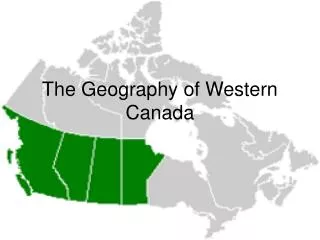
Geography of Canada. Physical Features, Where People Live, & How They Trade. Physical Features. Great Lakes. 5 large freshwater lakes in central North America HOMES (Huron, Ontario, Michigan, Erie, Superior)

E N D
Geography of Canada Physical Features, Where People Live, & How They Trade
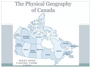
Physical Features
Great Lakes • 5 large freshwater lakes in central North America • HOMES (Huron, Ontario, Michigan, Erie, Superior) • Serve as the “industrial heartland” of the continent because of all of the factories • One of the world’s busiest shipping areas • Most of Canada’s population lives in this region
St Lawrence River • Major source of overseas and US/Canada shipping & trade • Shortcut that connects the Great Lakes to the Atlantic Ocean • Huge producer of hydroelectricity
St Lawrence Seaway • A canal completed in 1959 at the eastern end of the Great Lakes • Connects the Great Lakes with the St. Lawrence River (which flows to the Atlantic Ocean) • Major source of overseas and US/Canada shipping & trade • Closed from November to April (frozen) • Seaway has made cities in Eastern Canada home to many successful manufacturing companies
Hudson Bay • HUGE inland sea in east central Canada • “an arm” of the Atlantic Ocean • Grain from Alberta & Saskatchewan is shipped from Hudson Bay out to the Atlantic and on to other countries • Only navigable from July to October
Atlantic Ocean • This is the 2ndlargest of the earth’s 5 oceans. • It’s also the most heavily traveled ocean. • It forms the eastern border of Canada. • It’s a major shipping route to Europe & Africa.
Pacific Ocean • Largest & deepest of the world’s 5 oceans • Covers 1/3 of the earth’s surface! • Western border of Canada • Major shipping route to Asia
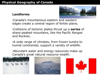
Canadian Shield • Stretches from Great Lakes to Arctic Ocean; covers half of Canada! • Horseshoe region around Hudson Bay • Region of mostly thin soil lying on top of rock, with many bare outcrops of rock & thousands of lakes • Major source of natural resources: timber, minerals, & water • Region is sparsely populated.
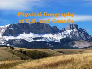
Rocky Mountains • Mountains located in Western Canada • Includes western Alberta and eastern British Columbia • Stretch a distance of 2,000 miles! • Mining is the biggest industry in the region, followed closely by logging. • Major minerals include: iron ore, copper, coal, gold. • Sparsely populated & contain few cities
Where People Live & How They Trade
Let’s Review: Physical Features
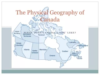
Location • 2nd largest country in the world (Russia is larger) • Surrounded by three oceans: Atlantic, Arctic, & Pacific • Southern border is the US • Alaska also forms part of the western border. • Population is 33 million, which is small compared to its size (US population is 9 times larger!) • 90 percent of population lives within 100 miles of the US-Canadian border…WHY?
Location & Trade • Canada’s location in the world helps it to be a leader in world trade: • It’s uniquely located on 3 oceans, so it has opportunities to trade with Europe & Asia. • Great Lakes and the St. Lawrence Seaway allow goods to be shipped to and from central Canada and the Atlantic Ocean • A major benefit for Canada is its border with the US (#1 trading partner). • Share over 3,000 miles of border & trade is relatively easy • 80% of Canada’s exports come to US
Climate • Southeastern part of Canada has a MUCH warmer climate than the rest of the country. • Warm to hot summers & cold winters • Allows for a long growing season • Pacific coast has a temperate climate. • Pacific ocean cools the region in summer and warms it in winter. • Over 100 inches of precipitation per year • Northern Canada is COLD! • Few people live here – temperatures can be below freezing even in summer!
Climate & Trade • Canada’s location in the world helps it to be a leader in world trade: • It’s uniquely located on 3 oceans, so it has opportunities to trade with Europe & Asia. • Great Lakes and the St. Lawrence Seaway allow goods to be shipped to and from central Canada and the Atlantic Ocean • A major benefit for Canada is its border with the US (#1 trading partner). • Share over 3,000 miles of border & trade is relatively easy • 80% of Canada’s exports come to US
Natural Resources • Rich in natural resources: • coal, oil, natural gas, iron ore, nickel, zinc, copper, gold, lead, molybdenum, potash, diamonds, & silver • Rivers and lakes have an abundance of fish, fresh water, & hydroelectric power. • Good soil allows farmers to grow crops for Canadians--with enough left over to trade with other countries • Timber is also a major natural resource.
N.R. & Trade • Sells oil and natural gas, fish, agricultural products, & timber to other countries • Hydroelectricity is used in Canada and also sold to the US. • 5% of the land in Canada is arable (actually a large amount because there is so much land). • Rich soil produces valuable crops that are consumed in Canada and traded to other countries.