Download
1 / 15
150 likes | 352 Views
Geography of Canada. Objective 1: to understand the climate and main geographic features of Canada. Objective 2: to understand how Canadians interact with their environment. Quick Facts. Majority of population live near the U.S. border. 2 nd largest country (by landmass)

E N D
Geography of Canada Objective 1: to understand the climate and main geographic features of Canada. Objective 2: to understand how Canadians interact with their environment.
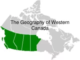
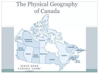
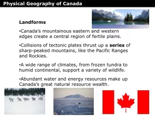
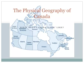
Quick Facts • Majority of population live near the U.S. border. • 2nd largest country (by landmass) • Most populous region is the St. Lawrence River Valley • Arctic Archipelago – within the Arctic Circle • Canadian Shield – rocky area dotted with thousands of lakes is largest physical region (2.8 million square miles! Over ½ of the country!
Climate Regions • Climate depends on temperature, elevation, wind patterns and precipitation. • Precipitation – amount of rain, snow, sleet or hail that falls in an area. • Great temperature extremes in the summer and winter in interior plains (land heats up and cools off more quickly than bodies of water).
Canadian Shield • Minnesota to the St. Lawrence River to Arctic Circle • Produces minerals like copper, iron, and nickel. • Large deposits of lead, gold, and silver
Geographic Areas cont.. • Arctic Archipelago : • Permafrost – most soil remains permanently frozen. • Made up of thousands of islands i.e. Baffin islands. • St. Lawrence River – helps to connect the Great Lakes to the Atlantic Ocean. • Atlantic Coast – Grand Banks by Newfoundland and Labrador. • Mixing Zone created in this area with warm waters from the Gulf Stream and cold water of the Labrador Current.
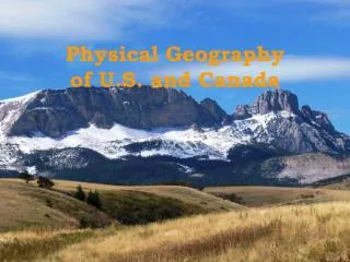
Canadian Cordillera • Cordillera “chain of mountains” in Spanish. • Canadian portion of the Rocky Mountains
Environmental Concerns • Over forestation, over development and over extraction of minerals have hurt the Canadian environment • Melting of Arctic ice caps and global warming a key concern • Canada – United States Air Quality Agreement has reduced acid rain • Border Air Quality Strategy helps to reduce smog between U.S. and Canada • Climate Change Plan (Canada) – guidelines to help reduce global warming.