Download
1 / 1
10 likes | 125 Views
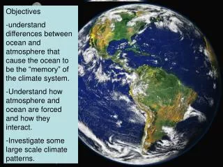
This NOAA initiative focuses on developing a virtual constellation of satellites to mitigate data gaps in ocean color radiometry (OCR) for effective monitoring of harmful algal blooms (HABs) and water quality. The project aims to integrate data from multiple sensors, including MODIS, VIIRS, and future high-resolution systems like S-GLI, ensuring comprehensive global coverage at 1 km resolution. Key activities include calibration and validation, product generation, and showcasing improved applications to support ecological forecasts, stock assessments, and marine resource management.

E N D
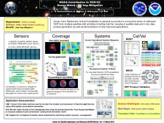
NOAA Contribution to OCR-VC Ocean Watch : OC Gap Mitigation S. Ramachandran, K. Hughes, P. DiGiacomo, Y.S. Kim Requirement:Global Coverage Science:HABs, Water Quality monitoring Benefit: Data Gap Mitigation Ocean Color Radiometry Virtual Constellation is planned to provide for a long time series of calibrated OCR from multiple satellites with activities including Cal/Val, merging of satellite data and in situ data, product generation as well as demonstration of new improved applications. Sensors Coverage Systems Cal/Val MOBY 1km daily (current) Current Operational System (Okeanos) 1) MODIS, SeaWiFS, MERIS (2009) 2) OCM-2, VIIRS-NPP, OLCI (2010+) 3) S-GLI, VIIRS-NPOESS (2014+) hi-res (planned) Development System (Tethys) For new data flows for OCR constellation during pre-operational stage MDCE Cross calibration at heritage site that is accurate, precise, well characterized, and SI traceable. OceanWatch (GLOBAL) Combination of sensors to mitigate for varied revisit times and swath width differences and to ensure minimal daily data gaps for routine use in applications. NRT Product Validation For VIIRS-NPP onwards we plan for full global coverage at 1km resolution for L2 products Application Demonstration HAB : Ocean Color data routinely used to monitor the location and movement of harmful algal blooms using Chlorophyll concentration anomalies. WQ: Monitor water Quality in the Chesapeake Bay using derived products like Total Suspended Matter to measure sediment and contaminant loading from terrestrial runoff. LM: Support for ecological forecasts, stock assessments and living marine resource management. Science Challenges:inter-sensor differences Next Steps: multi-sensor data merging Transition Path: CoastWatch to OceanWatch