
Let’s Explore the World Through Maps!
"Let’s Explore the World Through Maps!" is an engaging text set designed for 1st graders, focusing on understanding maps and their features. By learning the purpose of maps and related concepts, students will develop a foundational knowledge of geography that enhances their exploration of the world around them. This curriculum incorporates interactive elements, such as creating personal maps and 'feeling maps', helping students connect their experiences with mapping. The materials promote curiosity and a sense of adventure in geographical learning.
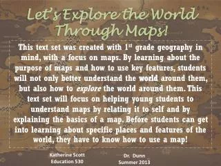

Let’s Explore the World Through Maps!
E N D
Presentation Transcript
Let’s Explore the World Through Maps! This text set was created with 1st grade geography in mind, with a focus on maps. By learning about the purpose of maps and how to use key features, students will not only better understand the world around them, but also how to explore the world around them. This text set will focus on helping young students to understand maps by relating it to self and by explaining the basics of a map. Before students can get into learning about specific places and features of the world, they have to know how to use a map! Katherine Scott Education 530 Dr. Dunn Summer 2013
Cartwright, S. (1976). What’s in a Map? New York, New York: Coward, McCann & Geoghegan, Inc.Level: High Genre: How To, Picture Book, NonfictionIn this book, the author asks the reader to make maps of the world around them. She asks them to make “feeling maps” of familiar places, such as their bed, their house, and their schoolyard. The author teaches the reader to draw maps, to build maps, and even to make pretend maps of worlds in their heads. This text is a great introduction to help student’s start to understand the feeling of exploration that comes with maps.
Sweeney, J. (1996). Me on the Map. New York: Crown Publishers, Inc.Level: Low Genre: NonfictionSweeney takes a child’s everyday understanding of the world around them and shows them the big picture through maps. Through this process of taking a child’s schema to build the concept of a map, students not only learn what a map is, but begin to understand the world in a broader sense. This book makes for a great introduction, because it takes the child’s schema and places it on a map.
Dr. Rodgers, A. (1998). The Illustrated World Atlas. New York, New York: Crabtree Publishing CompanyLevel: High Genre: AtlasStudents can explore many different countries through the various maps in this atlas. The text includes many types of maps, including industry, agriculture, and farming maps. There is also a wealth of data and graphs. Students would enjoy exploring each of these colorful maps. This atlas would also be a good reference for the teacher during a map unit.
Hartman, G. (1991). As the Crow Flies. New York, New York: Aladdin PaperbacksLevel: Easy Genre: Fiction, Picture BookStudents have to think as if they were each of these adventurous animals as they make maps of the places they go. As students follow each of the animals, they see how their surroundings create a map. This book would be great for small groups for lower leveled readers.
Ritchie, S. (2009). Follow That Map!: A First Book of Mapping Skills. Level: Average Genre: Picture Book, NonfictionAs students follow Sally and her friends on their search for Max and Ollie, they learn valuable information about map features. Students learn about such features as the purpose of specific maps, the use of symbols, and specific terminology. The book is very interactive and practically begs students to play and explore through maps.
Knowlton, J (1986). Maps and Globes. New York, New York: HarperCollinsLevel: High Genre: NonfictionThis book gives a nice overview of the history of maps. Students learn how people made maps over the years. Not only are there illustrations of the different types of maps, but the text also explains why and how maps evolved over time. This text illustrates the importance of maps and their overall purpose.
Fanelli, S. (2001). My Map Book. Hong Kong: HarperFestivalLevel: Low Genre: Picture Book, FictionMy Map Book shows the reader a map through the eyes of a child. The illustrations and labels are presented in a childlike manner. Students will enjoy reading a map made for them and written from their point of view.
Shulevitz, U. (2008.) How I Learned Geography. United States: Farrar, Straus and GirouxLevel: Medium Genre: Memoir, Picture BookWhen a boy and his family flee from war to a strange country, they find themselves living with strangers in poverty. When the father brings home a map instead of food, the boy is furious. However, overtime the boy starts to realize the map brings adventure into his life as he dreams of distant places. Through this heartwarming story, students can start to imagine the magic of maps. This would be a good book for small groups of medium level readers.
A GlobeA globe gives students a tangible way to look at the world as a whole. Students can spin, touch, and point as a way of interacting with the globe. The globe gives students a better idea of what the world looks like. The globe should be assessable to students during stations. The teacher should also used the globe as a reference during map lessons.
Local and State MapsStudents can find their location by looking at local and state maps. The teacher should show the student where the school is located on the maps and then leave the maps out so students can explore on their own.
CompassThe teacher should show students how a handheld compass works. She should use this compass to explain a compass rose on a map. She should give the students a chance to look at the compass themselves. The class could even label the direction on walls of their classroom using the compass.