Download
1 / 15
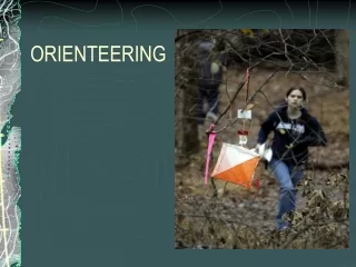
180 likes | 291 Views
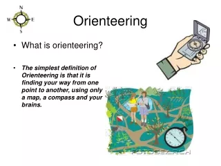
Learn to read and interpret orienteering maps effectively. Explore map parts, colors, symbols, terrain features, and more in this educational unit. Practice identifying forest types, water features, open ground, and man-made objects. Enhance your navigation skills!

E N D
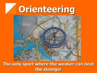
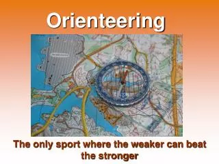
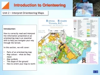
Introduction to Orienteering Unit 2 – Interpret Orienteering Maps • Introduction: • How to correctly read and interpret the information presented on an orienteering map is an essential skill to help you navigate your way through the terrain. • In this section, we will cover: • Parts of an orienteering map • Map colours – what do they mean • Map symbols • The shape of the ground • How to orient your map to north
Unit 2 - Interpret Orienteering Maps Introduction to Orienteering Parts of an Orienteering Map MAP TITLE: The title explains the area it represents. The title is always oriented to North. LEGEND: The legend provides information about the symbols used on the map. SCALE: The scale describes the size on the map relative to the actual world. In this case: 1 cm on map = 7500 cm or 75 meters in real life MAP DETAIL: The main part of the map showing the area covered and the orienteering course. CONTROL DESCRIPTION: This is added to the map and provides clues on where to find the control flags. SCALE BAR:The scale bar provides a quick visual ruler by which to judge distance by. It is normally divided by 50 and 100 meter segments. Mouse over the map to discover the different parts of an orienteering map
Unit 2 - Interpret Orienteering Maps Introduction to Orienteering Map Colours What do the map colours represent? Let’s take a close look at a section of an orienteering map to examine the different colours and what they mean. Select a colour to view a description.
Unit 2 - Interpret Orienteering Maps Introduction to Orienteering Map Colours Forest - Easy Running Forest – Easy Running: The trees are placed well apart and there is little to no ground cover. It is easy to run through this forest. Try it Out: Can you spot the areas described as Forest- Easy Running? Click here to select another colour.
Unit 2 - Interpret Orienteering Maps Introduction to Orienteering Map Colours Forest - Slow Running Forest – Slow Running: The trees are little closer together. There may be some ground obstacles to jump over, but you can still run slowly through this forest. Try it Out: Can you spot the areas described as Forest- Slow Running? Click here to select another colour.
Unit 2 - Interpret Orienteering Maps Introduction to Orienteering Map Colours Forest - Walk Forest-Walk: The trees are closer together, and there is ground cover or deadfall that needs to be scrambled over. Progress is slow but not impossible. Try it Out: Can you spot the areas described as Forest- Walk? Click here to select another colour.
Unit 2 - Interpret Orienteering Maps Introduction to Orienteering Map Colours Answer: Here Forest - Fight Forest - Fight: There are lots of branches, thick growth and/or difficult ground cover that make progress very difficult. These areas are best avoided. Try it Out: Do you see an area of Forest-Fight on this map? Check Answer Click here to select another colour.
Unit 2 - Interpret Orienteering Maps Introduction to Orienteering Map Colours Cultivated Gardens Garden: This area contains flower beds is well maintained. Unless there are distinct paths indicated on the map, this area is FORBIDDEN TO CROSS. Try it Out: Where are the out-of-bounds areas on this map? Click here to select another colour.
Unit 2 - Interpret Orienteering Maps Introduction to Orienteering Map Colours Water features Water: Ponds, lakes, rivers, swamps, creeks etc are all shown by the colour blue. If they have a a black border, that means they are UNCROSSABLE. Try it Out: Are the ponds crossable on this map? Check Answer Answer: No, they have a black border.
Unit 2 - Interpret Orienteering Maps Introduction to Orienteering Map Colours Open Ground Open Ground: This usually looks like an open and smooth grass field such as one would find in designated parks. Try it Out: Can you find the areas described as Open Ground?
Unit 2 - Interpret Orienteering Maps Introduction to Orienteering Map Colours Rough Open Ground Rough Open Ground: This usually a rough open field, devoid of trees although there may be occasional low ground cover. Try it Out: Can you find the areas described as Rough Open Ground?
Unit 2 - Interpret Orienteering Maps Introduction to Orienteering Map Colours Paved Areas Answer: A parking lot Paved Areas: This colour is used to denote paved roadways as well as stone or paved walkways such as those found on university campuses. Try it Out: What do you think is the large area in the centre of the map? Check Answer
Unit 2 - Interpret Orienteering Maps Introduction to Orienteering Map Colours Man-Made Objects & Rock Features Man-Made or Rock: Black is used to designate man-made objects such as paths, signs and buildings, but is also used to identify prominent rock features, such as boulders and cliffs. Try it Out: Where are the buildings on this map?
Unit 2 - Interpret Orienteering Maps Introduction to Orienteering Map Colours Bare Rock Answer: Here Bare Rock: Prominent stretches of bare rock are identified in grey. They are obvious to see in the terrain and devoid of vegetation. Try it Out: Can you spot the area of bare rock on this map? Check Answer
Unit 2 - Interpret Orienteering Maps Introduction to Orienteering Map Colours Landforms Landforms: Brown contour lines help outline shapes and provide an indication of height. This topic will be expanded on in a later section. Try it Out: Can you spot the brown contour lines on this map?