Download
1 / 1
10 likes | 132 Views
American Meteorological Society, 6 th Symposium on Integrated Observing Systems, Orlando Florida, Jan. 2002. P1.7 The NOAA Ron Brown’s Shipboard Doppler Precipitation Radar. Michelle Ryan 1,2 , M.J. Post 1 , Brooks Martner 1 , John Novak 3 , and Larry Davis 4

E N D
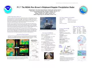
American Meteorological Society, 6th Symposium on Integrated Observing Systems, Orlando Florida, Jan. 2002 P1.7 The NOAA Ron Brown’s Shipboard Doppler Precipitation Radar Michelle Ryan1,2, M.J. Post1, Brooks Martner1, John Novak3, and Larry Davis4 1NOAA Environmental Technology Laboratory, Boulder, Colorado, USA 2Science Technology Corp., Boulder, Colorado, USA 3Quality Ventures, Inc., Golden, Colorado, USA 4Radtec Engineering, Inc., Broomfield, Colorado, USA A Doppler Weather Radar Available at Sea Oceans cover two-thirds of the planet's surface but remain data-sparse regions for weather and climate observations for obvious logistical reasons. A new tool for observing oceanic precipitation is the C-band Doppler weather radar on board the NOAA research vessel Ronald H. Brown (RHB). Commissioned in 1997, the RHB is among the world's most technologically advanced seagoing research platforms and the only ship in the U.S. civilian fleet to carry Doppler radar. The radar provides research-quality measurements of precipitation beyond the confines of land-based radar networks. Initial applications of the C-band radar data include studies of tropical rainfall, drizzling stratocumulus, monsoons, and validation of satellite-based rain estimates. NOAA/ETL serves as instrument mentor for the radar, which was built and installed by Radtec Engineering, Inc. The radar is available to principle investigators on the ship's numerous annual cruises for a variety of marine studies sponsored by NOAA and other agencies. The ship is routinely outfitted with an impressive suite of oceanographic and meteorological research instruments that measure various environmental conditions, while the radar provides a wide-area context on precipitation and storms with resolution as fine as 75 m. In addition, the RHB commonly hosts several investigator-provided instruments for individual cruises that typically last about six weeks. The C-band radar's beam is motion-stabilized by use of an inertial navigation system, which monitors the ship's attitude at 50 Hz and, through coordination with the antenna control system, compensates for ship motion to maintain the beam at the desired earth-relative elevation and azimuth angles. This feature provides accurate Doppler velocity data even in rough seas. PPI and RHI scans are available in programmable scan sequences or by manual control. Scan images of reflectivity and radial velocity are presented on a real-time color display, and post-processing data systems allow numerous more sophisticated radar products to be obtained at sea and following cruises. A New Tool for Studying Oceanic Precipitation • Major Capabilities: • Ship-based • Doppler • Scanning • Platform-motion-stabilized • Primary Uses: • Measurements of precipitation at sea • 3D storm structure and airflow • Satellite and model validations RHB Cruises Using C-band Radar Project Year Ocean Sponsors PACS/TEPPS 1997 E. Pacific NOAA INDOEX 1999 Indian NOAA/NSF JASMINE 1999 Indian NOAA/NSF Nauru99 1999 W. Pacific NOAA/DOE KWAJEX 1999 W. Pacific NOAA/NASA PACS 2000 E. Pacific NOAA EPIC/PACS 2001 E. Pacific NOAA/NSF Instruments onboard the RHB Oceanographic: Bathymetric acoustic sounders Ocean current profilers Salinometers Expendable bathy-thermographs (XBTs) Conductivity-temperature-depth (CTD) array Meteorological: C-band Doppler weather radar UHF Doppler wind profiler Radiosonde Standard surface met package Examples of PI-provided Instruments (EPIC cruise 2001): Air-Sea Flux instrument package Doppler cloud-profiling radar Microwave and infrared radiometers Doppler cloud lidar Lidar ceilometer The C-band weather radar atop the central mast of the Ronald H. Brown research vessel. Characteristics of the RHB Radar Frequency: 5.595 GHz (C-band, wavelength = 5.4 cm) Transmit Power: 250 kW peak Transmitter: Magnetron Antenna: 4.3-m diameter parabolic, center-feed dish within a 5.5-m radome. Antenna Gain: 44 dB with –22 dB sidelobes Beam Width: 1.0 deg., circular Pulse Length: selectable, typical defaults are 0.5, 0.8, 1.4, and 2.0 microsec. (resolution = 75, 120, 210, 300 m). PRF: selectable, 250-2100 Hz Scans: PPI, RHI, sector, fixed-beam, with elevations from below horizon to near zenith. Scan Rates: up to 36 deg/s (12 deg/s typical) Polarization: linear horizontal; system is designed to allow future upgrade to dual-polarization. Number of range gates: 1024 Maximum Unambiguous Range: 300 km at PRF=500. Sensitivity: approx. –22 dBZ at 10 km range using 0.5 microsec pulse length. Data System: Sigmet, Inc., RCP-02, and RVP-07 on HP Unix workstation. Platform: 83-m oceanographic research ship. Observations of Marine Precipitation Continental storms have been studied extensively with land-based Doppler radars, but there has been a dearth of similar radars at sea. Consequently, relatively little is known about marine precipitation mechanisms, although their impact on civilization through climate energetics and land-falling coastal storms may be great. The Doppler radar onboard the Ronald H. Brown offers an attractive new avenue for studying these problems. Acknowledgments: The following offices have sponsored the radar’s development and/or maintenance: NOAA/SAO, NOAA/OGP, NOAA/OAR, and NASA/TRMM. Grant Gray formulated scientific and engineering specifications for the radar. The RHB ship is operated by NOAA’s Office of Marine and Aviation Operations with a crew led by commissioned officers of the NOAA Corps. Research-quality storm reflectivity and Doppler velocity data are available from PPI and RHI scans (above) of the RHB C-band radar. Reflectivity statistics from this platform, such as in the PACS-2000 cruise data (right), can provide independent open-ocean validation information for assessing rainfall-estimation algorithms that are applied to data from satellite instruments. Fisheye-lens view of RHB from bow tower. (Photo by Scott Sandberg) Reflectivity data statistics processed by Jessica Koury.