Radar Artifacts
Radar Artifacts. Radar Beam Filling Non Uniformity Of Vertical Distribution Of Precipitation Variations In Z-R Relationship Attenuation By Intervening Precipitation Beam Blocking Attenuation Due To A Wet Radome Electromagnetic Interference Ground and Other Clutter Anomalous Propagation

Radar Artifacts
E N D
Presentation Transcript
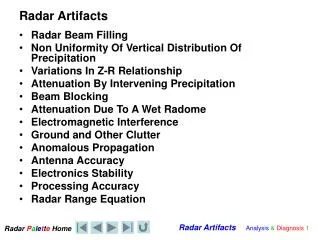
Radar Artifacts • Radar Beam Filling • Non Uniformity Of Vertical Distribution Of Precipitation • Variations In Z-R Relationship • Attenuation By Intervening Precipitation • Beam Blocking • Attenuation Due To A Wet Radome • Electromagnetic Interference • Ground and Other Clutter • Anomalous Propagation • Antenna Accuracy • Electronics Stability • Processing Accuracy • Radar Range Equation
Radar sensitivity and blockage • Not all radars are equal • Most are retrofitted Enterprise radars with 1.1° beam width and 4 m dishes • Some are Andrews radars with 0.65° beam width and 6 m dishes • Spirit River AB, WWW, has only 1.6° beam width! • Many have obvious issues • differences in sensitivity between each other • blockages • But many have less obvious, but significant problems that only become apparent with long-term precipitation accumulations
BC 15 Day Precip Accum CAPPI 1.5 km WWW 1015m XPG 1118m XSS 1829m WUJ 60m XSI 700m
Prairies 30 Day Precip Accum PRECIPET
Nrn Ontario 2 Day Precip Accum CAPPI 1.0 km Feb 16-17 2008
2 Day Precip Accum CAPPI 1.0 km Mar 8-9 2008 Srn Ontario
Srn Quebec 2 Day Precip Accum CAPPI 1.0 km Mar 8-9 2008 N
Atlantic 2 Day Precip Accum CAPPI 1.0 km Jan 28-30 2008
Sources of Error • Intervening precipitation • Wet radome • Beam blocking
Example of Attenuation in Precipitation Wedge of attenuation Foreground Storm
Cross Section constructed along this line
Sources of Error - Cell Blocking Cell blocking
??? ??? Spirit River, AB/BC BEAM BLOCKING Persistent Ground clutter Beam blockage N Clear Hills S Rockies
Wedge of attenuation Foreground Storm Attenuation
Attenuation • Warm Frontal Supercell
Attenuation • north • end • of • derecho?
RadomeWetting You just Checked The radar… NO PROBLEM… PROBLEM !
Sources of Error - Sidelobes Orographic Enhancement 3D View of Real Beam
Sources of Error - Blocking Impacts on Precipitation Estimates Why no precipitation amount maximum on the peaks? No PCPN? No PCPN?
Bright Band • Melting snowflakes are large bright radar targets • Reflectivity from melting snow is larger than that of the rain below or the snow above as falling snow passes through the melting layer • Huge impact on quantitative precipitation estimates
Bright band shows up as ring (or partial ring) of high Z centred on the radar Bright band
Melting of Snow Flakes starts at 2.5 km height Bright Band • Freezing Level ~2.5km AGL • Either associated with Rain or Freezing Rain
Melting Starts Melting Bright BandTime/height Display Time
Melting layer shows as peak in Z (note it shows up best in data for the 3.5 degree scan. Why?)
Doppler Reflectivity AP versus Real - Compared
Sources of Error - Anomalous Propagation AP Strong inversions Typical early morning after clear (long) nights – fall maximum Over cold water surface – spring maximum
Anomalous Propagation of the Radar Beam Only Real Weather AP and Real Weather The Doppler Velocity View
AP and Frontal Analysis Anomalous Precipitation AP
AP … Water Vapour and Fog VISIBILITY Probably still OK
Ground Clutter • Direct reflections from ground targets, either in the main lobe or sidelobes • Echoes are unusually variable in space, but constant in time (in contrast to AP, which is variable in time) • Well handled by clutter filters during signal processing
Ground Clutter • Rockie Mountains • persistent • even on EchoTop product
Ground Clutter Bethune, Saskatchewan • Missouri Couteau • only seen on 0.5PPI
0.3 Degree PPI 0.3 Degree PPI PPI and CAPPI 4.0 km CAPPI 1.5km CAPPI
NORTH Illustration Using King Radar Georgian Bay Lake Simcoe Lake Huron Lake Ontario
Calculated horizon in Panorama Far side of LkOntario To G.Bay To Lk Huron Lake itself Lk Simcoe North East South West North Shaded by distance to horizon. Red is basically the neighbourhood (“look down”) and mauve is see forever.
The Digital Elevation Map isn’t 100% complete or up-to-date. Largest Landfill in Canada Buildings Trees YOU are HERE Behind the trees

