Download

1 / 23
270 likes | 671 Views
Mesoscale convective systems. Review of last lecture. 3 stages of supercell tornado formation. Tornado outbreak (number>6) Tornado damage: Enhanced Fujita Scale (EF-0 65-85 mph, EF-5 >200 mph)

E N D
Review of last lecture • 3 stages of supercell tornado formation. • Tornado outbreak (number>6) • Tornado damage: Enhanced Fujita Scale (EF-0 65-85 mph, EF-5 >200 mph) • Tornado occurrence: Global and U.S.. Which country has the largest number of tornadoes in the world? Which state has the largest number of tornadoes per unit area in U.S.? Tornado season in U.S. (March-July)
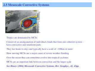
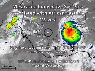
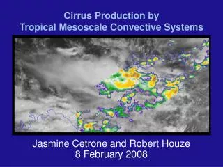
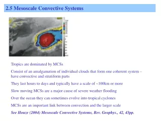
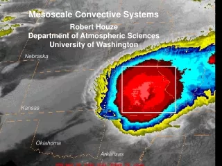
Convective systems • Tornadoes: about 100-600 m, last 1 minute to 1 hour • Thunderstorms: about 10 Km, last 10 minutes to a couple of hours. 3 types: ordinary, multicell, supercell • Mesoscale convective systems (MCSs): A cloud system that occurs in connection with an ensemble of thunderstorms and produces a contiguous precipitation area on the order of 100 Km or more in at least one direction, and often last for several hours to a couple of days.
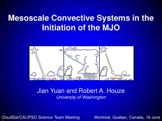
2 types of Mesoscale Convective Systems 1. MesoscaleConvective Complex 2. Squall line
Video: Mesoscale convective complex https://www.youtube.com/watch?v=3y7mxqNXYpc
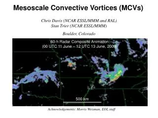
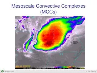
Mesoscale Convective Systems I. Mesoscale Convective Complex (MCC) An organized mass, or collection, of thunderstorms that extends across a large region is called a mesoscale convective complex (MCC). They can be up to 1000 x larger than individual storms. With weak upper level winds, such MCC's can regenerate new storms and last for upwards of 12 hours and may bring hail, tornadoes, and flash floods. They often form in summer beneath a ridge of high pressure, with moisture fed from S by low level jets.
Global distribution of MCCs From Doswell et al. 2000
Mesoscale Convective SystemsII. Squall Line • A squall line may contain several severe thunderstorms, some possibly supercells, extending for more than 1000 kilometers. • A squall line always contains a convective precipitation region and a trailing stratiform precipitation region.
Vertical structure of squall lines Convective updrafts (controlled by lower troposphere temperature and moisture) Mesoscale updrafts Mesoscale downdrafts Convective downdrafts Zipser (1977), modified by Houze (1993)
Development of a squall line Thunderstorm stage Bow echo stage Comma or line echo stage
Developement of a squall line:Horizontal view 1. Thunderstorm 2. Bow echo 3. Comma echo
Video: The June 2012 Derecho http://www.youtube.com/watch?v=K61qGvKltL8
Derechos • A derecho (spanish word meaning “straight ahead”) is a widespread, long-lived wind storm that is associated with a band of rapidly moving showers or thunderstorms (often a squall line). • By definition, the wind damage swath extends more than 240 miles and wind speed > 57 mph. Can produce destruction similar to that of tornadoes. The damage typically is directed in one direction along a relatively straight swath. From NOAA SPC Derecho website
Clouds associated with a derecho From NOAA SPC Derecho website
Different types of derechos Serial derechos Progressive derechos Hybrid derechos Low dewpoint derechos
Serial derecho From NOAA SPC Derecho website typically is associated with an extensive squall line or quasi-linear convective system with multiple embedded bow echoes. usually occur in conjunction with well-defined, migratory low pressure system. Overall convective system (and, therefore, derecho) motion is dominated by advection --- the downstream movement of individual thunderstorm cells by the environmental wind.
Progressive derecho June 2012 derecho over the Midwest and Ohio Valley From NOAA SPC Derecho website typically is associated with a squall line of restricted length that may involve a single bow echo or multiple bows. usually are associated with a stagnant large scale weather pattern. Overall convective system (and, therefore, derecho) motion is dominated by thunderstorm propagation --- that is, the development of new storm cells downstream from existing ones.
Timing of derecho events From NOAA SPC Derecho website
Summary • 2 types of mesoscale convective systems (mesoscale convective complex, squall line) • Structure of MCCs • Structure of squall lines: four components • Derechos. Definition (swath wider than 240 miles, wind speed>57 mph). 4 types (serial, progressive, hybrid, low dewpoint). Which state has the largest annual number of derecho events? Most derechos happen in the three months of May, June and July
Works cited http://usatoday30.usatoday.com/weather/wcomform.htm