Download
1 / 19
190 likes | 256 Views
Explore theories like Von ThÜnen's Agricultural Land Use and Bid-Rent Curves to understand urban spatial structure and economic rent. Learn about Agricultural and Urban Rent Gradients, Population Density Gradients, and models like Concentric Zone, Commuting Sector, Multiple Nuclei, and Urban Realms. Delve into Social Area Analysis and practical assignments analyzing population and employment density gradients in MS Excel. Enhance your knowledge of city growth and development dynamics.

E N D
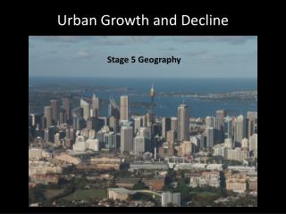
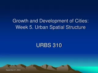
Growth and Development of Cities: Week 5. Urban Spatial Structure URBS 310
Urban Land Use Theory • Agricultural Land Use Theory (Von ThÜnen) • Early 1800s. A particular type of production depends on three items: 1) distance to the market (perishable close to the market; more extensive crops farther from the market) 2) selling prices at the market 3) land rent • Specialize in producing the ag. products yielding the highest land rent (economic rent) return at the particular location.
Urban Land Use Theory • Graphing Bid-Rent Curves • Economic rent (monetary return from producing a particular good after all costs were deducted) • Bid rent curve (relationship between economic rent and distance from the market)
Population Density Gradient • Negative Exponential Model (Colin Clark) • di = doe-bx • ln di = ln do - bx
Population Density Gradient • Modified Negative Exponential (Bruce Newling) • di = doe+bx-cx(^2) • ln di = ln do + bx – cx2
Population Density Gradient • Crater Effect: depressed level of density in the center • Density Rim: the peak
Change in Population Density Gradient Patterns in North American Cities
Three Models of Urban Land Use • Graphic prepared by Department of Geography and Earth Sciences, University of North Carolina at Charlotte.
Concentric Zone Model • E.W. Burgess, a sociologist, a study of Chicago, 1925. A set of concentric circles. • Zone 1: CBD • Zone 2: Factory, slum, ethnic community (transition zone or gray zone) • Zone 3: Lower income working people’s homes • Zone 4: Middle income housng • Zone 5: High income housing • Zone 10: Commuting
Sector Model • Homer Hoyt, a land economist, a study of patterns in over 100 cities, 1939 • Once similar land uses emerge around the CBD, activities remain in the area and extend over time in the same direction (following rail, highway arteries, high or llow ground, clustering on the same side of the city). • High income housing areas are dominant in urban growth.
Mutilple Nuclei Model • Chauncy Harris and Edward Ullman, geographers, 1945. • Land uses evolve at several nodes or focal points. • Each node has a special function – commercial, industrial, residential.
Urban Realms Model • James Vance, 1964. Peter Muller & Others Applied to LA Region & greater NY • Pepperoni Pizza • Emergence of large self-sufficient suburban sectors.
Social Area Analysis • Eshref Shevky, Marily Williams,a nd Wendell Bell, sociologists, 1949. • A theory of social differentiation. This theory shows how family characteristics, economic status, and ethnic patterns interrelate to produce distinct spatial patterns within the city. • Use three constructs: social rank (economic status), urbanization (family status), and segregation (ethnic status).
Optional Assignment 4(Due on 10/5) • Draw a chart of population density gradients for 2000 and 2030 using xy scatter function in MS Excel. Determine whether the form of population density model is negative exponential or modified negative exponential. Interpret the change of the population density pattern between 2000 and 2030. • Draw a chart of employment density gradients for 2000 and 2030 using xy scatter function in MS Excel. Determine whether the form of employment density model is negative exponential or modified negative exponential. Interpret the change of the employment density pattern between 2000 and 2030. • The excel data for assignment 4 are available in the class webpage. Turn in 1 page answer in a MS Word format.