Download
1 / 4
40 likes | 182 Views
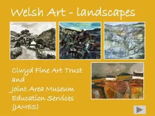
Unit Two – The Natural Environment – Coastal Landscapes – One Page Summary. The formation of Headlands and Bays

E N D
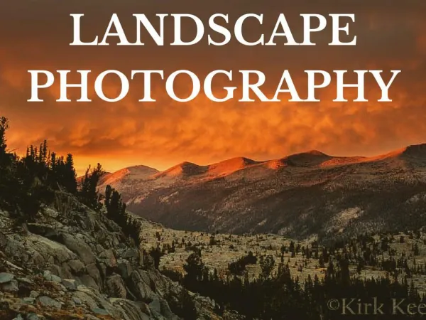
Unit Two – The Natural Environment – Coastal Landscapes – One Page Summary The formation of Headlands and Bays Rocks of Varying resistance lie at right angles to the sea. Bays are softer rock and erosion rates are greatest here. Headlands are more resistant and protrude into the sea, as the sea cuts the bays back the waves reaching the coast become less powerful as they have to travel over a longer expanse of beach, the headlands then experience more powerful waves, they are eroded faster than before. Key Terms: Longshore drift – the movement of sand and pebbles down a coastline. Swash is pulled up the beach at the angle of the prevailing winds. Backwash moves straight down (90◦) the beach due to the pull of gravity. Slumping –during dry weather clay contracts and crack, when it rains water is absorbed until rock is saturated . This weakens the rock and gravity causes it to slip down t the slope. • Hard engineering techniques • Sea wall - Usually made of concrete. Reflects and absorbs wave energy, very visible and make people feel safe. But are ugly and expensive to build. • Groynes- Usually made from wood, stretches from the coastline to the sea. Prevents Longshore drift, effective for many years. But are unattractive , make it difficult to walk on the beach and disrupt natural processes. • Soft engineering techniques • Beach replenishment - placing of sand/pebbles on a beach. Looks natural and is cheap. Requires constant maintenance and may affect plant / animal life. • Cliff regrading – Cliff cut back and given a gentle slope to stop slumping. Very natural and will encourage wildlife. Not affective alone, houses may need demolishing. Formation of wave-cut platforms The sea moves against the base of the cliff using corrosion and hydraulic action it undercuts the cliff and forms a wave-cut notch. Above the notch an overhang will form, in time it will fall into the sea due to the pressure of its own weight and gravity. This process is repeated and the cliff will retreat becoming higher and steeper. The remains of the cliff rock, now below the sea at high tide, form a rocky wave-cut platform. As the width of the platform increases, the power of the waves decreases as they have further to travel to reach the cliff. Formation of caves, arches, stacks and stumps Formed in rocks that have a fault or line of weakness. Hydraulic action exploit the fault. In time the fault will widen to form a cave. When formed on a headland caves form on both sides and eventually erode through to form an arch. As the sea continues to undercut the bottom of the arch a wave cut notch will form. It will collapse in time, pulled down by gravity. Leaving a column of rock known as a stack. Continued erosion and weathering will lead to the formation of a stump. • Management- Walton on the naze • Groynes- used to address the longshore drift and to keep the beach in place • To manage slumping the cliff was regraded to produce a gentler slope and drainage channels were installed to allow water to flow underground and out of the cliff through holes in the seawall • 167,000 for 300 tonnes of Leicester granite to be placed around the Tower breakwater. • The beach in front of the cliffs was replenished in 1999. • Factors affecting cliff recession • Waves - the longer the fetch, the stronger the winds and the more powerful the waves. • Steepness of the slope – the more gentle the beaches incline the more energy the wave will loose, the steeper the beach the more energy and greater erosion rates. • Rock type – resistant rocks (granite) erode more slowly, soft rocks (clay) erode more quickly. • Gentle and well vegetated slopes are more resistant to mass movement. Formation of spits and bars. Formed by constructive waves on gently sloping beaches where waves have less energy, material is deposited on straight stretches of coastline where Longshore drift occurs. If there is a river estuary, the meeting of the waves and the river causes a change in speed causing both the waves and the river dropping their sediment. The material builds to form a ridge of sand and shingle known as a spit. The wind and sea currents may curve the end of a spit around. On the land side, silt and alluvium are deposited and salt marshes form – the spit protects the area from wave action. Spits’ shape and form continually change. If a spit develops in a bay It may build across it linking two headlands. (only possible if there is a gently sloping beach and no river entering the sea) This is known as a bar. Effects of coastal recession –Happisburg 25 properties and the village’s lifeboat launching station have been washed away. The main area of concern now is Beach Road which terminates in the sea. The houses were worth £80,000 when the coast was being defended, but are now valued at just £1. In the next 100 years 1,000 homes, 3.5Km of road and 7 golf courses will be lost to the sea. Effects of coastal recession –Dawlish The main railway line runs along the coast to Dawlish, when the sea is rough trains are cancelled or delayed, with 160 passengers being stranded for 4 hours on one occasion as the trains electrics where affected. The annual building and repair bill is £400,000. If this main line is washed away the economy in the area will suffer The formation of Beaches A beach is an area of land between low tide and storm tide. Formed by constructive waves, often in bays where the waves have less energy due to the gently sloping land, and as a result deposit material. Sometimes they can be found on straight stretches of coastline where long shore drift occurs.
Unit Two – The Natural Environment – RIVER LANDSCAPES– One Page Summary V- shaped valleys / Interlocking spurs: The river is small , most of its water is in contact with the bed and banks there is a lot of friction, which the river’s energy is used to overcome , so it flows more slowly. The rest of the river’s energy is used to erode downwards (vertical erosion), leading to V-SHAPED VALLEY. The river usually flows around the valley side slopes (called spurs), rather than being able to erode them, they are more resistant rock and are left interlocking across the valley – INTERLOCKING SPURS. Key Terms: Water shed - The boundary of a drainage basin, separating one drainage basin from another, usually high land, such as hills and ridges. Confluence - A point where two streams or rivers meet.Tributary - A stream or small river that joins a larger stream or river. • Hard engineering techniques • Embankments – Raised banks along the river. Concrete embankments are good at stopping bank erosion and can be used as a path next to the river But are ugly and spoil the view. • Channelisation – Widening or Deeping of the river allowing it to carry more water, long lasting and protects immediate area as water moved quickly away but could cause flooding further downstream and unnatural • Soft engineering techniques • Afforestation – trees are planted near river to intercept rainfall and slow down the flow of water to the river • Warning systems –a network of sirens giving early warning, are very cheep but can be vandalised and might not give people enough time to evacuate. The formation of a Water fall Ariver crosses a band of less resistant rock. The weaker rock is eroded more quickly and a step develops in the river’s bed. The increased velocity gained as it falls over the step increases erosion of the weaker rock. The softer rock is cut back more quickly, leaving an overhang of harder rock, this becomes too heavy ( because of Gravity) and falls into the river below. Abrasion and hydraulic action at the base of this step cause undercutting and the formation of a plunge pool. It contains large rocks that have fallen from the overhang and smaller rocks that have been eroded off the back wall of the waterfall. The waterfall retreats in an upstream direction. Formation of Meanders The outside of a meander bend is fastest-flowing, resulting in erosion (abrasion) and undercutting, a steep bank called a RIVER CLIFF is formed. Water is fastest here because of the increased depth and subsequent reduced friction. A gently-sloping bank, known as a SLIP-OFF SLOPE forms on the inside of the meander bend because of deposition, as the water is moving more slowly and is shallower – meaning there is more friction making the river unable to carry its load. • Causes of river Flooding • Urbanisation – Concrete is impermeable, water flows to the storm drains and moves quickly to the River. • Deforestation - less interception and water will move more quickly to river. • A sudden Rise in Temperature – a rapid thaw can happen, river cant cope with the amount of water and flood. • Steep Valley slopes – make rainwater run off rapidly into the channel. • Effects of river Flooding • Mexico (2007) Grijava River – 70% of state was under water, 100% of Crops destroyed. • Sudan (2007) River Nile– 3.5 million people at risk from water born diseases (cholera), 89 people killed and 73,000 homes destroyed. • India (2008) Kosi River – Flood waters changed the course of the river, it now flows 120 KM east of its original course. • Bolivia (2007) Rio Grande – roads blocked by mudslides. Formation of Oxbow lakes/ Oxbow Scars As meander bends grow, their neck becomes narrower. Eventually the river may erode right through the neck, especially during a flood. Water flows through the new, straight channel and the old gradually dries up and, helped by deposition at the neck, becomes sealed off as a horseshoe-shaped lake( Oxbow –scar) Levees and Floodplains A FLOODPLAIN is wide, low, flat area of land either side of a river. Lateral erosion makes the valley floor wide and flat. When the river floods, the flood water spreads out on the valley floor, slows down and deposits its load. LEVEES are natural embankments of sediment on the banks of a river. They are formed along rivers that carry a large load, occasionally flooding. In times of flood, water and sediment come out of the channel as the river floods it immediately loses velocity and energy. It drops some of the load it is carrying and drops the largest amount and biggest close to the river channel, this builds up to form LEVEES. The River Nene 2002 - 450m clay flood embankment built in Weedon (raising the level of the land by 6.8m).Creates flood storage area behind the embankment. Cost £2million. 2003 - Warning system upgraded in St. James area to give 2 hours notice. 2007- £8million defences built around Upton creating washland. Road protected by 2m high concrete floodwall.
Unit Two – The Natural Environment – TECTONIC LANDSCAPES– One Page Summary What is plate tectonics and continental drift? The earth’s crust is divided into 7 large and 12 small plates. Are ‘floating’ on the hotter molten rock of the mantle below - most are moving at the rate of a few cm each year in a process known as continental drift that is due to convection currents in the mantle. Where there is a weakness in the earth’s crust, it is possible for magma from the mantle to erupt through this hotspot and form volcanic islands. The focus is the point below the surface where the crust snaps leading to the earthquake - the epicentre is the point on the surface directly above this. • Convergent / Destructive plate boundaries – plates colliding • Continental to Oceanic - Heavier oceanic plate subducted. Oceanic plate melts in mantle and creates molten magma that comes to the surface to form volcanoes. Earthquakes due to pressure. • Oceanic to oceanic - The heavier oceanic plate is subducted, leading to volcano formation. Earthquakes due to pressure. • Continental to Continental - Continental plate is light so no subduction and no volcanoes. Intense folding takes place leading to fold mountains. Less earthquakes. • Divergent / Constructive plate boundaries – plates moving apart • New crust is created – it happens most frequently in the middle of oceans. Convection currents cause the movement and create a gap called a mid-oceanic ridge. Magma rises to fill the gap and forms new land, leading to the formation of volcanic mountains. • Conservative / Transform plate boundaries- moving past each other • No new crust is created or destroyed and no new landforms appear - as no crust is being subducted and destroyed, there are no volcanoes. Plates don’t move smoothly past each other, but ‘stick’ - tension builds and they then suddenly jerk forwards sending shock waves to the surface in the form of an earthquake. Predicting tectonic activity As magma nears the volcano’s surface, sulphur dioxide gas escapes and changes in the amount of this can indicate an eruption. Mount Pinatubo evacuated due to this. Before an eruption, magma moves into the area beneath the volcano and collects in a magma chamber. This movement causes small earthquakes and vibrations that can be measured using a seismometer. Managing tectonic activity Earthquakes – Education: In Japan, 1st September is Disaster Prevention Day – schools and businesses practice evacuations, ducking under desks. Earthquakes – Building design: The Yokohama Landmark Tower is the tallest building in Japan – it has a flexible structure to absorb earthquakes. Volcanoes: In 1996, the Italian army detonated 7000kg of mining explosives to successfully block a lava flow from Mount Etna reaching villages. Large volumes of water sprayed on lava to disrupt the flow. • The Haiti Earthquake of January 2010. • Haiti is part of a Caribbean island and lies right on the boundary of the Caribbean and North American plates. On 12 January 2010, a magnitude 7 earthquake hit Haiti The earthquake’s epicentre was 25 km west of Port-au-Prince, the capital. • Causes: • Conservative plate boundary where the plates are sliding past one another. • Two major fault lines run through Haiti; the earthquake near Port-au-Prince occurred along the Enriquilla-Plantain Garden – a strike-slip fault. • Over time, the pressure had built due to the friction as the plates were moving past each other – a rate of 20mm a year and 250 years since last quake. • The source / focus was shallow at 6.3 miles. • Effects: • 3 million people affected with over 220,000 deaths and 300,000 injured. • A huge number of buildings were destroyed due to poorly designed buildings (very poor country). 1.3 million made homeless and 30,000 commercial buildings were destroyed affecting the economy. • Emergency services struggled to respond as several hospitals collapsed. Difficulties in aid reaching the country caused by damage to the port and airport in the capital. • Deforestation of hills around Port-au-Prince resulting in landslides How are earthquakes measured? Richter Scale measures the earthquake’s magnitude (strength) using a seismograph. - provides a precise reading using a logarithmic scale (each whole number is a ten fold increase in power. Mercalli Scale measures the earthquake’s impact by applying a 12 point scale that relies on the judgement of people to apply it. It gives an indication of the extent of the damage on people, buildings and the environment. Why might people live in zones of tectonic activity? Economic reasons: Volcanic soil is very fertile – wine growing in Naples region in Italy. Cheap geothermal energy provided in Iceland. Social reasons: People feel safe because of the improved design of earthquake proof buildings – since 1981, earthquake proof buildings in Japan. Environmental reasons: Areas of tectonic activity known for their beauty meaning people want to live there – Malibu in California.
Unit Two – The Natural Environment – A WASTEFUL WORLD– One Page Summary • What are the differences between HIC and LIC waste production? • HICs produce more waste because of the consumer society that operates in these countries. People in these countries have the ability to buy more products and therefore to generate more waste. • Excessive packaging used to protect food is one source of waste. - packaging to get the products to store then packaging it is sold in. • E-waste in HICs as people discard electronic devices that work for an up to date model - people change a phone after just 11 months. • Most people use disposable nappies rather than traditional nappies that can be washed and re-used. • How is waste recycled at a local scale? (Bracknell Council in Berkshire) • 2 household waste recycling centres – one-way system and good signs. • 150 recycling sites at easy to reach places such as large supermarkets. • Alternate week waste collection (one week general waste and one week recycling) – people need to recycle or bins overflow! • Paper and cardboard is taken to a recycling facility and then to a paper mill in Kent - it becomes new packaging. • Cans are sent to the Biffa waste management facility in Southampton – to be used for new cans (steel and aluminium) or cars (steel) • Plastic bottles are recycled by Bayliss Recycling in Bristol and become garden furniture, fleece jackets or new bottles. How do HICs dispose of different types of waste? (Germany) Landfill - In 2008, Germany only had 160 landfill sites for domestic waste (a huge drop on the figure in the past) and since 2005, all waste has had to be treated before it can be put into landfill. Recycling - All products that can be recycled have the ‘GrunePunkt’ logo on them – they cost the average family an extra £100 - £200 a year with the cost of recycling added to the initial cost of the product making it expensive. Incineration - At present there are 68 incinerators in Germany. The owners of these plants receive money to incinerate the waste and income from the heat it gives off. These plants do release carbon dioxide that is harmful. Exporting /Nuclear Waste - Until 2009 , Germany paid a lot of money to Britain and France to export nuclear waste. Facilities are being developed that will mean in the future all nuclear waste can be dealt with in Germany. What are the advantages and disadvantages of renewable energy sources? Non-renewable / coal: Advantages that it is relatively cheap to mine and easy to convert to energy by burning it. Disadvantages that ugly waste heaps are left (the Aberfan disaster killed 116 children) and carbon dioxide is released / acid rain caused (Scandinavia experiencing acid rain). Renewable / wind: Advantages that wind is free, it is relatively cheap to build turbines and no greenhouse gases are released. Disadvantages that they can be ugly and disrupt bird movements leading to people not wanting them built near them (Green Park in Reading avoids this by giving locals cheap energy). How can we solve the problem of energy wastage in the UK on a national local and a domestic scale? National – Government policy providing grants for energy efficient measures (£2,500 a household) and removing planning permission for energy efficient measures (solar panels and wind turbines) for homeowners. Local - Oldham City Council is upgrading its social priority housing to make it more energy efficient – cavity wall insulation / double glazing. It also has info on its website to reduce energy use and gives all households two energy saving light bulbs. Domestic - Fitting loft insulation saves £180-£220 in energy costs and around 1 tonne of CO2 a year. Draught proofing windows and doors saves £20 and around 150kg of CO2 a year. How is energy wasted domestically and industrially? What is a carbon footprint? Domestically - Energy wasted through heat escaping due to poor insulation (20% of heat escapes through windows). Electrical appliances left on standby or mobile phone chargers plugged in. Lights left on in empty rooms or for security purposes. Industrially – Offices leaving electrical devices on overnight or over holidays. For the British iron and steel industry, £1 in every £12 spent on fuel is wasted. Carbon Footprint - the amount of carbon dioxide released into the atmosphere as a result of the activities of a particular individual, organization, community or country.