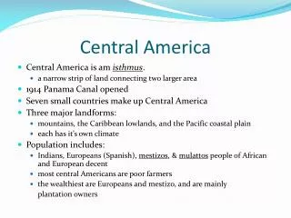
Central America
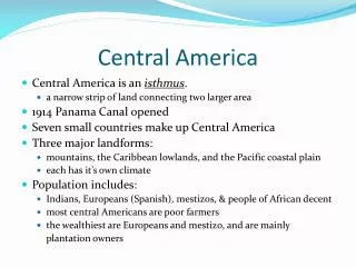
Central America. Mrs. Barrow’s 5 th Grade Social Studies. Physical features of Central America. Central Mountains The mountains of Central America are part of a large horseshoe shaped band that follows the edge of the Pacific Ocean. (found in ALL CA countries) Ring of Fire


Central America
E N D
Presentation Transcript
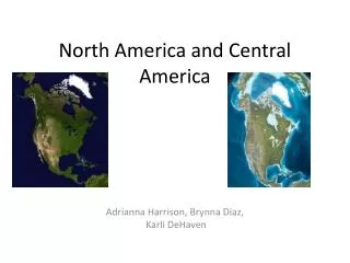
Central America Mrs. Barrow’s 5th Grade Social Studies
Physical features of Central America • Central Mountains • The mountains of Central America are part of a large horseshoe shaped band that follows the edge of the Pacific Ocean. (found in ALL CA countries) • Ring of Fire • The band that the Central Mountains follow • Faults • Weak points in the layers of rock beneath the earth’s crust the occur along the Ring of Fire. They produce earthquakes and active volcanoes in Central America.
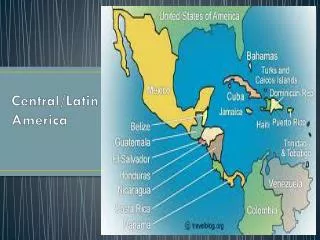
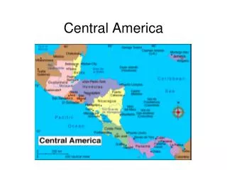
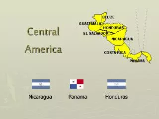
Belize • Capital: Belmopan • Has the fewest number of people • Has the greatest amount of rainfall/year • Major physical features: • Belize River • Coral Barrier Reef
Guatemala • Capital: Guatemala City • Has the greatest number of people • Major Physical features: • Petén • Lake Atitlan • Central Mountains
Petén • It constitutes more than one-third of the country’s territory. Petén is a low limestone plateau, varying in elevation between 500 and 700 feet above sea level at the base of the Yucatán Peninsula. Except for areas of savanna vegetation, the region is covered by dense tropical rainforests. Few rivers penetrate Petén, for most of the heavy rainfall is drained underground. • Because of difficult terrain, Petén long has avoided European-style plantations and settlements. Ruins of many Mayan cities indicate that despite difficult geographical circumstances, the Maya adapted to the region and even flourished. Their great cities were abandoned in the 10th century, only to be recolonized by the Itzá Maya from Mexico, who resisted Spanish subjugation until 1697. In 2005 scientists confirmed that the ancient Maya capital of La Corona in Petén was a long-sought location believed to be the provenance of a number of looted Mayan monuments that were sold on the antiquities market in the second half of the 20th century. • The major resources of Petén lie in its forests, which yield mahogany, tropical cedar, rubber, and chicle. Some oil has been found in the area. Sugarcane, cacao (the source of cocoa beans), fruits, and grains are cultivated around Flores, the main city, which lies on Lake Petén Itzá. Thousands of people have migrated to Petén from the overworked lands to the south and, through slash-and-burn agriculture, have attempted to turn the forests into farmland. • In the mid-20th century the region’s population was less than 20,000. By the beginning of the 21st century, the population was about five times greater because of colonization, oil exploration, commercial logging, and tourism. Flores is accessible by highway from Belize; other roads radiate to the Mexican border and to navigable rivers. The first road connecting the central part of the country with northern Petén was completed in 1970. Much transportation in Petén is by air. • http://www.britannica.com/EBchecked/topic/453589/Peten
El Salvador • Capital: San Salvador • Major Physical Features: • Gulf of Fonseca
Honduras • Capital: Tegucigalpa • Major Physical features • Central Mountains • Ulua River • Aguan River • Coco River • Gulf of Honduras • Caribbean Lowlands
Nicaragua • Capital: Managua • Has the least amount of rainfall/year • Physical Features: • Central Mountains • Coco River • San Juan River • Lake Managua • Lake Nicaragua • Gulf of Fonseca
Costa Rica • Capital: San Jose • Major Physical Features: • San Juan River
panama • Capital: Panama City • Major Physical Features: • Gulf of Mosquitos • Isthmus • Gulf of Panama • Panama Canal • Central Mtns.
Natural Resources • Climate & soil • Natural resources of Central America are centered around these two. Agriculture revolves around the rich and fertile volcanic soil. There is still subsistence farming. • Plantations-large farms • Cash crops: coffee, cotton, and cane • Transportation • Not well-developed • Cannot support Heavy manufacturing industry • Pan American Highway • A series of roads extending more than 16,000 miles • Panama Canal • More than 12,000 ships travel through the 51-mile canal • Raveling through the canal between NYC and San Francisco saves thousands of miles & money • More than 14,000 people work there
Panama canal • The Panama Canal is a 77 km long waterway across the Isthmus of Panama. It is a key channel for international marine trade in Panama. The canal joins the Atlantic Ocean and the Pacific Ocean. • A trip along the canal from its Atlantic entrance would take you through a 7 mile dredged channel in Limón Bay. The canal then proceeds for a distance of 11.5 miles to the Gatun Locks. This series of three locks raise ships 26 metres to Gatun Lake. It continues south through a channel in Gatun Lake for 32 miles to Gamboa, where the Culebra Cut begins. This channel through the cut is 8 miles long and 150 metres wide. At the end of this cut are the locks at Pedro Miguel. The Pedro Miguel locks lower ships 9.4 metres to a lake which then takes you to the Miraflores Locks which lower ships 16 metres to sea level at the canals Pacific terminus in the bay of Panama. • The tactical location of the Panama Canal and the short distance between the oceans, have provoked many attempts over the centuries to construct a trading route between the oceans. Spanish, Scottish, European had attempted to bridge the oceans but only the French and Americans succeeded!
Panama canal • The Locks
Fast facts • Spanish is the major language. • Catholicism is the major religion.