Download

1 / 9
90 likes | 171 Views
Engage students with historical data to study the evolution of Philadelphia's vibrant South 4th Street, known as Fabric Row, using static GIS maps. Analyze changes in ethnicity, population, land use, and occupations over time.

E N D
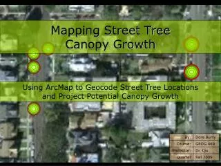
Mapping South 4th Street to Fabric Row Unit #2 - Urbanization
Activity Introduction • Although you may not realize it, many students are already quite familiar with Geographic Information Systems (GIS). From the use of MapQuest for driving directions to watching a weather map on the evening news, GIS influences many aspects of daily life. It has also become a valuable educational tool in the history classroom. Its ability to integrate data into a visual, geographic format develops interpretative and analytical skills in the young historian.
Activity Introduction • This lesson will utilize GIS maps of the vibrant commercial and residential area of South 4th Street in Philadelphia. To produce these maps, historical data was gathered from several archival sources. Census records provide details about the ages, ethnicities, addresses, and occupations of city residents. Fire Insurance maps provide information about land usage giving valuable insight into the commercial and residential landscape. These maps also present visual representations of what city blocks looked like at different periods of time. This historical information is integrated and displayed visually on the maps allowing students to analyze the ethnic composition as well as the commercial development of blocks or neighborhoods over time. Additionally, students place these changes in the larger social, economic, and political context.
Activity Introduction • This activity is designed to introduce students to GIS mapping through the exploration of static maps from Philadelphia’s South 4th Street, or “Fabric Row.” The maps presented in this exercise are not interactive GIS maps that allow users to zoom in and out of the map and turn layers on and off. These are static maps that can be printed, analyzed, and compared to show change over time. Historical data related to South 4th Street creates the basis for this mapping exercise. South 4th Street was the commercial center of Philadelphia’s early 20th century Jewish community. It was known as Der Ferder(the fourth) in Yiddish, and has been dubbed “Fabric Row” because of the past and present predominance of fabric and garment-related merchandise along the corridor. Many of the original shops on Fabric Row remain, and are entering their third and fourth generation of family ownership. Through this activity, students will see the evolution of South 4th Street into Fabric Row.
Activity Introduction • Part One of this activity introduces students to actual census records and land use data - the building blocks of the GIS maps that they will engage in during Part Two of this activity. This data provides a detailed snapshot of individuals living on South 4th Street in the 1880s. • In Part Two, students will see how the raw data was taken and aggregated into GIS maps. Students will compare these maps over time and draw conclusions about the transformations South 4th Street underwent at the turn of the century and make connections to present-day Fabric Row.
Part One: Notes (Put in notebook) • 4th Street, Philadelphia – commercial center with residential dwellings above storefronts • Early 20th century – business owners reside above stores and purchase property • Post WWII – businesses relocated to Northeast Section or suburbs and commuted to stores • You will be working with historical data and maps to investigate the long history of this vibrant commercial and residential area.
Part One: Census Data • Open the 4th Street 1880 Census file (Excel) • Answer the questions on the “Dissecting Historical Data” Worksheet for 1880 • Open the 4th Street 1888 Land Use Data file • Answer the questions on the “Dissecting Historical Data” Worksheet for 1888
Part Two: GIS Maps • Open the GIS Maps for ETHNICITY, LAND USE, OCCUPATION AND POPULATION. • The maps organize the raw historical data the students worked with in Part One into a visual representation. Students should be aware that as a result of a fire, there is no U.S. census information for 1890, thus there is no map for that year. • Analyze the GIS Maps and answer the questions on the worksheet – Interpreting Static GIS Maps • Look for general trends and draw conclusions about changes over time in ethnicity, population, land use and occupations
Conclusion • Answer the following questions on a separate piece of paper in COMPLETE SENTENCES – • What some of the benefits of using the GIS map as a historical tool? • How do the GIS Maps compare to the raw census data?