East Asia 2
230 likes | 415 Views
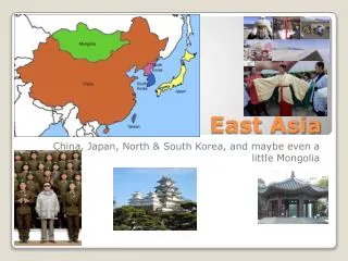
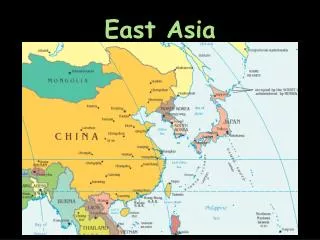
East Asia 2. Map test Questions Review East Asia Physical China. Regions of the Realm - Review. China proper - eastern half; the core Xizang (Tibet)- high elevation; sparsely populated Xinjiang- vast desert basin & mountain rim Mongolia- a desert, buffer state

East Asia 2
E N D
Presentation Transcript
East Asia 2 • Map test • Questions • Review • East Asia • Physical • China
Regions of the Realm - Review • China proper- eastern half; the core • Xizang (Tibet)- high elevation; sparsely populated • Xinjiang- vast desert basin & mountain rim • Mongolia- a desert, buffer state • Jakota triangle • Japan, South Korea, Taiwan • Rapid economic development
E A S T A S I A
Physiography and Climate of Chna • Longitudinal extent is comparable to Canada 75° • Latitudinal range from Northern Quebec to central Caribbean • Bordered by Pacific and 4 seas, • Mountains: e.g. Kunlun Shan, Himalayas • Steppe and desert • Monsoon Asia
Chinese Perspectives • Culture hearth-Huang He – Yellow River • Civilization for over 4,000 years • China as center of the civilized world • Natural protection and isolation • distance • ocean and mountain barriers
COLONIAL SPHERES Opium Wars 1842, 1857 Imperial pressures Britain France Portugal Germany Russia Japan
Extraterritoriality • Doctrine of European international law • ‘diplomatic immunity’ • Nineteenth century treaty ports, enclaves • e.g. Qingdao • Erosion of Chinese sovereignty • Shanghai • American, British, French Concessions • Canton
China’s Political Map • 4 central-government-administered municipalities • Beijing (capital); Tianjin (Bo Hai Gulf); Shanghai (Chang Jiang); Chongqing (upper Chang Jiang) • 5 autonomous regions • Nei Mongol (Inner Mongolia); Ningxia Hui; Xinjiang; Guangxi Zhuang (South); Xizang (Tibet) • 22 provinces • Grow in size from east to west • 2 Special Administrative Regions • Xianggang (1997 - Hong Kong) • Macau (1999 – Portugese Macao
ETHNIC GROUPS Han Chinese 91.9% Zhuang Uygur Hiu Yi Tibetan 8.1% Miao Manchu Mongol Buyi Korean
Communist Revolution • 1949 Communists prevail • Soviet style expropriation and collectivization of agriculture • State-owned enterprise, heavy industry • Great Leap Forward 1958-1960 • Economic restructuring: 24,000 rural communes, brigades, work teams – division of labour • 600,000 back yard, charcoal-based steel industry produced 11 million tonnes of steel • Party cadres apply doctrine and red book
Great Leap Forward 1958-1960 • Rapid and sweeping socio-economic transformation & propaganda • Steel broke, farm machinery fell apart, backyard furnaces also used too much coal, China’s railways could not move resources • Too much labour was moved out of agriculture to increase industrial output • Floods, drought, famine, starvation, disease • 20-30 million died
Great Leap Forward 1958-1960 • Mao concedes defeat: • “The chaos caused was on a grand scale, and I take responsibility. Comrades, you must all analyse your own responsibility. If you have to fart, fart. You will feel much better for it.” • Private ownership and production was reinstated • Communes were reduced in size
Great Proletarian Cultural Revolution 1965-1968 • Purge of all educated professionals • Red Guards – youthful gangs oppose elites • Permanent revolution closing schools to eliminate bourgeois ideas • Labour camps for "re-education“ • Millions executed/ or "commited suicide" • Ends with Mao's death in 1976
Deng Xiaoping Era • Liberalized Communist dogma with capitalist economic practices, “socialist market economy” • Open door policy • Access to foreign science and technology • Permitted students to study abroad • Decentralized decision-making • Restructured agriculture • Created SEZs, Open Cities, Open Coastal Areas • Growth poles • Containment of foreign influence
Languages • World’s oldest active language, Sino-Tibetan Family. • Spoken dialects not mutually intelligible but characters are the same. • Kanji – Japanese for Chinese character • Transliteration - Romanji
PINYIN SYSTEM • Language as centripetal force • Adopted in 1958 from northern Mandarin • Standard form of Chinese • Peking→Beijing • Canton→Guangzhou • Chunking→Chongquing • Sinkiang→Xinjiang • Yangtse (regional)→Chang Jiang
PINYIN • System for Romanizing & transliterating Chinese ChineseTranslation Bei North Nan South Xi West Dong East Jing Capital Shan Mountain He River (in the north) Jiang River (in the south)
China’s Population • 1.306 billion • Annual rate of natural increase 0.7% (1970s - 3%) • Doubling time: 100 years • Life expectancy: 70 (males), 73 (females) • TFR 1.8 (1997) • Arithmetic density: 353 people/sq mi • Physiological density: 3,524 people/sq mi • Only 10% of the land is arable and 69% of the population lives on this land