Download
1 / 1
10 likes | 142 Views
81. 82. 83. 84. 85. 86. 87. 88. 89. 90. 91. 92. 93. 94. 95. 96. 97. 98. 99. 00. 01. 02. 03. 04. 05. 06. 07. 08. 09. 10. 11. N07. N09. N11. N09. N14. N16. N17. AVHRR. Terra. MODIS. Aqua. NPP. VIIRS. NPOESS. AVHRR continuity products.

E N D
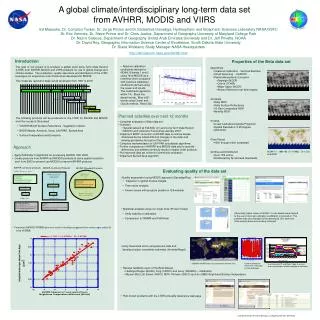
81 82 83 84 85 86 87 88 89 90 91 92 93 94 95 96 97 98 99 00 01 02 03 04 05 06 07 08 09 10 11 N07 N09 N11 N09 N14 N16 N17 AVHRR Terra MODIS Aqua NPP VIIRS NPOESS AVHRR continuity products MODIS Continuity Products MODIS Standard Products AVHRR GAC L1B 1981 - present MODIS Level 0 2000 - present MODIS coarse resolution surface reflectance 2000 - present • Geolocation • Calibration • Cloud/Shadow Screening • Atmospheric Correction • Geolocation • Calibration • Cloud/Shadow Screening • Atmospheric Correction Land products Land products Gridding MODIS standard products (Full resolution and CMG) Gridding AVHRR products MODIS products 0.05 degree products: Surface Reflectance, VI, Surface Temperature and emissivity, Snow, LAI/FPAR, BRDF/Albedo, Aerosols, burned area Format: HDF Geographic projection 1/20 deg resolution Daily, multi-day, monthly A global climate/interdisciplinary long-term data set from AVHRR, MODIS and VIIRS Ed Masuoka, Dr. Compton Tucker, Dr. Jorge Pinzon and Dr.Sadashiva Devadiga, Hydrospheric and Biospheric Sciences Laboratory NASA GSFC Dr. Eric Vermote, Dr. Steve Prince and Dr. Chris Justice, Department of Geography University of Maryland College Park Dr. Nazmi Saleous, Department of Geography United Arab Emirates University and Dr. Jeff Privette, NOAA Dr. David Roy, Geographic Information Science Center of Excellence, South Dakota State University Dr. Diane Wickland, Study Manager NASA Headquarters http://ltdr.nascom.nasa.gov/ltdr/ltdr.html Introduction Properties of the Beta data set • Absolute calibration coefficients derived for NOAA 16 bands 1 and 2 using Terra MODIS as a reference were compared with vicarious calibration coefficients derived using the ocean and clouds. The coefficients agreed to within 1%. Black line desert trends. Blue is B1 trends using Ocean and Clouds method. Red is B2 • The goal of our project is to produce a global Land Long Term Data Record (LTDR) from AVHRR, MODIS and VIIRS products for use in global change and climate studies. The production, quality assurance and distribution of the LTDR leverages our experience and infrastructure developed for MODIS. • This moderate resolution data record will stretch from 1981 to 2015 • The following products will be produced for the LTDR for AVHRR and MODIS over the course of the project. • VIS/NIR Mid-IR Surface Reflectance , Vegetation Indices • BRDF/Albedo, Aerosols, Snow, LAI/FPAR, Burned Area • Surface Temperature and Emissivity • Algorithms • Vicarious Calibration - Vermote/Kaufman • Cloud screening - CLARVR • Partial Atmospheric Correction • Rayleigh (NCEP) • Ozone (TOMS) • Water Vapor (NCEP) • Aerosol Retrieval over dark targets • Products • Daily NDVI • Daily Surface Reflectance • 16-Day Composited NDVI • Monthly NDVI • Format • Linear Latitude/Longitude Projection • Spatial Resolution: 0.05 Degree • HDF-EOS • Time Period • 1981 through 2000 completed • Archive and Distribution • Over 1TB online • Distributed by ftp and web downloads • Planned activities over next 12 months • Complete evaluation of Beta data set • Outreach • Special session at Fall AGU on Land Long Term Data Record • MODIS Land Collection 5 workshop January 2007 • Implement BRDF correction of AVHRR data to remove biases • introduced by the orbital drift and changes in the solar and • viewing geometries throughout the record • Complete implementation of LAI/FPAR and albedo algorithms • Further comparisons of AVHRR and MODIS data sets to quantify • differences and address continuity issues in higher order products • Put improved data set online for community evaluation • Implement Burned Area algorithm Approach NOAA-11 - 1992193 (7/11/1992) : Ch1,Ch2 and NDVI • Apply Pathfinder 2 algorithms for processing AVHRR 1981-2000 • Create products from AVHRR and MODIS products at same spatial resolution • and from 2000 to present use MODIS to improve AVHRR products Evaluating quality of the data set • Quality assessment using MODIS approach (Devadiga/Roy) • Inspection of global browse images • Time series analysis • Known Issues with products posted on Q/A website • Statistical analysis using non-linear tools (Pinzon/Tucker) • Verify stability of calibration • Comparison to GIMMS and Pathfinder • Verify theoretical errors using Aeronet data and • develop product uncertainty estimates (Vermote/Nagol) Abnormally higher values in NOAA-11 over deserts were tracked to the use of incorrect calibration coefficients in production. This problem was also detected by the operational Q/A team see (time series) above and is being corrected. • Coincident MODIS/AVHRR data were used to develop an approach for water vapor retrieval • from AVHRR. 50x50km AVHRR data cuts centered on Aeronet sites Surface reflectance NDVI time series plots on Q/A web page Use Aeronet AOT and Water Vapor to assess errors arising from limited atmospheric correction • Receive feedback users of the Beta dataset • Heidinger/Kogan (NOAA), King (CSIRO) and Leroy (CESBIO) – Calibration • Myneni (BU) LAI, Brown (GSFC) NDVI, Pinheiro (GSFC) and Jin (UMD) Brightness/Surface Temperature • Post known problems with the LTDR at Quality Assurance web page Joint Biodiversity, Terrestrial Ecology, and Applied Sciences Workshop