Download
1 / 18
180 likes | 474 Views
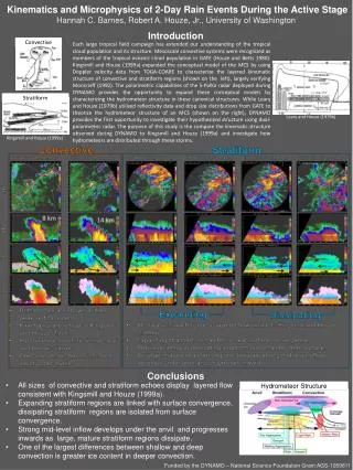
The Hydrometeor Structure of Mesoscale Convective Systems During DYNAMO Hannah C. Barnes Robert A. Houze, Jr. University of Washington 2013 Atmospheric System Research (ASR) Fall Working Group Meeting Hilton Washington DC / Rockville Hotel & Executive Meeting Center 5 November 2013.

E N D
The Hydrometeor Structure of Mesoscale Convective Systems During DYNAMO Hannah C. Barnes Robert A. Houze, Jr. University of Washington 2013 Atmospheric System Research (ASR) Fall Working Group Meeting Hilton Washington DC / Rockville Hotel & Executive Meeting Center 5 November 2013 Funded by NSF –Grant AGS 1059611
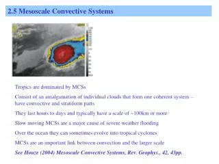
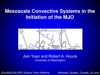
Conceptual Model of Mesoscale Convective Systems (MCSs) TOGA COARE: 3D, layer airflow Convective Stratiform Kingsmill and Houze (1999a)
DYNAMO-AMIE-CINDY SPolKa IndianOcean • Addu Atoll, Maldives • Dual wavelength • Only using S-Band • Doppler • Dual-polarimetric • Particle Identification Algorithm (Vivekanandan et al., 1999) • RHI sectors
Objective • Characterize hydrometeor structure of MCSs • Composite with respect to kinematic structure
Hourly Timeseries of Accumulated Rain Methodology 1 4 2 5 6 3 • 11 rain maximums during DYNAMO (Zuluaga and Houze, 2013) • Subjectively identify cases • SPolKa radial velocity • Layer lifting • RHI sector and within 100 km • One per storm • Manually map hydrometeor location using PID • Composite around layer lifting 8 9 7 10 11 Zuluaga and Houze (2013)
Convective Updraft dBZ Vrad 24 Oct 0250 UTC
Heavy Rain Very Light Rain Moderate Rain Light Rain Graupel / Rimed Aggregates Graupel - Rain Convective Updraft Wet Aggregates Dry Aggregates Small Ice Crystals Horz. Oriented Ice
Distribution of Convective Polarimetric Variables Reflectivity Differential Reflectivity G GR HR MR LR VLR WA DA SI HI G GR HR MR LR VLR WA DA SI HI Temperature Correlation Coefficient G GR HR MR LR VLR WA DA SI HI G GR HR MR LR VLR WA DA SI HI
Mid-Level Inflow dBZ Vrad 23 Dec 1850 UTC
Heavy Rain Very Light Rain Moderate Rain Light Rain Graupel / Rimed Aggregates Graupel - Rain Leading Line – Trailing Stratiform Wet Aggregates Dry Aggregates Small Ice Crystals Horz. Oriented Ice
Distribution of Squall Polarimetric Variables Reflectivity DifferentialReflectivity G GR HR MR LR VLR WA DA SI HI G GR HR MR LR VLR WA DA SI HI Temperature Correlation Coefficient G GR HR MR LR VLR WA DA SI HI G GR HR MR LR VLR WA DA SI HI
Conclusions • Comparison of model output and radar observations
Mesoscale Modeling of Squall Line Zonal Wind • WRF 3.4.1 • Resolution: Outer – 9km, Inner – 3km • Cu Param: Outer – KF, Inner – None • MP Param: Both - Goddard • PBL Param: Both – UW • Forcing: ERAi • 00 UTC 23 Dec – 00 UTC 25 Dec Reflectivity
Distribution of Hydrometeor Mixing Ratio Zonal Wind and Reflectivity Cloud Mixing Ratio Rain Mixing Ratio Graupel Mixing Ratio Snow Mixing Ratio Ice Mixing Ratio
Model Representation of Anvils over Afirca Powell et al., 2012