Download
1 / 30
300 likes | 429 Views
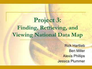
Geography 160 Project 3 Using Map Data and Integrating it into GIS. By Jerrica, Daniel, and Aaron. Project 3 Overview. Find, download, and view map data of an area of interest (your hometown) Make 3 map data sets and one map overlay with comments for each of them. Introduction.

E N D
Geography 160Project 3Using Map Data and Integrating it into GIS By Jerrica, Daniel, and Aaron
Project 3 Overview • Find, download, and view map data of an area of interest (your hometown) • Make 3 map data sets and one map overlay with comments for each of them
Introduction • You will be using USGS map data and ArcMap to learn how information from aerial photography, land elevation, and landmarks/features can be used and interpreted. • The information you will be applying is used by US, state, and even local government for things from development to planning.
Introduction of the 3 Map Data Types • Digital Elevation Model (DEM) • A raster representation of the terrain’s surface • Accuracy varies depending on the level of DEM • Digital Line Graphs (DLG) • Vector representations of most features and attributes • Warranted to be free of topological defects • Digital Orthophoto Quarter Quadrangle (DOQQ) • Raster images of rectified aerial photos • Error is caused by the rectification process
Digital Elevation Model (DEM) • A DEM is a raster representation of a terrain surface. More specifically, a DEM is a data product of the U.S. Geological Survey • A DEM is a raster illustration of the Earths’ surface
What a DEM Does • Shows the elevation of an area • Shows land characteristics like lakes and Mountains
DEM • Go to http://seamless.usgs.gov • Click on“View and Download United States data” • With your mouse, draw a square around the area you choose • Check NED Relief (under the elevation tab) • Click on “define downloads area” • Once you target the area click “download”
DEM • Open the file and click “use evaluation version” • Highlight all the files and click “extract” • Extract the files to the DEM folder you made and then click OK • Open ArcMap • Go to Add Data and find your map • Save this file to you WWW.
Uploading Your DEM Map • Once your map is uploaded, hold down alt and print screen so you will have a screen shot of the program to put on your website • Go to Start>Accessories>Paint • Go to Edit and paste your map • Save it in your WWW folder
DLG • Digital vector representations of cartographic information • Data files are derived from either aerial photos or cartographic sources • Can be converted manually or digitally
DLG • Composed of nodes, lines, and area identifiers • Lines connect nodes and the solid areas they create are identified with area identifiers
DLG Features that can be represented are: • Boundaries • Hydrography • Transportation • Man made features • U.S. Public Lands Survey System
DLG There are 3 scales of DLGs • Large Scale (7.5 minutes) • 1:20,000, 1:24,000, 1:25,000 • Intermediate Scale (30X30, 30X60 minutes) • 1:100,000 • Small Scale (52 rectangular units of U.S.) • 1:2,000,000
Steps to making a DLG • 1: Open the website http://arcdata.esri.com/data/tiger2000/tiger_download.cfm • 2: Select your state • 3: Select your county • 4: Click 3 or more features you want. • 5: Click to download the files
Steps to making a DLG • 6: Create a folder (a good place is on your network drive) • 7: Locate the ZIP file you downloaded in Step 5 and extract it to the file you just created in Step 6 (press Trial Version) • Once extracted you may have to extract files within your folder that you created
Steps to making a DLG • 8: Once all of the files are unzipped, open ArcMap • 9: Select “File”, “Add Data” • 10: Go to the folder you created and select all of the files you unzipped A complete DLG! • 11: Press “Alt”+“PrintScreen” with the ArcMap window up.
Steps to making a DLG • 12: Open Paint and go to “Edit” and click “Paste” • 13: Save this image into your folder
DLG Sources A good place to learn about DLGs is http://edc.usgs.gov/guides/dlg.html or http://www.ctre.iastate.edu/Research/bts_wb/cd-rom/spatial/dlg.htm
DOQQ Maps (digital orthophoto quarter quadrangles) • Raster images created by scanning black and white vertical aerial photographs into a computer • Image is digitally warped to correct distortion in terrain relief and camera tilt in a process called orthorectification • Scale is uniform throughout the image. Therefore it is possible to measure distance directly on the map.
DOQQ Accuracy and Error • DOQQ maps have a scale of 1:12,000 • 90% of all points lie within 20 feet of there actual position • Error is created in the orthorectification process
Uses of DOQQ maps • Editing and revising vector planimetric data • The State Department of Transportation uses these maps to update road data. Road data is plotted on DOQQs and then can be revised to show new road layouts Information found in the online text: Module 3; Air photos and photogrammetry; USGS DOQ
Creating a DOQQ • Go to http://seamless.usgs.gov • Zoom into your area make it small • Uncheck all boxes under the elevations tab from both layers tabs (display and download) • Under the download tab…orthoimagery….select 1m B&W DOQQ
Continued DOQQ Making 5. Select the “define download area” button on the left side of the screen 6. Download, extract, and upload to arcmap the same as with the DEM map. • Because DOQQ files are large delete them after use
Conclusion • DEM • Illustrates elevation • Raster illustration of the terrain • DLG • Uses lines, and nodes to represent different areas. • Used for planning and analysis • DOQQ • An actual image of the area you are looking at • Also good for planning and analysis
Sources • DEM and DOQQ maps • http://seamless.usgs.gov • DLG • http://arcdata.esri.com/data/tiger2000/tiger_download.cfm • Map Information • Online text: http://training.esri.com/Courses/geodata_ArcGIS/index.cfm?c=31
Further Questions • Any questions can be emailed to • jmb810@psu.edu • dlh281@psu.edu • ajk5128@psu.edu • This slide show will be posted on our Personal websites for access to instructions