Download
1 / 18
180 likes | 302 Views
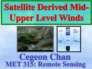
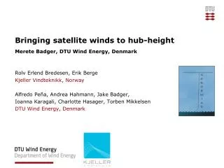
Bringing satellite winds to hub-height. Merete Badger, DTU Wind Energy, Denmark Rolv Erlend Bredesen, Erik Berge Kjeller Vindteknikk , Norway Alfredo Peña, Andrea Hahmann, Jake Badger, Ioanna Karagali, Charlotte Hasager, Torben Mikkelsen DTU Wind Energy, Denmark.

E N D
Bringing satellite winds to hub-height Merete Badger, DTU Wind Energy, Denmark Rolv Erlend Bredesen, Erik Berge KjellerVindteknikk, Norway Alfredo Peña, Andrea Hahmann, Jake Badger, Ioanna Karagali, Charlotte Hasager, Torben Mikkelsen DTU Wind Energy, Denmark
Level of detail for scatterometer and SAR winds QuikScatmeanwind speed Envisat ASAR meanwind speed Presentation name
From radar backscatter to wind A geophysical model function is applied to retrieve 10-meter ocean winds from radar backscatter. Presentation name
Application 1:Wind resourcemapping from SAR windfields- and model validation Presentation name
Application 2:Wind farm wake analyses using SAR windfields- and wake model validation Wind speed from ERS-2 SAR, February 25, 2003 • From: Christiansen, M. B. & Hasager, C. B. 2005, Wake effects of large offshore wind farms identified from satellite SAR. Remote Sensing of Environment, 98, 251-268 Presentation name
Challenges for the application of SAR windfields in offshore windenergy Challenge 1: Dealingwith a limitednumber of samples See:Badger et al. 2010, Wind class sampling of satellite SAR imagery for offshore wind resource mapping. J. Appl. Meteor. Climat., 49, 2474-2491. Challenge 2: Bringingsatellitewinds from the 10-m verticallevel to the hub-height of modernwind turbines - the topic of thispresentation Presentation name
Recent advances- whichmake the lifting of SAR windfieldspossible A validateddescription of verticalwindprofiles at highlevels is available (Peña, A. et al. 2008, Measurements and Modelling of the Wind Speed Profile in the Marine Atmospheric Boundary Layer, Bound.-Layer Meteor., 129,pp. 479-495) Wind retrievalalgorithmscanproduceEquivalent Neutral Winds (ENW) (Hersbach, H. 2010, Comparison of C-band Scatterometer CMOD5.N Equivalent Neutral Winds with ECMWF, J. Atmos. Oceanic Technol., 27, pp. 721-736) Satellite SAR imagery is available in largerquantities (500-1,000 overlapping scenes over sites in the European Seas) Mesoscalemodeling has beenperformed for significantareas and time periods Offshore measurementsareavailable for validation (masts and LiDAR) Presentation name
Bringingsatellitewinds to hub-height (100 m) • Frictionvelocity, u* from the satelliteENW: , • Obukhovlength, L - using WRF parameters T2 and HFX: LWRF/SAR > 0: stable LWRF/SAR ≤ 0: unstable Presentation name
Bringingsatellitewinds to hub-height (100 m) • Stabilityfunction, ψ(z/L): LWRF/SAR > 0 : LWRF/SAR ≤ 0 : , • Wind speed at 100 m, u100 - using WRF parameters T2, HFX, PBLH: LWRF/SAR > 0 : LWRF/SAR ≤ 0 : Presentation name
Envisat ASAR data collection Daily download of new scenes covering the NORSEWIND domain: • Data archive at DTU: • >8,000 ASAR WSM scenes • Mainly for 2006-2011 • Additional scenes canbeordered from ESA (2002- ) • – nowfree of charge Presentation name
100-m winds at Fino-1 Presentation name
100-m Weibullfit at Fino-1 Presentation name
Spatialwindvariability over the North Sea Presentation name
Sampling effects over the North Sea Presentation name
Special situation: Lowboundary-layerheight • The appliedwindprofileequationsare valid within the atmosphericboundary-layer • Data arediscardedwhen the boundary-layerheight is <50 m • Up to 4% of the WRF samples arediscarded over the North Sea over a year • None of the 80 SAR scenes, and concurrent WRF samples, arediscarded Presentation name
Conclusions Satellite SAR data lifted to 100 m under-estimate the wind speed at Fino-1 Concurrent WRF simulations alsounder-estimate the 100-m wind speed at Fino-1 SAR-WRF agreement is generallygood over the North Seawith the largest differences near the coast of Germany The number of SAR samples (80) is insufficient to describe the meanwindclimateaccurately Work is in progress to improve the accuracy of liftedsatellitewindfields Satelliteobservationsrepresent a valuablesource of information for offshore windenergyapplications (e.g. windresourcemapping, wind farm wake analyses) Presentation name
Acknowledgements Add Presentation Title in Footer via ”Insert”; ”Header & Footer” Satellite data: The European Space Agency (ESA) Remote Sensing Systems (RSS) SAR windfieldretrieval: CollecteLocalisation Satellites (CLS) The Johns Hopkins University, AppliedPhysicsLaboratory (JHU/APL) Fino-1 and Fino-2 mast data: BundesministeriumfürUmwelt (BMU), ProjektträgerJuelich (PTJ), DeutschesWindenergieInstitut (DEWI) Funding: EU-NORSEWInD (TREN-FP7EN-21908) Presentation name