Download
1 / 18
180 likes | 289 Views
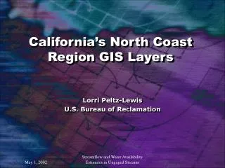
California’s North Coast Region GIS Layers. Lorri Peltz-Lewis U.S. Bureau of Reclamation. Watershed Basin Characteristics:

E N D
California’s North Coast Region GIS Layers Lorri Peltz-Lewis U.S. Bureau of Reclamation Streamflow and Water Availability Estimates in Ungaged Streams
Watershed Basin Characteristics: Total Drainage, Contributing Drainage, Non-Contributing Drainage, Perimeter, Shape Factors, Effective Width, Compactness, Elongation, Relief, Relative Relief, Total Stream Length, Main Channel Length, Channel Slope, Basin Slope, Basin Length, Drainage Density, etc. Geospatial Data Layers Reviewed Here: National Elevation Data (NED) or Digital Elevation Model (DEM) National Hydrologic Database (NHD) Elevation Derivatives for National Applications (EDNA) Watersheds - CALWATER Streamflow and Water Availability Estimates in Ungaged Streams
National Elevation Data (NED) Seamless raster elevation database Combination of 10 & 30 m – final currently 30 m – future will be 10 m. Processing to eliminate merge problems Digital Elevation Model (DEM) Raster elevation database 10 & 30 m data files Tiled by quadrangle Others: LIDAR, SAR, RADAR, etc. Streamflow and Water Availability Estimates in Ungaged Streams
Streamflow and Water Availability Estimates in Ungaged Streams
Streamflow and Water Availability Estimates in Ungaged Streams
Streamflow and Water Availability Estimates in Ungaged Streams
xxx Streamflow and Water Availability Estimates in Ungaged Streams
References: Gesch, Dean et.al, 2002. The National Elevation Dataset, PE&RS January 2002. www.asprs.org/asprs/publications/pe&rs/2002journal/january/highlight.html Franken, S.K. et.al, 2001. Development of a National Seamless Database of Topograhy and Hydrologic Deravatives, ESRI 2001 Users Conference www.esri.com/library/userconf/proc01/professional/papers/pap730/p730.htm http://edcnts12cr.usgs.gov/ned/ Streamflow and Water Availability Estimates in Ungaged Streams
National Hydrologic Database (NHD) Seamless vector hydrology database representing surface hydrology 100K currently available, 24K under development Comprehensive inter-related relational database. http://nhd.usgs.gov/ Streamflow and Water Availability Estimates in Ungaged Streams
Streamflow and Water Availability Estimates in Ungaged Streams
Streamflow and Water Availability Estimates in Ungaged Streams
Streamflow and Water Availability Estimates in Ungaged Streams
Challenges for a national database – blank area is San Jose. Hydrology disappears – red line is connector for unknown. Streamflow and Water Availability Estimates in Ungaged Streams
Elevation Derivatives for National Applications (EDNA): New Product!! Systematic derivation of standard hydrologic derivatives using NED and NHD http://edcnts12cr.usgs.gov/ned-h/ Streamflow and Water Availability Estimates in Ungaged Streams
Watersheds Basin Delineation: USGS HUC 250K Original delineations done by USGS Problem areas – Central Valley CALWATER 24K Delineations for California Not all watershed oriented, some administrative boundaries http://www.ca.nrcs.usda.gov/wps/calwater CA delineations being reviewed following NRCS & USGS national methodology. Streamflow and Water Availability Estimates in Ungaged Streams
HUC250 and CALWATER – status of review here!!! Streamflow and Water Availability Estimates in Ungaged Streams
Streamflow and Water Availability Estimates in Ungaged Streams
North Coast Watershed Assessment Program GIS Data and Synthesis Chris Keithley Utilization of high resolution GIS data. Streamflow and Water Availability Estimates in Ungaged Streams