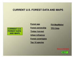
CURRENT U.S. FOREST DATA AND MAPS
CURRENT U.S. FOREST DATA AND MAPS. CURRENT U.S. FOREST DATA AND MAPS. Forest age Forest ownership Timber harvest Urban influence Forest covertypes Top 10 species. FIA MapMaker TPO Data. Return to FIA Home. NEXT. CURRENT U.S. . CURRENT U.S. . FOREST DATA . FOREST DATA . AND MAPS.

CURRENT U.S. FOREST DATA AND MAPS
E N D
Presentation Transcript
CURRENT U.S. FOREST DATA AND MAPS CURRENT U.S. FOREST DATA AND MAPS Forest age Forest ownership Timber harvest Urban influence Forest covertypes Top 10 species FIA MapMaker TPO Data Return to FIA Home NEXT
CURRENT U.S. CURRENT U.S. FOREST DATA FOREST DATA AND MAPS AND MAPS Productive unreserved forest area (timberland) in the U.S. by region and stand age class, 2002 Return Forests in the South, where timber production is highest, have the lowest average age. Northern forests, predominantly hardwoods, are of slightly older in average age and Western forests have the largest concentration of older stands. Source: National Report on Forest Resources NEXT
CURRENT U.S. CURRENT U.S. FOREST DATA FOREST DATA AND MAPS AND MAPS Forest ownership Return Eastern forests are predominantly private and western forests are predominantly public. Industrial forests are concentrated in Maine, the Lake States, the lower South and Pacific Northwest regions. Source: National Report on Forest Resources NEXT
CURRENT U.S. CURRENT U.S. FOREST DATA FOREST DATA AND MAPS AND MAPS Timber harvest by county Return Timber harvests are concentrated in Maine, the Lake States, the lower South and Pacific Northwest regions. The South is the largest timber producing region in the country accounting for nearly 62% of all U.S. timber harvest. Source: National Report on Forest Resources NEXT
CURRENT U.S. CURRENT U.S. FOREST DATA FOREST DATA AND MAPS AND MAPS Urban influence on forests Return In the East forests tend to be in counties with small towns or larger urban settings In the West, forests tend to be in counties with small towns or rural settings Source: National Report on Forest Resources NEXT
CURRENT U.S. CURRENT U.S. FOREST DATA FOREST DATA AND MAPS AND MAPS Major forest types of the U.S. Return Click here to go to FIA forest type map on the National Atlas web site National Report on Forest Resources NEXT
CURRENT U.S. CURRENT U.S. FOREST DATA FOREST DATA AND MAPS AND MAPS Top 10 species in U.S. forests Return Douglas-fir, in the West, is the most common tree by volume with nearly twice the volume of the next most common species, Loblolly pine, in the South. These 10 species account for 45% of all volume. Red maple, in the North, is the most common tree found in U.S. forests followed closely by Loblolly pine, the most commonly planted tree, in the South. These 10 species account for 39% of all trees. NEXT
CURRENT U.S. CURRENT U.S. FOREST DATA FOREST DATA AND MAPS AND MAPS Learn about FIA Return Special FIA issue of the Journalof Forestry, December 1999