Download
1 / 19
190 likes | 324 Views
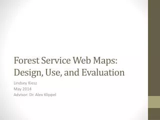
Forest Service Web Maps: Design, Use, and Evaluation. Lindsey Kiesz May 2014 Advisor: Dr. Alex Klippel. Outline . Introduction to project: a web map Forest Service direction and background Design process and design criteria Project status. Designing a Map. Background

E N D
Forest Service Web Maps:Design, Use, and Evaluation Lindsey Kiesz May 2014 Advisor: Dr. Alex Klippel
Outline • Introduction to project: a web map • Forest Service direction and background • Design process and design criteria • Project status
Designing a Map • Background • Northwest Forest Plan • Aquatic and Riparian Effectiveness Monitoring Program • Watershed score • Multi-agency • Bureau of Land Management • US Fish and Wildlife Service • Needs • Share data with many agencies • Agency Hydrologists will review model outputs Northwest Forest Plan Area Source: Collier, Odell (2002). Reproduced here for educational purposes.
What is the Forest Service? Ranger hats? • National Park Service • or US Forest Service? • Federal agency in the Department of Agriculture “Caring for the land, serving people” “The mission of the USDA Forest Service is to sustain the health, diversity, and productivity of the Nation’s forests and grasslands to meet the needs of present and future generations.” Forest Service (2013) A ranger hat Source: National Park Service (2014), reproduced here for educational purposes.
FS Map goes here… Map of the contiguous United States. National Forest Land shown in green.
What is a Web Map? • Dynamic maps • ArcGIS API for JavaScript or Google Maps API • Static maps • ArcGIS map products • .Pdf • Figures
Paper versus Web Maps Web • Reach a greater audience • Software, training costs • Screen resolution • More information Paper • Printing costs • Better resolution
Forest Service Web Maps “The broad objectives of conducting information programs and activities are to: 1. Increase public awareness of and understanding of Forest Service programs, activities, benefits, and services, and stewardship of natural resources. 2. Facilitate the participation of individuals, organizations, groups, other Federal agencies, and State, local, and tribal governments in Forest Service decision making processes, programs, and activities.” Source: Forest Service Manual (2012)
Forest Service Web Maps • ArcGIS Online for Organizations • ArcGIS Server • Google Maps • Campgrounds and trailheads • Web mapping technologies business rules • Internal documents related to file naming standards and other internal processes for publishing maps. • No extensive design and evaluation guidelines for the map itself.
Design • Design Process: • Needs assessment • Users, Tasks, Data, Products • Draft • Publish • Evaluation • Iterative
Design Criteria Overview • Map Design • Many print map cartography concepts apply to web maps • Web Map Design • Criteria for web maps • Web Criteria • Meet web standards
Web Map Design
Capstone Project Status • Map • Currently draft • Map data ready Summer 2014 • Finalize design and evaluation criteria • Survey/Evaluation by intended audience • Internal documents • Criteria and guidelines • Information for managers
Presentation • Northwest GIS Users Conference • Lynnwood, WA. • October 13 to 17, 2014 • WORKING ACROSS BORDERS • Abstract due August/September 2014
References • Brewer, Cynthia (2005). Designing Better Maps, A Guide For GIS Users. Redlands, CA: ESRI Press • Brown, A (2001) Web Maps and Tourists in Kraak, MJ, Brown, A. Web Cartography: Developments and prospects (pp. 127 – 137) London: Taylor & Francis. • Cartwright, W (2005). Maps on the Web. In Peterson, M. P. (Ed.). (2003). Maps and the Internet. (pp. 35 – 56) Elsevier. • Cinnamon, J., Rinner, C., Cusimano, M. D., Marshall, S., Bekele, T., Hernandez, T., Glazier, R.& Chipman, M. L. (2009). Evaluating web-based static, animated and interactive maps for injury prevention. Geospatial health, 4(1), 3-16.\ • Collier, K,, Odell, S. (2001). The Northwest Forest Plan An Overview. Retrieved 4/13/2014 from http://www.reo.gov/documents/presentations/NFP-transplan-approvedodes.ppt • Detwiler, J. (2014). Types of Web Maps. The Pennsylvania State University. Retrieved 4/26/2014 from https://www.e-education.psu.edu/geog863/resources/l3_p4.html • Forest Service Manual (2012). FSM 1600-Information Services, Chapter Zero Code. Retrieved 4/16/2014 from http://www.fs.fed.us/im/directives/fsm/1600/1600_zero_code.doc • Forest Service (2013) About Us – Mission. Retrieved 4/10/2014 from http://www.fs.fed.us/aboutus/mission.shtml • Klippel, A., Freska, C. & Winter, S. (2006) You-are-here maps in emergencies – The Danger of getting lost. Journal of Spatial Science, 51(1), pp 117-131 • McNeil, P (2012). The Designer’s Web Handbook. Ohio: HOW Books • National Park Service (2014). Ask A Ranger. Retrieved 4/10/2014 from http://www.nps.gov/fost/forkids/ask-a-ranger.htm • Nivala, A. M., Brewster, S., & Sarjakoski, T. L. (2008). Usability evaluation of web mapping sites. The Cartographic Journal, 45(2), 129-138 • Regional Ecosystem Office, (no date) Regional Ecosystem Office. Retrieved 4/21/2014 from reo.gov • Robinson, A; Hardisty, F, & Chaplin, G. (2014). What is Design. The Pennsylvania State University. Retrieved 4/26/2014 from https://www.e-education.psu.edu/geog583/node/91 • Svennerberg, G. (2010) Beginning Google Maps API 3. Apress • van Elzakker, C. P. J. M. (2001). Use of maps on the Web. In M. J. Kraak & A. Brown (Eds.), Web cartography: Developments and prospects (pp. 21-36). London: Taylor & Francis • Us Department of Heath and Human Services (2014). Comply with Section 508.Retrieved 4/26/2014 from http://guidelines.usability.gov/guidelines/28 • You, M., Chen, C. W., Liu, H., & Lin, H. (2007). A usability evaluation of web map zoom and pan functions. International Journal of Design, 1(1), 15-25.