Discussion Topics – Delaware River Basin Pilot Project
80 likes | 291 Views
Discussion Topics – Delaware River Basin Pilot Project. Synergistic opportunities between FIA/FHM/GC/USGS Scaling – top down/bottom up – multi-tier approach Multi-phase estimation techniques Integrated monitoring – land/air/water (e.g. fragmentation and water q.)

Discussion Topics – Delaware River Basin Pilot Project
E N D
Presentation Transcript
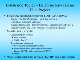
Discussion Topics – Delaware River Basin Pilot Project • Synergistic opportunities between FIA/FHM/GC/USGS • Scaling – top down/bottom up – multi-tier approach • Multi-phase estimation techniques • Integrated monitoring – land/air/water (e.g. fragmentation and water q.) • Specific variables (e.g. soils) or unique systems (e.g. riparian) • Specific future projects? • Additional pilot studies: • DRB 2? Where? • NACP “Tier 3”? • Techniques development: • New variables or enhanced variables? • Estimation methods for multi-phase inventories? • Linking P1/P2/P3 with research sites (P4/P5)? • Others? • Ways to strengthen links between FIA/FHM and other research
Reduce the uncertainty in land-based monitoring of changes in carbon stocks Fully integrate land-based measurements with atmospheric measurements Provide the mechanistic foundation for inverse modeling and data assimilation North American Carbon Program (NACP) – Biophysical Measurements and Models
The Multi-tier Approach to Monitoring USFS approach to forest health monitoring MODIS with field validation – “bigfoot”
NACP Hierarchical land surface measurement program • Tier One – Remote Sensing and Mapping • Wall-to-wall coverage; stratification • Temporal resolution = high or low • Tier Two – Extensive Inventories and Surveys • Representative regional statistical sample • Temporal resolution = low • Tier Three – Condition Sample (new) • Representative of specified condition classes • Temporal resolution = medium • Tier Four –Intensive Areas • Relatively small number of specific sites • Temporal resolution = high
Multi-tier Monitoring Concept for the Land Component of NACP * Designed experiments
Objectives of “Tier 3” of NACP • Augment coverage of the land surface by tier 4 sites • Natural disturbances and management • Edges/fragmented landscapes • Mountain terrain • Facilitate scaling from intensive sites to landscapes • Model parameterization or validation
Proposal: The primary sampling unit of a Tier 3 site will be a 1 x 1 km grid of inventory plots surrounding a special research installation • 9-36 inventory plots km-2 • Flux, meteorological tower or other installation at center • Primary sampling units (1 x 1 km grids) may be combined • Other measures (litterfall, respiration) take place at inventory plots
Tier 3 Pilot Test Locations FS Flux Tower Other Flux Tower Potential New FS Flux Tower Potential New FS Biometric Site