Download

1 / 18
180 likes | 368 Views
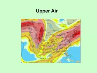
DISCOVER-AQ Forecast Briefings. Meteorology Forecast maps – NWS surface and NAM upper air; today and the next 3 days NAM/MOS time series – Denver and Ft. Collins; today and next 3 days; T, TD, WS, WD, RH, POP, Sky cover

E N D
DISCOVER-AQ Forecast Briefings Meteorology Forecast maps – NWS surface and NAM upper air; today and the next 3 days NAM/MOS time series – Denver and Ft. Collins; today and next 3 days; T, TD, WS, WD, RH, POP, Sky cover BUFKIT – NAM – time series of cloud amount by altitude, precip, and PBLH – next 3 days PBLH from NOAA/ARL WRF-ARW Wind fields at several sigma levels from NOAA/ARL WRF-ARW Cloud forecast maps – NAM, GFS, Canadian, GEOS-5 NWS forecaster comments/advice Fly/no-fly recommendations
DISCOVER-AQ Forecast Briefing Air Quality Air quality yesterday – surface station O3 observations Air quality forecast maps – NOAA/ARL CMAQ products – O3, NO2, HCHO today and tomorrow Ozone forecasts from State agency – today, tomorrow, beyond? Air quality yesterday – surface station PM2.5 observations AERONET and MODIS AOD – yesterday Air quality forecast maps – NOAA/ARL CMAQ product – surface PM2.5 Air quality forecast maps and time series – GEOS-5 aerosol extinction, AOD, mass concentrations by aerosol type PM2.5 forecasts from State agency – today, tomorrow, beyond?
DISCOVER-AQ Forecast Products • NAQFC - β Forecasting support (NOAA/ARL) • Initialized at 00 UTC with 60 hours forecast duration • WRF-ARW (12km N-America & 4 km CONUS) • CMAQ 4.7.1 (12km CONUS & 4 km DISCOVER-AQ/FRAPPÉ region) • Includes Aero5 aerosol mechanism (not in NCEP operational version) • GEOS-5 (NASA/GSFC) • Global at 25 km; • 5-day chemical forecasts twice daily (00 and 12 UTC) • Total column O3, GOCART aerosols, CO, CO2, SO2 (simple chemistry) • QFED fire emissions • Includes aerosol assimilation (MODIS AOD) • QFED Fire Emissions (NASA/GSFC) • Near real time estimates based on MODIS Fire Radiative Power (AQUA/TERRA)
NAQFC-orecasting support: Initialized at 00 UTC with 60 hours forecast duration AForecast: 12 km nested to 4 km 42 vertical layers Air Resources Laboratory/NOAA: DISCOVER-AQ/FRAPPÉ preparation meeting, April 3 2014, Boulder
NOAA Experimental CMAQ Forecast 5 PM 3 PM Examples
NASA GEOS-5 aerosol forecast from: 00 UT 14 Sept. Examples Cloud cover Extinction AOD GEOS-5 global model at 0.25 deg. resolution; GOCART aerosols, CO, SO2; includes assimilation of MODIS AOD Run by Arlindo da Silva at NASA/GSFC
FRAPPÉ Forecast Briefings • Jointly with DISCOVER-AQ • Additional Met & Chemistry Products • Short-term forecasts for aircraft and mobile vans • Decisions on Flight Day and Flight Pattern for C-130 • up to 3-5 days out, larger CO regions • Flight Objectives: special events (fires, LRT,..), recirculation, emissions, ... CDPHE/APCD 4meteorologists will continue to issue statewide and Front Range forecasts for O3 and other pollutants 7 days a week. Includes 9 AM MDT update, a 24-36 hour forecast by 3 PM MDT, and a multi-day outlook. (see presentation by Patrick Reddy)
FRAPPÉ Forecast Products • Satellite Products • FINN near-realtime fire emissions (based on MODIS fire counts) (NCAR/ACD) • MOPITT CO (within 1 day of overpass) (NCAR/ACD) • IASI CO (~ 4-day delay) (NCAR/ACD) • Met Forecasts • WRF with assimilation (NCAR-RAL) • 3DVar (no radar DA, 3h UC/12h fcst/1km) • 3DVar (with radar DA, 1h UC/12h fcst)4DVar (with radar DA, 3h UC/12h fcst) • RTFDDA (with radar DA, 3h UC/24h fcst)
Nested WRF domain NCAR/RAL STEP - Short Term Explicit Prediction • Outside systems: • NSSL (3DVar with radar DA, 1h UC*/12h fcst) • GSD/FAB (LAPS with radar DA, 1h UC/12h fcst) • UK MetOffice (UM-WRF, 6h UC/36h fcst) • NCAR systems: • WRF 3DVar (no radar DA, 3h UC/12h fcst/1km) • WRF 3DVar (with radar DA, 1h UC/12h fcst) • WRF 4DVar (with radar DA, 3h UC/12h fcst) • RTFDDA (with radar DA, 3h UC/24h fcst) • * UC – Update Cycle CHILL S-Pol 1km Examples 1km nowcast/hydro domain 3km radar DA domain
NCAR/ACD MOPITT and IASI CO • MOPITT CO – available within a day of overpass • IASI CO – about 4-day delay, global coverage 2x/day
FRAPPÉ Forecast Products • Chemical/Tracer Forecasts • MOZART-4 global, 5-day forecast (NCAR) • Full chemistry at 1.9°x2.5° (possibly assimilation of CO) • Tracer forecasts at 0.5°x0.5° (CO, isoprene-like, ....) • RAQMS (NOAA/NESDIS) • Global 1x1 degree on-line chemical and aerosol assimilationand forecasting system • Assimilation of MODIS AOD, MLS stratospheric O3 profiles and OMI total O3 • WRF-Chem(NOAA/ESRL) • WRF-Chem on RAPid refresh (RAP) 13km domain; 48 hour forecast • WRF-Chem Tracers (NCAR/ACD) - added to RTFDDA • FLEXPART (NCAR/ACD): Forward trajectories for defined sources
Cooperative Institute for Meteorological Satellite Studies (CIMSS) Real-time Air Quality Modeling System (RAQMS) • Global 1x1 degree on-line chemical and aerosol assimilation and forecasting system • Assimilation of MODIS aerosol optical depth, MLS stratospheric ozone profiles and OMI cloud cleared total column ozone • MODIS fire detection and Ecosystem/Severity dependent fire emissions • Real-time verification using US EPA AIRNow surface ozone and PM2.5 measurements Examples
NCAR MOZART-4 Forecasts Examples • Full chemistry at 1.9°x2.5° http://www.acd.ucar.edu/acresp/forecast/5-day forecasts, hourly output, currently operational • Forecasts of tracers at 0.5° horizontal resolution • Isoprene-like tracer based on MEGAN isoprene emissions • Anthropogenic NOx tracer from individual cities and/or regions • Fire CO tracer for various regions • Others for discussion • Similar to forecasts for DC3, will be run specifically for FRAPPE
NOAA/ESRL RAP-Chem = WRF-Chem on RAPid refresh (RAP) domain • Dx=13km, RAP (met): operational at NCEP with hourly forecast cycle • Experimental RAP-Chem: • Includes gas-phase chemistry (O3), aerosols (modal approach), Secondary Organic Aerosols ( SOA, Volatility Basis Set approach) • Chemical boundary conditions from RAQMS or MACC – still to be decided • NEI 2011 emissions • 48-hr forecasts • http://ruc.noaa.gov/wrf/WG11_RT/ - different zooms and parameters possible Examples O3 (ppbV)
NCAR WRF-Chem with Tracers • Added to 3km STEP Forecast: • Inert tracers with specified lifetime • Suggested tracers: • Anthro tracer (NOx like)(area, non-road, point sources) • Mobile tracer (NOx like) • Oil & Gas tracer (ethane like) • Agricultural tracer (emissions needed) Examples
NCAR/ACD: Lagrangian particle dispersion products with FLEXPART • trajectories from ground stations / aircraft paths/ sources • forward and backward in time • based on GFS (global) and WRF (regional) model forecasts / analysis • can be convolved with emissions • provides: airmass history and emissions loading, horizontal and vertical information, deterministic trajectory, trajectory clusters, sensitivity maps 24-hr forward trajectory from Denver on 2013082318 UTC (during SEC4RS) Examples
Forecast Schedule 8 - 10 AM Review meteorological and air quality products 10 - 11 AM Consult with NWS forecaster and CDPHE air quality forecaster 11 AM – 1 PM Prepare/finalize briefing 1 PM Conduct briefing