Download

1 / 15
150 likes | 295 Views
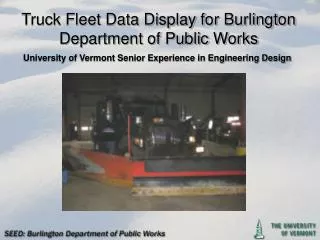
Truck Fleet Data Display for Burlington Department of Public Works. University of Vermont Senior Experience in Engineering Design. The Team. University of Vermont Undergraduates: Yago Alonso Garcia – Electrical Engineering Kenn Austin – Computer Science Matt Clark – Mechanical Engineering

E N D
Truck Fleet Data Display for Burlington Department of Public Works University of Vermont Senior Experience in Engineering Design
The Team University of Vermont Undergraduates: Yago Alonso Garcia – Electrical Engineering Kenn Austin – Computer Science Matt Clark – Mechanical Engineering Alex Estey – Mechanical Engineering University of Vermont Faculty Advisor: Jeff Frolik – Electrical Engineering Burlington Department of Public Works: Norm Baldwin – Assistant Director of Public Works
The Customer Burlington Department of Public Works (BDPW) Responsible for approximately: 240 lane-miles of road 220 miles of sidewalk 14 Full time employees working within the Right of Way (R.O.W.) workgroup Fleet: 10 Full-sized Trucks with Wing Plows 3 Mid-Sized Trucks 3 Bucket Loaders 12 Sidewalk Tractors
The Problem Develop an operational tracking system for BDPW’s fleet of Snow Removal and Deicing Vehicles System must be real time Collect data for: Position (GPS) Speed Salt Spreading Temperature (Road and Ambient) Plow Engagement All data sent back to BDPW real-time Data Displayed in Easily Readable Format For BDPW Customer Support and Management
Motivation For Tracking System No Real-Time Accountability For Road and Sidewalk Clearing Better Response Customer Inquiries Alter Deployment to Respond to Varying Conditions Analyze Clearing Schemes For Improved Response
Potential Solution: Data Collection Cirus Controls SpreadSmart RxTM Collects Data For: Position via GPS Speed Salt Spreading Temperature (Road and Ambient) Plow Engagement Drive-By Download of Data via Wi-Fi Router Not Real-Time Scalable Maintainable Long-Term
Potential Solution: Data Collection Motorola Digital Mobile Radio Tracks Location (GPS) Sends Data Over Digital Radio Channel Real-time Service Charge to use radio network Limited capabilities for integration with other sensors Scalable
Our Solution Integrate Cirus Controls Logger System with Broadband Enabled Ruggedized Tablet PC Real-Time Sensor Integration with Logger Already Established Ruggedized Tablet PC to withstand harsh operating environment
The Data Flow: Collection • Sensors: • Location • Speed • Salt Spreading • Temperature • Plow Engagement Cirus Controls Logger Tablet PC
The Data Flow: Distribution Verizon Wireless Broadband Network Card Tablet PC MySQL Database On City of Burlington Server BDPW
Software Overview Both in-truck and customer service applications developed using Visual Basic .Net MS Visual Studio 2005 Customer service app uses ArcEngine dev kit to display truck information GIS shapefiles created by automatically running Cirus Controls' Shapemaker software from command line in customer service app MySQL database connections made using MySQL Connector/Net 5.2 libraries
Why MySQL? Familiarity – one less thing to learn More elegant and easier to deal with than FTP Future possibility of parsing raw data and putting it into more precise fields for improved searchability and long term data tracking Allows for an easy transition between desktop and web based technologies
Why ArcEngine? BDPW uses ESRI's products for many other applications Seemed like the most seamless integration into their current computing environment Powerful with tools for multiple programming languages Fairly inexpensive for the SDK itself
To Do List Finish development & testing of in-truck upload software Live testing with multiple trucks Interface usability feeback & improvements Phase out Cirrus' Shapemaker application and have the customer service app make the shapefiles it needs by itself Write up usage documentation Determine specific licensing requirements for use