Download

1 / 20
200 likes | 341 Views
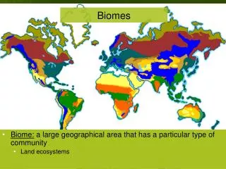
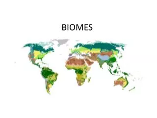
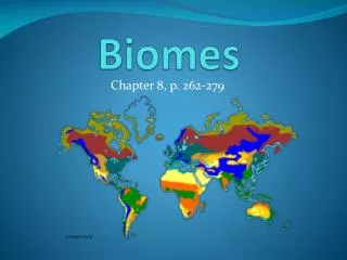
Biomes. Factors that Influence the Characteristics and Distribution of Biomes. Factors that Influence Biome Characteristics and Distribution. Temperature Precipitation Latitude Elevation Ocean Currents. Temperature and Precipitation.

E N D
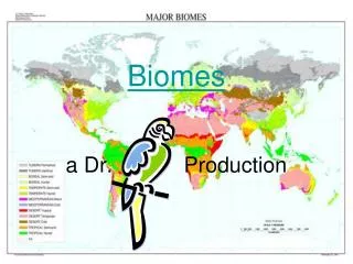
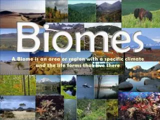
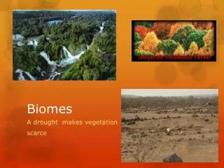
Biomes Factors that Influence the Characteristics and Distribution of Biomes
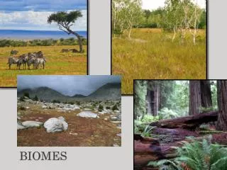
Factors that Influence Biome Characteristics and Distribution • Temperature • Precipitation • Latitude • Elevation • Ocean Currents
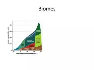
Temperature and Precipitation • Temperature and precipitation (which includes rainfall, snow, mist and fog) are two of the MOST IMPORTANT abiotic factors that influence the characteristics of biomes and the distribution of biomes on Earth • Other factors influence temperature and precipitation in a biome, including latitude, elevation, and ocean currents
Climatographs • Climate = the average pattern of weather conditions that occur in a region, which are observed and recorded over a period of years • Climatograph = is a graph of climate data for a specific region and is generated from data usually obtained over 30 years from local weather observation stations • A climatograph includes average monthly temperature and an average of the total monthly precipitation for each month
Climatographs The rainfall is shown as a blue bar graph, and measured in mm The temperature is shown as a red line graph, and measured in degrees Celsius
Comparing Climatographs Comparing Climatographs: Which region has hotter summers? Which region has colder winters? Which region gets more rain?
Latitude • Latitude is the distance measured in degrees north or south from the equator
Latitude and Temperature • The equator is at 0°and divides the Earth into the northern and southern hemispheres • At the equator, the rays from the sun shine down from almost directly overhead this means lots of sun (warm!) and little temperature fluctuation • The greater the angle between the sun and the Earth, the less intense the sun’s rays this means you get cooler temperatures the further towards the poles you go
Latitude and Precipitation • At the equator, the direct sunlight heats moist air, which quickly rises, cools in the upper atmosphere, and falls back to Earth as rain • The land and ocean that are on the equator receive the greatest amount of rainfall on Earth • In polar regions, little moisture can be picked up and carried in cold air, so clouds do no form readily and there is little precipitation • Temperate regions experience the collision of cold air masses from the poles and warm, moist air masses from the tropics that result in seasonal rainfall patterns
Elevation • Elevationis the height of a land mass above sea level
Elevation and Temperature • Temperature changes occur because the atmosphere becomes thinner at higher elevations, and a thinner atmosphere retains less heat
Elevation and Precipitation • On the windward side of a mountain, clouds filled with moisture rise and cool, then release rain or snow • On the leeward side of a mountain, which is the side sheltered from the wind, the air warms again, which allows it to absorb water, creating a dry land area
Ocean Currents • The sinking and rising of deep ocean waters produces a giant convection belt that transports water – and thermal energy – around Earth, affecting (or contributing to) the characteristics of the biomes along its path • Surface currents exchange heat with the atmosphere, so these currents influence both weather and climate. • Over half the heat that reaches the earth from the sun is absorbed by the ocean's surface layer, so surface currents move a lot of heat.
Ocean Currents Ocean currents carry warm water towards the poles and cold water towards the equator Since warm air can absorb more moisture, biomes in the path of this warm moving air receive more rain
Adaptations to Biomes • Plants and animals have adaptations that allow them to survive in the biomes they live in Example: Polar bears and beluga whales have blubber to insulate them from the freezing cold in the polar ice biomes Example: Mosses and lichens cling to trees where they are able to get more sunlight than on the forest floor in the temperate rainforest
Adaptations to Biomes • Example: Toucans have have big strong beaks that cut nuts from the trees and crack open the tough shells in the tropical rainforest • Example: Arctic crocus has a fuzzy covering on their stems, leaves, and buds to provide protection from the wind in the tundra
Adaptations to Biomes • Example: The fur of snowshoe hares changes from summer brown to winter white, which camouflages them from predators in the boreal forest • Deciduous trees shed their large, broad leaves in winter, which prevents water loss and reduces breakage of limbs from heavy snow in the temperate deciduous forest
Adaptations to Biomes • Example: Some trees, such as acacia, have thorns that deter animals from eating them in the tropical grasslands • Example: Large grazing animals are found in grassland because there is plenty of grass. Flat teeth that grind plant materials enable these grazer to make use of all the grass