Download
1 / 41
420 likes | 804 Views
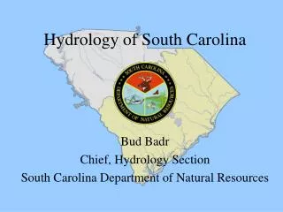
Hydrology of South Carolina. Bud Badr Chief, Hydrology Section South Carolina Department of Natural Resources. How much water do we have, and where is it?. South Carolina’s Water Budget. How much water do we have, and where is it?. Surface Water Rivers Lakes. How much water do we have,

E N D
Hydrology of South Carolina Bud Badr Chief, Hydrology Section South Carolina Department of Natural Resources
How much water do we have, and where is it?
How much water do we have, and where is it? • Surface Water • Rivers • Lakes
How much water do we have, and where is it? • Surface Water • Rivers • Lakes • Ground Water • Coastal Plain aquifers • Piedmont fractures
Piedmont LINE Coastal Plain FALL
How much water do we have, and where is it? • Surface Water • Rivers • Lakes • Ground Water • Coastal Plain aquifers • Piedmont fractures • Surface Water and Ground Water are Connected
Is there enough water in South Carolina? • There is usually more than enough water. • Problems occur because of variations in water availability. The water needs to be in the right place at the right time.
Factors Affecting Water Availability • Most of South Carolina’s rivers are shared with North Carolina or Georgia.
Factors Affecting Water Availability • Most of South Carolina’s rivers are shared with North Carolina or Georgia. • Seasonal variations in rainfall
Station Name and Location Lowest Daily Mean Flow(Date) Highest Daily Mean Flow(Date) AnnualMean Flow(Year) Waccamaw River near Longs 58(Nov. 18, 1999) 28,100(Sep. 23, 1999) 3,556(1999) Congaree River at Columbia 1,360(Sep. 16, 1998) 90,600(Feb. 5, 1998) 11,680(1998) Stevens Creek near Modoc 7.1(Sep. 1, 1998) 16,300(Mar. 9, 1998) 544(1998) Coosawhatchie River near Grays 0.06(Jul. 10, 1998) 7,030(Feb. 6, 1998) 718(1998)
Factors Affecting Water Availability • Most of South Carolina’s rivers are shared with North Carolina or Georgia. • Seasonal variations in rainfall • Drought
Ground-water levels decline during drought Beginning of drought
Factors Affecting Water Availability • Most of South Carolina’s rivers are shared with North Carolina or Georgia. • Seasonal variations in rainfall • Drought • Flood
Factors Affecting Water Availability • Most of South Carolina’s rivers are shared with North Carolina or Georgia. • Seasonal variations in rainfall • Drought • Flood • Salt water intrusion
SALTWATER ENCROACHMENT IN THE UPPER FLORIDAN AQUIFER NEAR HILTON HEAD ISLAND, S.C. FRESHWATER BRACKISH WATER SALTWATER
Can we run out of water? • Pee Dee River
Can we run out of water? • Pee Dee River • Savannah River
LAKE THURMOND 335 FLOOD POOL 330 NORMAL LAKE LEVELS 326 CONSERVATION POOL DAM LOWEST LAKE LEVEL 315 312 DEAD POOL
Can we run out of water? • Pee Dee River • Savannah River • Dry wells
Town of Neeses Declines in town wells due to combined effects of drought and irrigation pumping. Midway community Declines in 17 residential wells. (Water-table and Black Creek aquifers) Town of Ridgeland Declines in 30+ residential wells. (Upper Floridan aquifer)
How can we meet water demands? • South Carolina Water Plan
South Carolina Water Plan Considerations, guidelines, and procedures for the effective management of the State’s water resources in order to sustain the availability of water for present and future use. South Carolina Department of Natural Resources Land, Water, and Conservation Division 1201 Main Street, Suite 1100 Columbia, South Carolina 29201 1998
Ground Water Allocation INDUSTRY & IRRIGATION DOMESTIC SHALLOW AQUIFER DEEP AQUIFER
How can we meet water demands? • South Carolina Water Plan • Savannah River Model
Savannah River Basin Comprehensive Water Resources Study Major areas identified for analysis: • Water Supply Allocations • Flood Control • Hydropower Generation • Water Quality and Flow • Fish and Wildlife • Aquatic Plant Control • Recreation
How can we meet water demands? • South Carolina Water Plan • Savannah River Model • FERC Relicensing
Keowee-Jocassee August 2016 Catawba-Wateree August 2008 Yadkin-Pee Dee April 2008 Buzzards Roost November 2035 Saluda August 2007 Santee-Cooper March 2006 Expiration dates of FERC hydropower licenses
How can we meet water demands? • South Carolina Water Plan • Savannah River Model • FERC Relicensing • Monitoring Networks
Ground Water Monitoring Well Network A network of 76 wells equipped with automatic water-level recorders that record water levels every hour. SCDNR USGS Potentiometric Maps A network of 543 wells that are measured once every 5 years to construct potentiometric maps of the Floridan, Black Creek, and Middendorf aquifer systems.