Weather Analysis and Forecasting
Weather Analysis and Forecasting. Dr. R. B. Schultz. Weather Information Agencies. In the United States, the governmental agency responsible for gathering and disseminating weather related information is the National Weather Service (NWS).

Weather Analysis and Forecasting
E N D
Presentation Transcript
Weather Analysis and Forecasting Dr. R. B. Schultz
Weather Information Agencies • In the United States, the governmental agency responsible for gathering and disseminating weather related information is the National Weather Service (NWS). • Perhaps the most important services provided by the the NWS are forecasts and warnings of hazardous weather including: • thunderstorms, • flooding, • hurricanes, • tornadoes, • winter weather, • and extreme heat. • The process of providing weather forecasts and warnings throughout the United States occurs in three stages.
Stages of Weather Forecasts and Warnings • First, data is collected and analyzed on a global scale. • Second, a variety of techniques are used to establish the future state of the atmosphere; a process called weather forecasting. • Finally, forecasts are disseminated to the public, mainly through the private sector.
Forecasting and Analysis • The task of determining the future state of the atmosphere is called weather forecasting. • Weather analysis, assessing the current atmospheric conditions involves: • collecting, • transmitting, • and compiling millions of pieces of observational data. • On a global scale, the World Meteorological Organization is responsible for gathering, plotting, and distributing weather data. • Once collected, the information is distributed to three National Meteorological Centers near Washington, D.C., Moscow, and Melbourne, Australia.
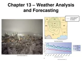
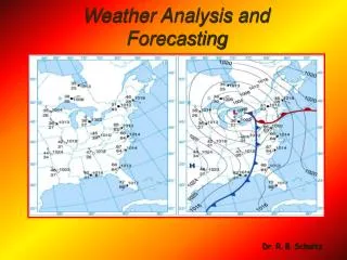
Weather Maps • Normally, the large body of weather data once collected is displayed on a synoptic (observations made at the same time) weather map. • A weather map shows the status of the atmosphere and includes data on: • temperature, • humidity, • pressure, and • airflow. • In addition to surface maps, twice-daily upper air charts which depict the pressure field are drawn at various millibar levels.
Weather Forecasting Approaches • The approaches used in modern weather forecasting include: • traditional synoptic weather forecasting, • numerical weather prediction, • statistical methods, and • various short-range forecasting techniques.
Synoptic Weather Forecasting • Synoptic weather forecasting, the preeminent method for making weather predictions until the late 1950s, involves the analysis of synoptic (summary) weather charts, employing several empirical rules. • This is the first way weather predictions were made.
Numerical Weather Prediction • Numerical weather prediction, used extensively in modern weather forecasting, is based on the fact that the gases of the atmosphere obey many known physical principles. • Ideally, these physical laws can be used to predict the future state of the atmosphere, using the current conditions. • This really should be called “Chemical Weather Prediction” since it uses a great deal of chemistry.
Numerical Weather Prediction (cont.) • Numerical weather prediction uses a number of highly refined computer models that attempt to mimic the behavior of the atmosphere.
Statistical Methods • Statistical methods, using past weather data to predict future events, are often used in conjunction with numerical weather predictions. • One statistical approach, the analog method, examines past weather records to find ones that come close to duplicating current conditions. • The Farmers’ Almanac uses statistical methods to predict future events. Usually correct 40-50% of the time.
Short-Range Forecasting • The simplest short-range forecasting techniques, called persistence forecasts, predict that the future weather will be the same as the present conditions. • Another technique, often called nowcasting, uses radar and geostationary satellites to quickly forecast severe weather events, such as thunderstorms, tornadoes, hail storms, and microbursts.
Long-Range Forecasting • Long range weather forecasting is an area that relies heavily on statistical averages obtained from past weather events, also referred to as climatic data. • Weekly, monthly, and seasonal weather outlooks prepared by the National Weather Service are not weather forecasts in the usual sense. • They indicate only whether the region will experience near-normal precipitation and temperatures or not.
Forecasting Skill • Weather forecasting relies on the skill of the forecaster. • Very short-range (0 to 12 hours) forecasts have demonstrated considerable skill, especially for predicting the formation and movement of large weather systems. • Short-range forecasts (12 to 72 hours) of maximum and minimum temperatures and wind speeds are quite accurate. Furthermore, predicting precipitation amounts is much better than forecasts made only two decades ago. • Medium-range forecasts (3-7 days into the future) have shown significant improvement in the last 20 years. However, the predictability of the day-to-day weather for periods beyond 7 days is usually small.
Technical Advances • Many technical advances have been made to improve forecast accuracy. • Automated Surface Observing Systems (ASOS) are now being used in places currently outside the observational network. • Interactive microcomputer systems make it possible for forecasters to display, manipulate, and rapidly digest the great quantity and variety of available data. • Advanced radar networks such as NEXRAD (Next Generation Weather Radar) in association with Doppler radar, aid in the detecting and tracking of small-scale weather phenomena, such as tornadoes and thunderstorms.
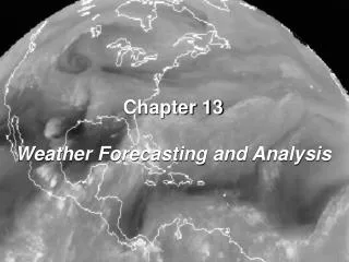
Weather Satellites • Weather forecasting relies heavily on information provided by both polar and geostationary weather satellites. • Their primary importance is to help to fill gaps in observational data, especially over the oceans. • Weather satellites can generate several types of images, including: • visible, • infrared, and • water vapor images.
Weather Satellites (cont.) • Currently, infrared images (images obtained from radiation emitted rather than reflected by an object) from satellites help determine regions of possible precipitation within a cyclone. • Future satellites will be able directly or indirectly to detect wind speeds, humidity, and temperatures at various heights.
Observations and Forecasting • For many years meteorologists have been aware of a strong correlation between cyclonic disturbances at the surface and the seasonal fluctuations in the wavy flow of the westerlies aloft. • Frequently, when upper-air flow produces large-amplitude waves and a general north-to-south flow, cold air moves southward and cyclonic activity dominates the weather. • On the other hand, when the flow is nearly west-to-east, mild temperatures and few cyclonic disturbances are experienced south of the jet stream. • Although the effects of the upper-level flow on weather are well documented, the somewhat unpredictable manner of the flow aloft keeps long range weather forecasting beyond the forecaster's reach.
Key Terminology National Weather Service Forecasting Analysis World Meteorological Org. (WMO) National Meteorological Ctr. Synoptic Forecasting Numerical Weather Prediction Statistical Methods Short-Range Forecasting Analog Method Persistence Forecasting Nowcasting Long-range Weather Forecasting Climatic Data Automated Service Observing System (ASOS) NEXRAD (Next Generation Weather Radar) Polar Satellite Geostationary Satellite