Download
1 / 17
170 likes | 458 Views
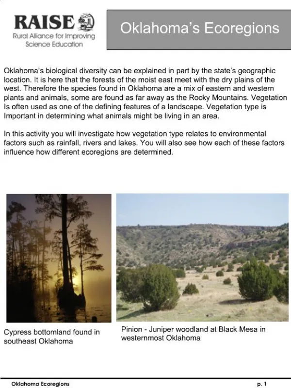
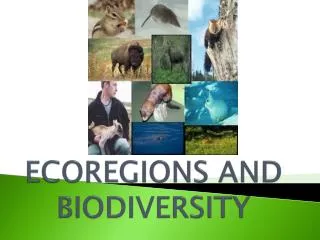
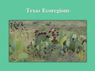
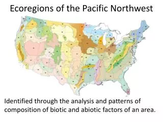
Ecoregions of Texas. What Is An Ecoregion ?. Ecoregion - a major ecosystem with distinctive geography, characteristic plants and animals, ecosystems, and receiving uniform solar radiation and moisture Sometimes called an ecological region or bioregion Smaller than a biome. Where Are They?.

E N D
What Is An Ecoregion? • Ecoregion - a major ecosystem with distinctive geography, characteristic plants and animals, ecosystems, and receiving uniform solar radiation and moisture • Sometimes called an ecological region or bioregion • Smaller than a biome
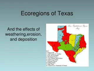
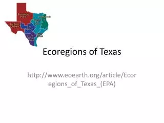
Where Are They? • Region 1: Pineywoods • Region 2: Cross Timbers or Oak Woods and Prairies • Region 3: Blackland Prairies • Region 4: Gulf Coast Prairies and Marshes • Region 5: Coastal Sand Plains • Region 6: South Texas Brush Country
Where Are They? • Region 6: South Texas Brush Country • Region 7: Edwards Plateau • Region 8: Llano Uplift • Region 9: Rolling Plains • Region 10: High Plains • Region 11: Trans Pecos
Region 1 Piney Woods • Climate: average annual rainfall of 36 to 50 inches is fairly uniformly distributed throughout the year, and humidity and temperatures are typically high • Soil: generally acidic and mostly pale to dark gray sands or sandy loams • Elevation: ranges from 200 to 500 feet above sea level • Geography: rolling terrain • Vegetation: pine and oak tall hardwood forests with scattered areas of cropland, planted pastures, native pastures, and rich bottomlands
Region 2 Cross Timbers or Oak Woods & Prairies • Climate: Average annual rainfall averages 28 to 40 inches per year • Soil: Upland soils are light colored, acidic sandy loam or sands. Bottomland soils may be light brown to dark gray and acidic with textures ranging from sandy loams to clays • Elevation: ranges from 300 to 800 feet above sea level • Geography: gently rolling to hilly terrain • Vegetation: oak savannah, where patches of oak woodland alternate with grassland
Region 3 Blackland Prairies • Climate: average annual rainfall ranges from 28 to 40 inches. May is the peak rainfall month for the northern end of the region; however, the south-central part has a fairly uniform rainfall throughout the year. • Soil: soils are uniformly dark-colored alkaline clays interspersed with some gray acidic sandy loams. • Elevation: ranges from 300 to 800 feet above sea level • Geography: gently rolling to nearly level terrain • Vegetation: food and forage crops
Region 4 Gulf Coast Prairies and Marshes • Climate: annual rainfall varies from 30 to 50 inches per year, high humidity and warm temperatures • Soil: acidic sands and sandy loams, with clays occurring in the river bottoms • Elevation: nearly level, less than 150 feet above sea level, cut by streams and rivers flowing into the Gulf of Mexico • Geography: barrier islands along the coast, marshes near bays and estuaries, and prairies • Vegetation: salt grass, tallgrassprairies, live oak woodlands, mesquite and acacias, oaks scattered along the coast, and tall woodlands in the river bottomlands
Region 5 Coastal Sand Plains • Climate: Average annual rainfall is 24 to 28 inches per year • Soil: primarily sands • Elevation: fairly level with elevations less than 150 feet above sea level • Geography: windblown sands and unstable dunes with grasslands, stands of oak, and salt marshes • Vegetation: tallgrass prairie with live oak woodlands, mesquite savannah, and salt marshes
Region 6 South Texas Brush Country • Climate: average annual rainfall of 16 to 35 inches increases from west to east. Summer temperatures are high, with very high evaporation rates • Soil: alkaline to slightly acidic clays and clay loams and shallow caliche soils • Elevation: ranges from sea level to 1000 feet • Geography: flatplains to gently rolling terrain • Vegetation: thorny shrubs, trees, and cactus scattered with patches of palms and subtropical woodlands
Region 7 Edwards Plateau • Climate: average annual rainfall ranges from 15 to 34 inches • Soil: usually shallow with a variety of surface textures, underlain by limestone • Elevation: ranges from slightly less than 100 feet to over 3,000 feet above sea level • Geography: many springs, stony hills, and steep canyons and caves; several river systems dissect the surface, creating a rough and well-drained landscape • Vegetation: grasslands, juniper/oak woodlands, and plateau live oak or mesquite savannah
Region 8 Llano Uplift • Climate: averages about 24 to 32 inches per year • Soil: coarse textured sands, produced from weathered granite over thousands of years • Elevation: ranges from 825 to 2,250 feet above sea level • Geography: some of the oldest rocks in Texas, the region contains unique minerals and rock formations and large granite domes; hilly to rolling landscape • Vegetation: oak-hickory or oak-juniper woodlands, mesquite-mixed brush savannah, and grasslands
Region 9 Rolling Plains • Climate:average annual rainfall is 20 to 28 inches; dry summers with high temperatures and high evaporation rates • Soil: vary from coarse sands along outwash terraces by streams, to clays and shales • Elevation: ranges from 800 to 3,000 feet above sea level • Geography: gently rolling hills and broad flats are cut by several rivers and their tributaries • Vegetation: mesquite and shortgrass savannah; various hardwood species along streams, juniper on steep slopes along rivers
Region 10 High Plains • Climate:extended droughts have occurred several times this century • Soil: surface texture of soils ranges from clays in the north to sands in the south; Caliche underlies these surface soils at depths of two to five feet • Elevation: ranges from 3,000 to 4,500 feet above sea level • Geography: relatively level high plateau • Vegetation: mostly irrigated cropland; native vegetation includes mesquite and juniper
Region 11 Trans Pecos Climate: 9-15 inches of rain; semi-arid, warm, dry winters Soil: generally shallow, saline, and unproductive Elevation: 2,000 feet to mountain ranges, highest peak is 8,751 feet above sea level Geography: salt basins, sand hills, rugged plateaus, mountain slopes Vegetation: desert grassland, desert scrub, coniferous and mixed hardwood forests at mountain peaks
My Ecoregion • Which region do you live in? • Have you ever visited another region?