Download

1 / 15
150 likes | 384 Views
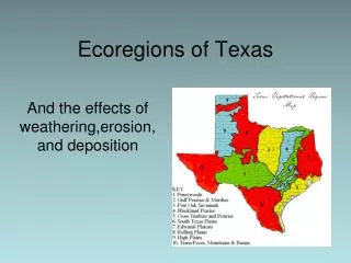
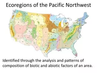
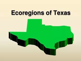
Ecoregions of Texas. What Is An Ecoregion ?. Ecoregion - a major ecosystem with distinctive geography, characteristic plants and animals, and receiving uniform solar radiation and moisture Sometimes called a bioregion. Where Are They?. Region 1: Gulf Coast Prairies and Marshes

E N D
What Is An Ecoregion? • Ecoregion - a major ecosystem with distinctive geography, characteristic plants and animals, and receiving uniform solar radiation and moisture • Sometimes called a bioregion
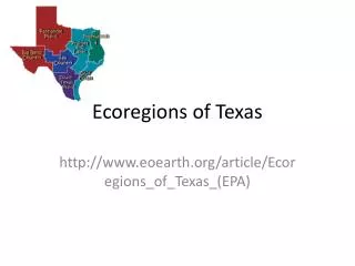
Where Are They? • Region 1: Gulf Coast Prairies and Marshes • Region 2: Piney Woods • Region 3: Blackland Prairies • Region 4: Oak Woods and Prairies • Region 5: Rolling Plains • Region 6: High Plains
Where Are They? • Region 7: Edwards Plateau • Region 8: South Texas Brush Country • Region 9: Trans Pecos
Region 1 Gulf Coast Prairies and Marshes • Climate: average rainfall of 40 inches a year and warm temperatures • Geography: marshes (muddy) near bays and estuaries, and prairies • Vegetation: tall grass prairies, live oak woodlands, and mesquite
Region 2 Piney Woods • Climate: average annual rainfall of 50 inches and temperatures are typically high • Geography: rolling terrain • Vegetation: pine and oak tall hardwood forests with scattered areas of cropland and rich bottomlands
Region 3 Blackland Prairies • Climate: average annual rainfall of 40 inches • Geography: gently rolling to nearly level terrain • Vegetation: food and forage crops
Region 4 Oak Woods & Prairies • Climate: Average annual rainfall of 40 inches per year • Geography: gently rolling to hilly terrain • Vegetation: oak savannah, where patches of oak woodland alternate with grassland
Region 5 Rolling Plains • Climate:average annual rainfall of 28 inches; dry summers with high temperatures • Geography: gently rolling hills and flats are cut by several rivers • Vegetation: mesquite and short grass savannah
Region 6 High Plains • Climate:extended droughts have occurred several times this century • Geography: relatively level high plateau • Vegetation: mostly irrigated cropland
Region 7 Edwards Plateau • Climate: average annual rainfall is 34 inches • Geography: many springs, stony hills, and steep canyons and caves • Vegetation: grasslands, plateau with live oak, or mesquite savannah
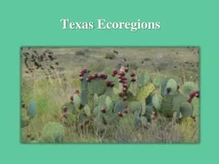
Region 8 South Texas Brush Country • Climate: average annual rainfall of 35 inches increases. Summer temperatures are high • Geography: flatplains to gently rolling terrain • Vegetation: thorny shrubs, trees, and cactus scattered with patches of palms
Region 9 Trans Pecos Climate: 15 inches of rain; warm, dry winters Geography: salt basins, sand hills, rugged plateaus, Vegetation: desert grassland, desert scrub
My Ecoregion • Which region do you live in? • Have you ever visited another region?